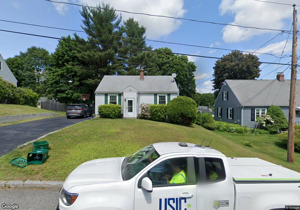
20 Conger Rd Worcester, MA 01602
West Tatnuck NeighborhoodEstimated Value: $392,000 - $456,000
3
Beds
2
Baths
1,248
Sq Ft
$339/Sq Ft
Est. Value
About This Home
This home is located at 20 Conger Rd, Worcester, MA 01602 and is currently estimated at $422,682, approximately $338 per square foot. 20 Conger Rd is a home located in Worcester County with nearby schools including West Tatnuck School, Chandler Magnet, and Jacob Hiatt Magnet School.
Ownership History
Date
Name
Owned For
Owner Type
Purchase Details
Closed on
Feb 5, 2021
Sold by
Merriam Andrew and Sullivan Kerrie A
Bought by
Merriam Andrew and Merriam Kerrie A
Current Estimated Value
Home Financials for this Owner
Home Financials are based on the most recent Mortgage that was taken out on this home.
Original Mortgage
$161,000
Outstanding Balance
$115,090
Interest Rate
2.65%
Mortgage Type
New Conventional
Estimated Equity
$307,592
Purchase Details
Closed on
May 15, 2006
Sold by
Martin Derek K and Martin Meghan E
Bought by
Merriam Andrew and Sullivan Kerrie A
Home Financials for this Owner
Home Financials are based on the most recent Mortgage that was taken out on this home.
Original Mortgage
$184,000
Interest Rate
6.4%
Mortgage Type
Purchase Money Mortgage
Purchase Details
Closed on
May 28, 1999
Sold by
Sullivan John L and Sullivan Christine M
Bought by
Martin Derek K and Martin Meghan E
Purchase Details
Closed on
May 27, 1987
Sold by
Callahan Alice M
Bought by
Sullivan John L
Create a Home Valuation Report for This Property
The Home Valuation Report is an in-depth analysis detailing your home's value as well as a comparison with similar homes in the area
Home Values in the Area
Average Home Value in this Area
Purchase History
| Date | Buyer | Sale Price | Title Company |
|---|---|---|---|
| Merriam Andrew | -- | None Available | |
| Merriam Andrew | $230,000 | -- | |
| Merriam Andrew | $230,000 | -- | |
| Martin Derek K | $113,900 | -- | |
| Sullivan John L | $112,500 | -- |
Source: Public Records
Mortgage History
| Date | Status | Borrower | Loan Amount |
|---|---|---|---|
| Open | Merriam Andrew | $161,000 | |
| Previous Owner | Merriam Andrew | $184,000 | |
| Previous Owner | Sullivan John L | $30,000 |
Source: Public Records
Tax History
| Year | Tax Paid | Tax Assessment Tax Assessment Total Assessment is a certain percentage of the fair market value that is determined by local assessors to be the total taxable value of land and additions on the property. | Land | Improvement |
|---|---|---|---|---|
| 2025 | $4,682 | $355,000 | $118,100 | $236,900 |
| 2024 | $4,599 | $334,500 | $118,100 | $216,400 |
| 2023 | $4,404 | $307,100 | $102,700 | $204,400 |
| 2022 | $4,031 | $265,000 | $82,200 | $182,800 |
| 2021 | $3,870 | $237,700 | $65,800 | $171,900 |
| 2020 | $3,779 | $222,300 | $65,800 | $156,500 |
| 2019 | $3,596 | $199,800 | $59,200 | $140,600 |
| 2018 | $3,608 | $190,800 | $59,200 | $131,600 |
| 2017 | $3,462 | $180,100 | $59,200 | $120,900 |
| 2016 | $3,382 | $164,100 | $43,200 | $120,900 |
| 2015 | $3,293 | $164,100 | $43,200 | $120,900 |
| 2014 | $3,207 | $164,100 | $43,200 | $120,900 |
Source: Public Records
Map
Nearby Homes
- 19 Assabet Ln
- 29 Scenic Dr
- 121 Bailey St Unit D31
- 10 Edwidge St
- 58 Wedgewood Rd
- 21 Baxter St
- 9 Newburn Rd
- 17 Walbridge Rd
- 148A Tory Fort Ln
- 23 Tiverton Pkwy
- 70 Moreland Green Dr
- 122 Copperfield Rd
- 118 Beaconsfield Rd
- 12 Cardinal Rd
- 47R Yarnie Unit 3A
- 47R Yarnie Unit 1B
- 47R Yarnie Unit 2B
- 47R Yarnie Unit 4B
- 47R Yarnie Unit 8B
- 47R Yarnie Unit 5A
Your Personal Tour Guide
Ask me questions while you tour the home.