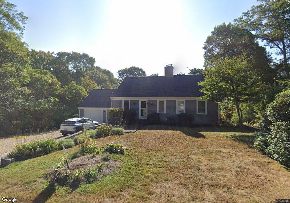
20 Cranberry Ln Mashpee, MA 02649
Estimated Value: $593,000 - $682,000
3
Beds
2
Baths
1,801
Sq Ft
$350/Sq Ft
Est. Value
About This Home
This home is located at 20 Cranberry Ln, Mashpee, MA 02649 and is currently estimated at $629,599, approximately $349 per square foot. 20 Cranberry Ln is a home located in Barnstable County with nearby schools including Kenneth C. Coombs School, Quashnet School, and Mashpee Middle School.
Ownership History
Date
Name
Owned For
Owner Type
Purchase Details
Closed on
Feb 12, 2024
Sold by
Cronin Mary E
Bought by
Mary E Cronin T E and Mary Cronin
Current Estimated Value
Purchase Details
Closed on
Aug 20, 2004
Sold by
Bradley Melinda H
Bought by
Cronin Mary E
Home Financials for this Owner
Home Financials are based on the most recent Mortgage that was taken out on this home.
Original Mortgage
$100,000
Interest Rate
6.03%
Mortgage Type
Purchase Money Mortgage
Create a Home Valuation Report for This Property
The Home Valuation Report is an in-depth analysis detailing your home's value as well as a comparison with similar homes in the area
Home Values in the Area
Average Home Value in this Area
Purchase History
| Date | Buyer | Sale Price | Title Company |
|---|---|---|---|
| Mary E Cronin T E | -- | None Available | |
| Cronin Mary E | $322,000 | -- |
Source: Public Records
Mortgage History
| Date | Status | Borrower | Loan Amount |
|---|---|---|---|
| Previous Owner | Cronin Mary E | $100,000 |
Source: Public Records
Tax History Compared to Growth
Tax History
| Year | Tax Paid | Tax Assessment Tax Assessment Total Assessment is a certain percentage of the fair market value that is determined by local assessors to be the total taxable value of land and additions on the property. | Land | Improvement |
|---|---|---|---|---|
| 2025 | $4,026 | $608,200 | $214,000 | $394,200 |
| 2024 | $3,698 | $575,100 | $194,600 | $380,500 |
| 2023 | $3,457 | $493,100 | $185,200 | $307,900 |
| 2022 | $3,284 | $402,000 | $150,600 | $251,400 |
| 2021 | $3,765 | $345,400 | $135,700 | $209,700 |
| 2020 | $4,986 | $332,300 | $130,500 | $201,800 |
| 2019 | $2,873 | $317,500 | $130,500 | $187,000 |
| 2018 | $2,446 | $274,200 | $124,800 | $149,400 |
| 2017 | $2,374 | $258,300 | $124,800 | $133,500 |
| 2016 | $2,299 | $248,800 | $124,800 | $124,000 |
| 2015 | $2,219 | $243,600 | $124,800 | $118,800 |
| 2014 | $2,268 | $241,500 | $124,500 | $117,000 |
Source: Public Records
Map
Nearby Homes
- 10 Briar Patch Ln
- 35 Santuit Ln
- 9 Santuit Ln
- 131 Timberlane Dr
- 42 Beechwood Dr
- 6 Santuit Pond Rd
- 59 Oregon Rd
- 78 Brittany Dr
- 95 Brittany Dr
- 7 Widow Coombs Walk
- 235 Main St
- 12 Sheffield Place
- 45 Fox Hill Rd
- 783 Santuit-Newtown Rd
- 19 Oriole Ln
- 68 Fox Hill Rd
- 22 Candlewood Ln
- 11 Warwick Way
- 16 Balfour Ln
- 1469 Santuit-Newtown Rd
- 24 Cranberry Ln
- 14 Cranberry Ln
- 21 Cranberry Ln
- 0 Cranberry Ln Unit 21908163
- 0 Cranberry Ln Unit 72593021
- 15 Cranberry Ln
- 30 Cranberry Ln
- 10 Cranberry Ln
- 27 Cranberry Ln
- 11 Cranberry Ln
- 50 Deer Ridge Rd
- 56 Deer Ridge Rd
- 47 Bayberry Dr
- 62 Deer Ridge Rd
- 34 Cranberry Ln
- 46 Deer Ridge Rd
- 54 Bayberry Dr
- 4 Cranberry Ln
- 43 Bayberry Dr
- 48 Bayberry Dr