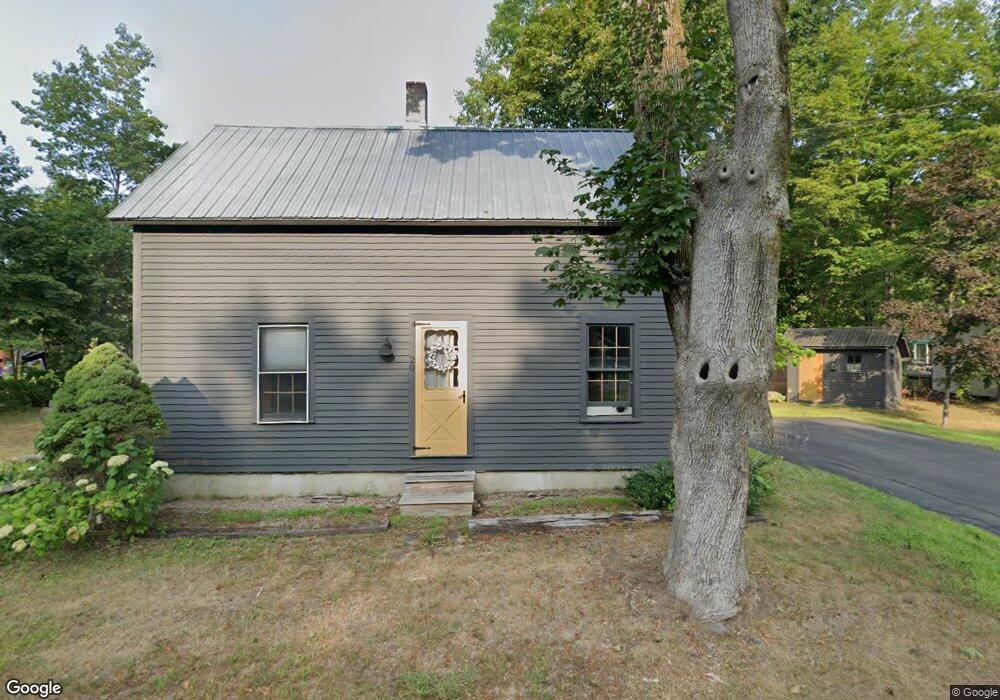
20 Cross St Conway, NH 03818
Estimated Value: $537,060 - $610,000
3
Beds
2
Baths
2,266
Sq Ft
$251/Sq Ft
Est. Value
About This Home
This home is located at 20 Cross St, Conway, NH 03818 and is currently estimated at $568,515, approximately $250 per square foot. 20 Cross St is a home with nearby schools including A. Crosby Kennett Middle School, Kennett High School, and The Lilliputian School.
Ownership History
Date
Name
Owned For
Owner Type
Purchase Details
Closed on
Oct 8, 2021
Sold by
Evans Melissa A
Bought by
Williams Miles H
Current Estimated Value
Purchase Details
Closed on
May 19, 2021
Sold by
Evans Steven B
Bought by
Evans Melissa A
Home Financials for this Owner
Home Financials are based on the most recent Mortgage that was taken out on this home.
Original Mortgage
$150,000
Interest Rate
2.9%
Mortgage Type
Stand Alone Refi Refinance Of Original Loan
Purchase Details
Closed on
May 5, 2017
Sold by
May Diann
Bought by
No Co Village Rt and May
Purchase Details
Closed on
Dec 9, 2016
Sold by
Thomas Q Cash T Q and Thomas Cash
Bought by
May Diann and Makos Anna
Home Financials for this Owner
Home Financials are based on the most recent Mortgage that was taken out on this home.
Original Mortgage
$216,000
Interest Rate
3.47%
Mortgage Type
New Conventional
Create a Home Valuation Report for This Property
The Home Valuation Report is an in-depth analysis detailing your home's value as well as a comparison with similar homes in the area
Home Values in the Area
Average Home Value in this Area
Purchase History
| Date | Buyer | Sale Price | Title Company |
|---|---|---|---|
| Williams Miles H | $250,000 | None Available | |
| Evans Melissa A | -- | None Available | |
| No Co Village Rt | -- | -- | |
| No Co Village Rt | -- | -- | |
| May Diann | $240,000 | -- | |
| May Diann | $240,000 | -- |
Source: Public Records
Mortgage History
| Date | Status | Borrower | Loan Amount |
|---|---|---|---|
| Previous Owner | Evans Melissa A | $150,000 | |
| Previous Owner | May Diann | $216,000 |
Source: Public Records
Tax History Compared to Growth
Tax History
| Year | Tax Paid | Tax Assessment Tax Assessment Total Assessment is a certain percentage of the fair market value that is determined by local assessors to be the total taxable value of land and additions on the property. | Land | Improvement |
|---|---|---|---|---|
| 2024 | $6,088 | $483,200 | $176,600 | $306,600 |
| 2023 | $5,537 | $483,200 | $176,600 | $306,600 |
| 2022 | $4,484 | $233,800 | $84,200 | $149,600 |
| 2021 | $3,820 | $233,800 | $84,200 | $149,600 |
| 2020 | $4,365 | $233,800 | $84,200 | $149,600 |
| 2019 | $4,049 | $233,800 | $84,200 | $149,600 |
| 2018 | $3,738 | $168,900 | $49,200 | $119,700 |
| 2017 | $3,375 | $168,900 | $49,200 | $119,700 |
| 2016 | $2,759 | $142,900 | $49,200 | $93,700 |
| 2015 | $2,705 | $141,700 | $49,200 | $92,500 |
| 2014 | $2,672 | $141,700 | $49,200 | $92,500 |
| 2013 | $2,531 | $141,700 | $49,200 | $92,500 |
Source: Public Records
Map
Nearby Homes
- 137 Skimobile Rd Unit 3
- 11 Black Diamond Rd Unit 3
- 7 Black Diamond Rd Unit 2
- 15 Black Diamond Rd Unit 4
- 00 Artist Falls Rd
- 28 Locust Ln
- 243 Skimobile Rd Unit 352
- 243 Skimobile Rd Unit 252
- 243 Skimobile Rd Unit 355
- 243 Skimobile Rd Unit 255
- 235 Skimobile Rd Unit 1404
- 239 Skimobile Rd Unit 305
- 239 Skimobile Rd Unit 304
- 00 White Mountain Hwy
- 2955 White Mountain Hwy Unit 123 (E20)
- 2955 White Mountain Hwy Unit 204 W28
- 2955 White Mountain Hwy Unit 114 (W25)
- 3002 White Mountain Hwy Unit Lots 29 and 30 - 300
- 72 Cranmore Woods Ln Unit 2
- 72 Cranmore Woods Ln Unit 4