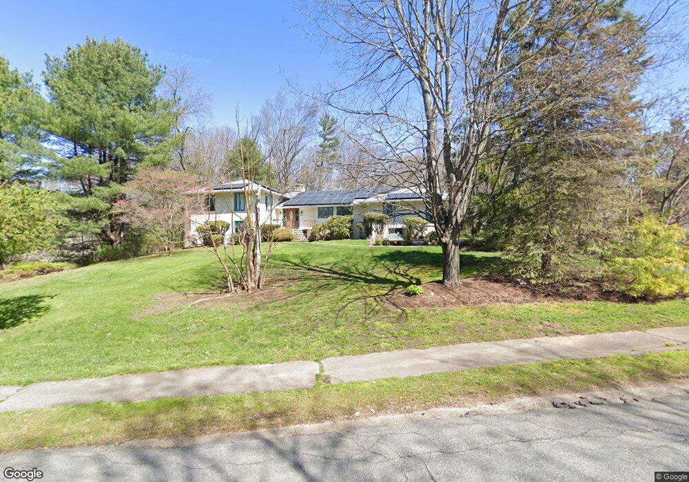
20 Dartmouth Dr Framingham, MA 01701
Estimated Value: $991,000 - $1,129,000
5
Beds
4
Baths
3,168
Sq Ft
$339/Sq Ft
Est. Value
About This Home
This home is located at 20 Dartmouth Dr, Framingham, MA 01701 and is currently estimated at $1,074,351, approximately $339 per square foot. 20 Dartmouth Dr is a home located in Middlesex County with nearby schools including Framingham High School and Sudbury Valley School.
Ownership History
Date
Name
Owned For
Owner Type
Purchase Details
Closed on
Jun 28, 2002
Sold by
Bhide Sameer B and Bhide Monica
Bought by
Riedl Edward and Riedl Elisa
Current Estimated Value
Purchase Details
Closed on
Aug 30, 2000
Sold by
Demeo Edward A and Demeo Barbara J
Bought by
Bhide Sameer B and Bhide Monica
Create a Home Valuation Report for This Property
The Home Valuation Report is an in-depth analysis detailing your home's value as well as a comparison with similar homes in the area
Home Values in the Area
Average Home Value in this Area
Purchase History
| Date | Buyer | Sale Price | Title Company |
|---|---|---|---|
| Riedl Edward | $478,900 | -- | |
| Riedl Edward | $478,900 | -- | |
| Bhide Sameer B | $409,900 | -- |
Source: Public Records
Mortgage History
| Date | Status | Borrower | Loan Amount |
|---|---|---|---|
| Closed | Bhide Sameer B | $300,000 | |
| Closed | Bhide Sameer B | $295,000 | |
| Previous Owner | Bhide Sameer B | $391,000 |
Source: Public Records
Tax History Compared to Growth
Tax History
| Year | Tax Paid | Tax Assessment Tax Assessment Total Assessment is a certain percentage of the fair market value that is determined by local assessors to be the total taxable value of land and additions on the property. | Land | Improvement |
|---|---|---|---|---|
| 2025 | $10,992 | $920,600 | $343,600 | $577,000 |
| 2024 | $10,284 | $825,400 | $305,800 | $519,600 |
| 2023 | $10,027 | $766,000 | $281,900 | $484,100 |
| 2022 | $9,651 | $702,400 | $256,200 | $446,200 |
| 2021 | $9,697 | $690,200 | $246,100 | $444,100 |
| 2020 | $9,882 | $659,700 | $223,800 | $435,900 |
| 2019 | $9,631 | $626,200 | $213,300 | $412,900 |
| 2018 | $9,575 | $586,700 | $208,900 | $377,800 |
| 2017 | $9,613 | $575,300 | $202,600 | $372,700 |
| 2016 | $9,653 | $555,400 | $210,500 | $344,900 |
| 2015 | $9,546 | $535,700 | $210,400 | $325,300 |
Source: Public Records
Map
Nearby Homes
- 6 Mountain View Dr
- 620 Edmands Rd
- 1011 Edmands Rd
- 28 Stetson Dr
- 463 Edmands Rd
- 1060 Grove St Unit 41
- 1060 Grove St Unit 43
- 1060 Grove St Unit 21
- 1060 Grove St Unit Lot 39
- 1060 Grove St Unit 31
- 123 Dutton Rd
- 11 Sonia Dr
- 31 Sonia Dr
- 53 Wagon Hill Rd
- 688 Boston Post Rd E Unit 324
- 20 Virginia Ave
- 0 Boston Post Rd
- 3 Garabed Blvd
- 32 Ethel
- 596 Boston Post Rd E Unit 23
- 18 Dartmouth Dr
- 22 Dartmouth Dr
- 16 Dartmouth Dr
- 24 Dartmouth Dr
- 32 Dartmouth Dr
- 28 Dartmouth Dr
- 22 Parmenter Rd
- 26 Dartmouth Dr
- 17 Dartmouth Dr
- 14 Dartmouth Dr
- 30 Dartmouth Dr
- 19 Dartmouth Dr
- 15 Dartmouth Dr
- 31 Dartmouth Dr
- 29 Dartmouth Dr
- 21 Dartmouth Dr
- 23 Dartmouth Dr
- 12 Dartmouth Dr
- 8 Dartmouth Dr
- 24 Parmenter Rd