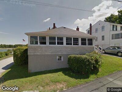
20 Driftway Rd North Weymouth, MA 02191
Estimated Value: $725,000 - $822,000
4
Beds
2
Baths
1,574
Sq Ft
$485/Sq Ft
Est. Value
About This Home
This home is located at 20 Driftway Rd, North Weymouth, MA 02191 and is currently estimated at $764,005, approximately $485 per square foot. 20 Driftway Rd is a home located in Norfolk County with nearby schools including Wessagusset Elementary School, Abigail Adams Middle School, and Weymouth Middle School Chapman.
Ownership History
Date
Name
Owned For
Owner Type
Purchase Details
Closed on
Jun 8, 2018
Sold by
Mutch Rt
Bought by
Mutch John F and Mutch Lisa A
Current Estimated Value
Purchase Details
Closed on
Jan 8, 2013
Sold by
Mutch George E and Mutch Gail L
Bought by
Mutch Rt
Home Financials for this Owner
Home Financials are based on the most recent Mortgage that was taken out on this home.
Original Mortgage
$50,000
Interest Rate
3.36%
Create a Home Valuation Report for This Property
The Home Valuation Report is an in-depth analysis detailing your home's value as well as a comparison with similar homes in the area
Home Values in the Area
Average Home Value in this Area
Purchase History
| Date | Buyer | Sale Price | Title Company |
|---|---|---|---|
| Mutch John F | $575,000 | -- | |
| Mutch Rt | -- | -- |
Source: Public Records
Mortgage History
| Date | Status | Borrower | Loan Amount |
|---|---|---|---|
| Previous Owner | Mutch George E | $50,000 | |
| Previous Owner | Mutch George E | $12,000 | |
| Previous Owner | Mutch George E | $4,400 |
Source: Public Records
Tax History Compared to Growth
Tax History
| Year | Tax Paid | Tax Assessment Tax Assessment Total Assessment is a certain percentage of the fair market value that is determined by local assessors to be the total taxable value of land and additions on the property. | Land | Improvement |
|---|---|---|---|---|
| 2025 | $6,976 | $690,700 | $380,900 | $309,800 |
| 2024 | $6,760 | $658,200 | $362,700 | $295,500 |
| 2023 | $6,623 | $633,800 | $335,900 | $297,900 |
| 2022 | $6,708 | $585,300 | $327,400 | $257,900 |
| 2021 | $6,375 | $543,000 | $327,400 | $215,600 |
| 2020 | $6,186 | $519,000 | $327,400 | $191,600 |
| 2019 | $6,042 | $498,500 | $314,800 | $183,700 |
| 2018 | $5,509 | $440,700 | $269,800 | $170,900 |
| 2017 | $5,301 | $413,800 | $257,000 | $156,800 |
| 2016 | $4,918 | $384,200 | $233,400 | $150,800 |
| 2015 | $4,791 | $371,400 | $233,400 | $138,000 |
| 2014 | $4,596 | $345,600 | $217,200 | $128,400 |
Source: Public Records
Map
Nearby Homes
- 51 Broad Reach Unit T62A
- 51 Broad Reach Unit T23A
- 61 Broad Reach Unit T62B
- 61 Broad Reach Unit T143B
- 130 Broad Reach Unit 409
- 130 Broad Reach Unit 305
- 130 Broad Reach Unit 206
- 20 Harlem Rd
- 119 Fort Point Rd
- 25 Fort Point Rd
- 10 Shipyard Dr Unit 402
- 23 Shipyard Dr Unit 303
- 9 Regatta Rd
- 121 Hms Halsted Dr Unit 121
- 2 Beach Ln
- 267 Neck St Unit C2
- 267 Neck St Unit B7
- 38 Kimball Beach Rd
- 34 Kimball Beach Rd
- 15 Hawthorne Rd