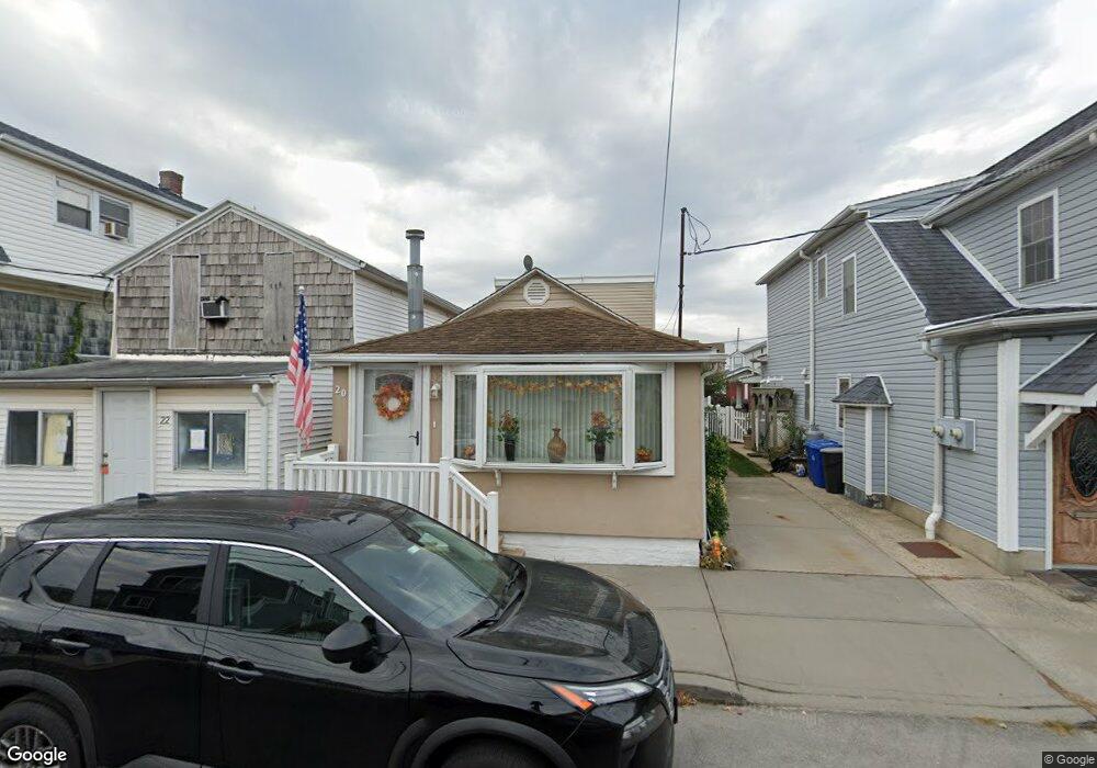
20 E 9th Rd Broad Channel, NY 11693
Broad Channel NeighborhoodEstimated Value: $576,735 - $700,000
Studio
--
Bath
1,530
Sq Ft
$425/Sq Ft
Est. Value
About This Home
This home is located at 20 E 9th Rd, Broad Channel, NY 11693 and is currently estimated at $649,934, approximately $424 per square foot. 20 E 9th Rd is a home located in Queens County with nearby schools including P.S. 47 - Chris Galas and St Rose of Lima Catholic Academy.
Ownership History
Date
Name
Owned For
Owner Type
Purchase Details
Closed on
Apr 1, 2002
Sold by
Pagano Frank A and Pagano Chris
Bought by
Shevlin John C and Lanzone Rosanne
Current Estimated Value
Home Financials for this Owner
Home Financials are based on the most recent Mortgage that was taken out on this home.
Original Mortgage
$140,000
Interest Rate
7.15%
Mortgage Type
Purchase Money Mortgage
Purchase Details
Closed on
Jan 26, 1997
Sold by
Pagano Luisa and Benizzi Maria
Bought by
Pagano Frank A and Pagano Kris
Home Financials for this Owner
Home Financials are based on the most recent Mortgage that was taken out on this home.
Original Mortgage
$101,250
Interest Rate
7.79%
Purchase Details
Closed on
Aug 21, 1984
Sold by
City Of New York
Bought by
Boudreau Paul J
Create a Home Valuation Report for This Property
The Home Valuation Report is an in-depth analysis detailing your home's value as well as a comparison with similar homes in the area
Home Values in the Area
Average Home Value in this Area
Purchase History
| Date | Buyer | Sale Price | Title Company |
|---|---|---|---|
| Shevlin John C | -- | -- | |
| Shevlin John C | -- | -- | |
| Pagano Frank A | -- | Commonwealth Land Title Ins | |
| Pagano Frank A | -- | Commonwealth Land Title Ins | |
| Boudreau Paul J | -- | -- | |
| Boudreau Paul J | -- | -- |
Source: Public Records
Mortgage History
| Date | Status | Borrower | Loan Amount |
|---|---|---|---|
| Previous Owner | Shevlin John C | $140,000 | |
| Previous Owner | Pagano Frank A | $101,250 |
Source: Public Records
Tax History
| Year | Tax Paid | Tax Assessment Tax Assessment Total Assessment is a certain percentage of the fair market value that is determined by local assessors to be the total taxable value of land and additions on the property. | Land | Improvement |
|---|---|---|---|---|
| 2025 | $3,518 | $18,916 | $3,307 | $15,609 |
| 2024 | $3,530 | $18,916 | $3,925 | $14,991 |
| 2023 | $3,475 | $18,700 | $3,290 | $15,410 |
| 2022 | $3,239 | $31,560 | $6,660 | $24,900 |
| 2021 | $3,217 | $28,020 | $6,660 | $21,360 |
| 2020 | $3,041 | $30,780 | $6,660 | $24,120 |
| 2019 | $3,005 | $27,480 | $6,660 | $20,820 |
| 2018 | $2,879 | $15,583 | $4,600 | $10,983 |
| 2017 | $2,701 | $14,718 | $4,628 | $10,090 |
| 2016 | $2,471 | $14,718 | $4,628 | $10,090 |
| 2015 | $1,455 | $13,136 | $5,976 | $7,160 |
| 2014 | $1,455 | $13,136 | $5,976 | $7,160 |
Source: Public Records
Map
Nearby Homes
- 19 E 10th Rd
- 815 Walton Rd
- 120 E 8th Rd
- 27 W 11th Rd
- 308 E 8th Rd
- 35 W 11th Rd
- 631 Cross Bay Blvd Unit 633
- 611 West Rd
- 33 W 12th Rd
- 120 E 6th Rd
- 621 Cross Bay Blvd
- 19 W 13th Rd
- 40 W 13th Rd
- 14-7 Cross Bay Blvd
- 12 W 14th Rd
- 14-11 Cross Bay Blvd
- 1515 Cross Bay Blvd
- 12&14 W 5th Rd
- 20 W 18th Rd
- 7416 Almeda Ave
Your Personal Tour Guide
Ask me questions while you tour the home.