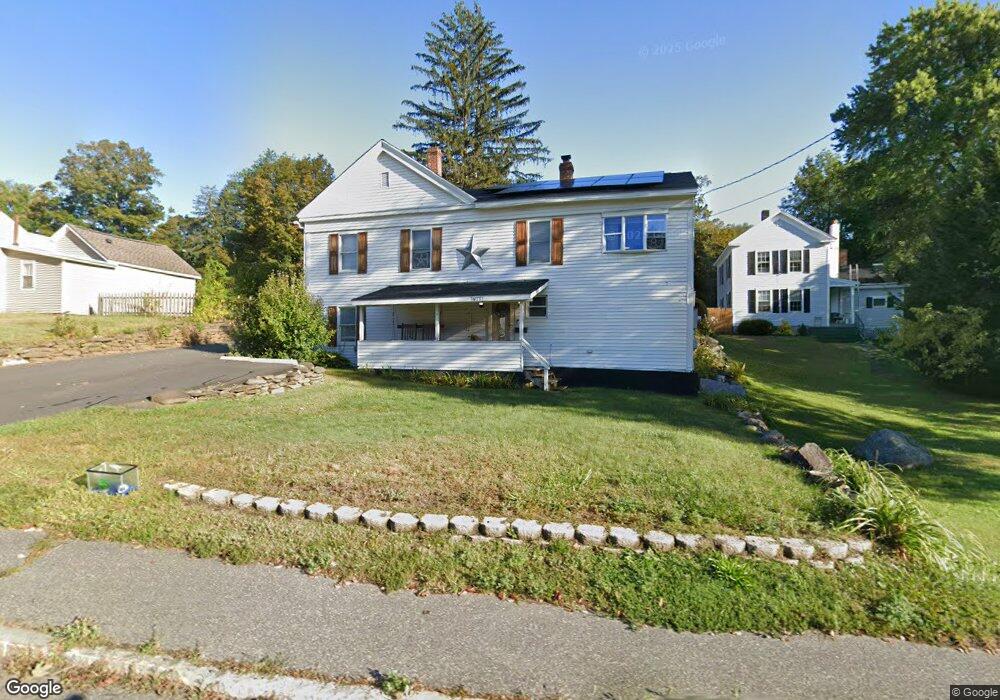
20 E Main St Huntington, MA 01050
Estimated Value: $230,000 - $330,000
5
Beds
2
Baths
2,172
Sq Ft
$130/Sq Ft
Est. Value
About This Home
This home is located at 20 E Main St, Huntington, MA 01050 and is currently estimated at $282,671, approximately $130 per square foot. 20 E Main St is a home located in Hampshire County with nearby schools including Gateway Regional High School.
Ownership History
Date
Name
Owned For
Owner Type
Purchase Details
Closed on
Sep 30, 2011
Sold by
Turner Eugene L and Turner Diane M
Bought by
Turner Joshua W and Lamountain Kayla B
Current Estimated Value
Home Financials for this Owner
Home Financials are based on the most recent Mortgage that was taken out on this home.
Original Mortgage
$125,400
Outstanding Balance
$84,475
Interest Rate
4.15%
Mortgage Type
Purchase Money Mortgage
Estimated Equity
$198,196
Purchase Details
Closed on
Mar 28, 1997
Sold by
Chiminello Richard D
Bought by
Caputo Rosemary
Purchase Details
Closed on
Apr 24, 1996
Sold by
Department Of Housing & Urban Dev
Bought by
Collier Diane M and Turner Eugene L
Home Financials for this Owner
Home Financials are based on the most recent Mortgage that was taken out on this home.
Original Mortgage
$50,200
Interest Rate
7.81%
Mortgage Type
Purchase Money Mortgage
Create a Home Valuation Report for This Property
The Home Valuation Report is an in-depth analysis detailing your home's value as well as a comparison with similar homes in the area
Home Values in the Area
Average Home Value in this Area
Purchase History
| Date | Buyer | Sale Price | Title Company |
|---|---|---|---|
| Turner Joshua W | $165,000 | -- | |
| Caputo Rosemary | $40,000 | -- | |
| Collier Diane M | $37,079 | -- |
Source: Public Records
Mortgage History
| Date | Status | Borrower | Loan Amount |
|---|---|---|---|
| Open | Collier Diane M | $125,400 | |
| Previous Owner | Collier Diane M | $113,400 | |
| Previous Owner | Collier Diane M | $95,957 | |
| Previous Owner | Collier Diane M | $50,200 |
Source: Public Records
Tax History
| Year | Tax Paid | Tax Assessment Tax Assessment Total Assessment is a certain percentage of the fair market value that is determined by local assessors to be the total taxable value of land and additions on the property. | Land | Improvement |
|---|---|---|---|---|
| 2025 | $3,357 | $218,000 | $34,700 | $183,300 |
| 2024 | $3,215 | $205,300 | $34,700 | $170,600 |
| 2023 | $3,211 | $188,300 | $31,700 | $156,600 |
| 2022 | $3,034 | $172,800 | $30,100 | $142,700 |
| 2021 | $3,150 | $157,600 | $30,100 | $127,500 |
| 2020 | $3,109 | $151,500 | $27,500 | $124,000 |
| 2019 | $3,018 | $151,500 | $27,500 | $124,000 |
| 2018 | $2,992 | $156,800 | $32,400 | $124,400 |
| 2017 | $2,830 | $156,800 | $32,400 | $124,400 |
| 2016 | $2,901 | $156,800 | $32,400 | $124,400 |
| 2015 | $2,733 | $158,700 | $32,400 | $126,300 |
Source: Public Records
Map
Nearby Homes
- 24 Worthington Rd
- 0 Lakeville Dam Rd Unit 25269273
- 0 Lakeville Dam Rd Unit 73445764
- 25 Basket St
- 49 Old Chester Rd
- 67 Bromley Rd
- Lot 2 Jourdan Rd
- Lot 9 Jourdan Rd
- 12 Pond Brook Rd
- 87 Highland Ave
- 0 E River Rd Lot 13 Map 409 Unit 72690617
- 49 Russell Stage Rd
- 0 Russell Stage Rd
- 6 Blueberry Ln
- 312 Fomer Rd
- 170 Timberidge Dr
- 30 Gore Rd
- 0 Old Chester Rd (Rear)
- 0 Address Withheld Unit 73485702
- 115 Crooked Ledge Rd
Your Personal Tour Guide
Ask me questions while you tour the home.