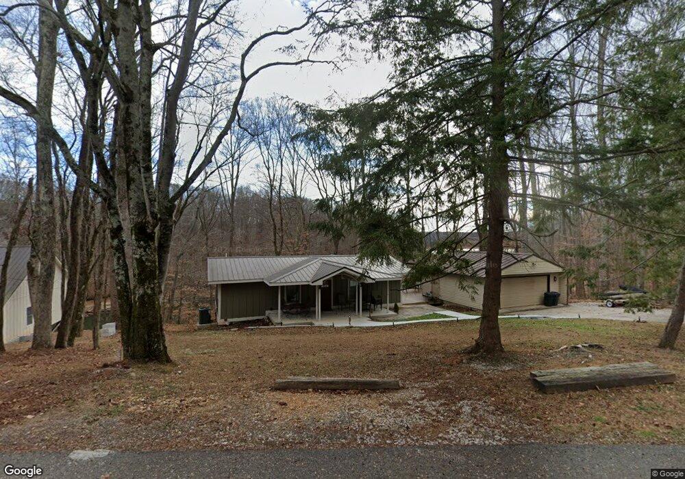
20 East Rd Winchester, TN 37398
Estimated Value: $657,000 - $1,276,000
--
Bed
2
Baths
2,364
Sq Ft
$398/Sq Ft
Est. Value
About This Home
This home is located at 20 East Rd, Winchester, TN 37398 and is currently estimated at $940,015, approximately $397 per square foot. 20 East Rd is a home located in Franklin County with nearby schools including North Middle School and Franklin County High School.
Ownership History
Date
Name
Owned For
Owner Type
Purchase Details
Closed on
Jul 21, 2017
Sold by
Williams Steven J And
Bought by
Williams Philip Jay and Williams Paula Jeanne
Current Estimated Value
Purchase Details
Closed on
Jul 10, 2003
Sold by
Williams Henry M
Bought by
Williams Steven J
Home Financials for this Owner
Home Financials are based on the most recent Mortgage that was taken out on this home.
Original Mortgage
$96,000
Outstanding Balance
$40,507
Interest Rate
5.16%
Estimated Equity
$899,508
Purchase Details
Closed on
Apr 28, 1975
Bought by
Williams Henry M and Williams Mary A
Create a Home Valuation Report for This Property
The Home Valuation Report is an in-depth analysis detailing your home's value as well as a comparison with similar homes in the area
Home Values in the Area
Average Home Value in this Area
Purchase History
| Date | Buyer | Sale Price | Title Company |
|---|---|---|---|
| Williams Philip Jay | $192,500 | -- | |
| Williams Steven J | $192,000 | -- | |
| Williams Henry M | -- | -- |
Source: Public Records
Mortgage History
| Date | Status | Borrower | Loan Amount |
|---|---|---|---|
| Open | Williams Henry M | $96,000 |
Source: Public Records
Tax History Compared to Growth
Tax History
| Year | Tax Paid | Tax Assessment Tax Assessment Total Assessment is a certain percentage of the fair market value that is determined by local assessors to be the total taxable value of land and additions on the property. | Land | Improvement |
|---|---|---|---|---|
| 2024 | $3,392 | $170,000 | $100,000 | $70,000 |
| 2023 | $3,392 | $170,000 | $100,000 | $70,000 |
| 2022 | $2,586 | $137,875 | $100,000 | $37,875 |
| 2021 | $2,332 | $137,875 | $100,000 | $37,875 |
| 2020 | $2,332 | $81,000 | $59,075 | $21,925 |
| 2019 | $2,332 | $81,000 | $59,075 | $21,925 |
| 2018 | $2,166 | $81,000 | $59,075 | $21,925 |
| 2017 | $2,166 | $81,000 | $59,075 | $21,925 |
| 2016 | $2,165 | $80,975 | $59,075 | $21,900 |
| 2015 | $2,165 | $80,975 | $59,075 | $21,900 |
| 2014 | $2,164 | $80,957 | $0 | $0 |
Source: Public Records
Map
Nearby Homes
- 74 Pine Bluff Rd
- 0 Cooper Ln
- 0 Old Tullahoma Rd Unit RTC2967846
- 0 Old Tullahoma Rd Unit RTC2967837
- 0 Old Tullahoma Rd Unit RTC2967835
- 265 Shasteen Bend Dr
- 423 Shasteen Bend Dr
- 0 Maple Bend Rd
- 28 Old Eastbrook Rd
- 0 Old Tullahoma Rd Unit RTC2823177
- 667 Maple Bend Rd
- 1750 Awalt Dr
- 369 Old Eastbrook Rd
- 0 Knott Rd
- 620 Maple Bend Rd
- 282 Owl Hollow Ln
- 60 Lees Ford Ln
- 712 Fanning Bend Dr
- 947 Fanning Bend Dr
- FB 175 Plan at Fanning Bend
- 34 East Rd
- 49 Ridgefield Cir
- 50 East Rd
- 73 East Rd
- 77 Ridgefield Cir
- 327 Phillips Dr
- 70 East Rd
- 0 Ridgefield Cir
- 540 Ridgefield Cir
- 294 Phillips Dr
- 514 Ridgefield Cir
- 113 Ridgefield Cir
- 276 Phillips Dr
- 257 Phillips Dr
- 480 Ridgefield Cir
- 163 Ridgefield Cir
- 495 Ridgefield Cir
- 142 Ridgefield Cir
- 52 Cannon Ct
- 236 Phillips Dr