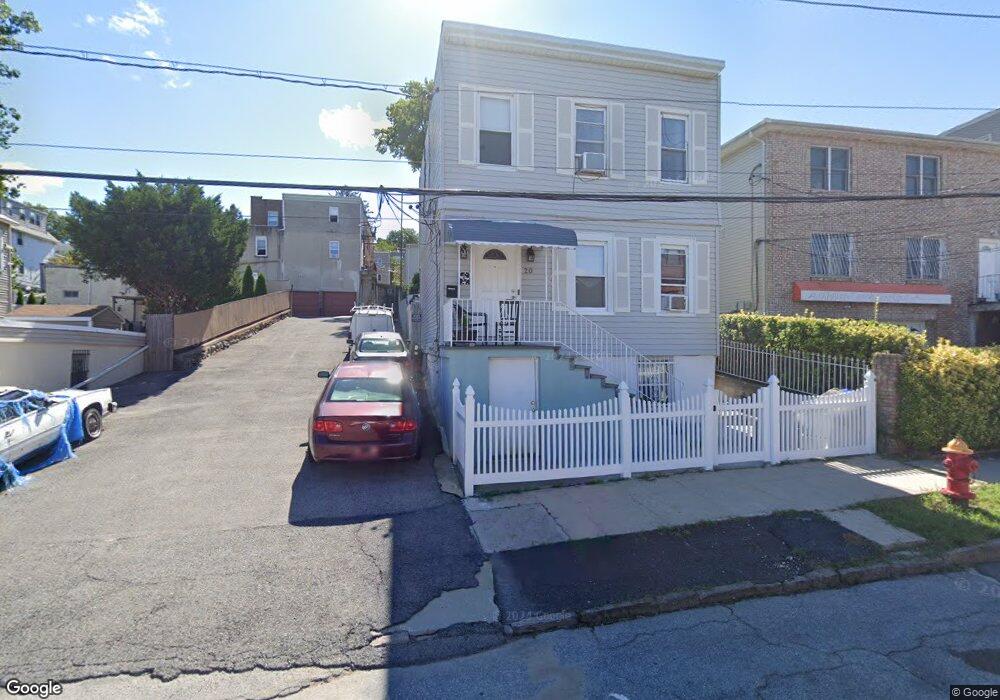
20 Fero St Yonkers, NY 10701
Bryn Mawr Park NeighborhoodEstimated Value: $599,119 - $764,000
6
Beds
3
Baths
1,780
Sq Ft
$392/Sq Ft
Est. Value
About This Home
This home is located at 20 Fero St, Yonkers, NY 10701 and is currently estimated at $697,280, approximately $391 per square foot. 20 Fero St is a home located in Westchester County.
Ownership History
Date
Name
Owned For
Owner Type
Purchase Details
Closed on
Mar 12, 2018
Sold by
Alves Emidio and Alves Maria
Bought by
Rojas Escolastico Lucia and Escolastico Guillermo Rojas
Current Estimated Value
Home Financials for this Owner
Home Financials are based on the most recent Mortgage that was taken out on this home.
Original Mortgage
$414,295
Outstanding Balance
$354,512
Interest Rate
4.32%
Mortgage Type
New Conventional
Estimated Equity
$342,768
Purchase Details
Closed on
Jan 18, 1996
Sold by
Filancia Edward and Filancia Marie
Bought by
Alves Emidio and Alves Maria
Create a Home Valuation Report for This Property
The Home Valuation Report is an in-depth analysis detailing your home's value as well as a comparison with similar homes in the area
Home Values in the Area
Average Home Value in this Area
Purchase History
| Date | Buyer | Sale Price | Title Company |
|---|---|---|---|
| Rojas Escolastico Lucia | $436,000 | Abstracts | |
| Alves Emidio | $160,000 | -- |
Source: Public Records
Mortgage History
| Date | Status | Borrower | Loan Amount |
|---|---|---|---|
| Open | Rojas Escolastico Lucia | $414,295 |
Source: Public Records
Tax History Compared to Growth
Tax History
| Year | Tax Paid | Tax Assessment Tax Assessment Total Assessment is a certain percentage of the fair market value that is determined by local assessors to be the total taxable value of land and additions on the property. | Land | Improvement |
|---|---|---|---|---|
| 2024 | $1,763 | $8,400 | $2,000 | $6,400 |
| 2023 | $1,767 | $8,400 | $2,000 | $6,400 |
| 2022 | $1,743 | $8,400 | $2,000 | $6,400 |
| 2021 | $6,221 | $8,400 | $2,000 | $6,400 |
| 2020 | $6,128 | $8,400 | $2,000 | $6,400 |
| 2019 | $7,569 | $8,400 | $2,000 | $6,400 |
| 2018 | $5,601 | $8,400 | $2,000 | $6,400 |
| 2017 | $0 | $8,400 | $2,000 | $6,400 |
| 2016 | $6,545 | $8,400 | $2,000 | $6,400 |
| 2015 | -- | $8,400 | $2,000 | $6,400 |
| 2014 | -- | $8,400 | $2,000 | $6,400 |
| 2013 | -- | $8,400 | $2,000 | $6,400 |
Source: Public Records
Map
Nearby Homes
- 34 Lockwood Ave
- 53 Lockwood Ave
- 62 Fortfield Ave
- 82 Burhans Ave
- 1 Lowell St
- 116 Gavin St
- 64 Woodycrest Ave
- 261 Edwards Place
- 127 -133 Frederic St
- 175 Frederic St
- 55 Ramsey Ave
- 166 Lockwood Ave
- 331 Sommerville Place
- 372 Sommerville Place
- 147 Orchard St
- 11 aka 15 Bobolink Rd
- 136 Buckingham Rd
- 41 Portland Place
- 54 Albemarle Place
- 82 Morningside Ave
- 40 Fero St
- 34 Fero St
- 20 Fero St
- 2 Fero St
- 30 Fero St Unit 1
- 30 Fero St
- 26 Fero St Unit 2S
- 26 Fero St Unit 3S
- 26 Fero St Unit 1n
- 26 Fero St
- 41 Clarendon Ave
- 24 Lockwood Ave
- 35 Clarendon Ave
- 33 Fero St
- 47 Clarendon Ave
- 31 Clarendon Ave
- 43 Clarendon Ave
- 43 Clarendon Ave Unit 2
- 43 Clarendon Ave Unit 1
- 0 Fero St