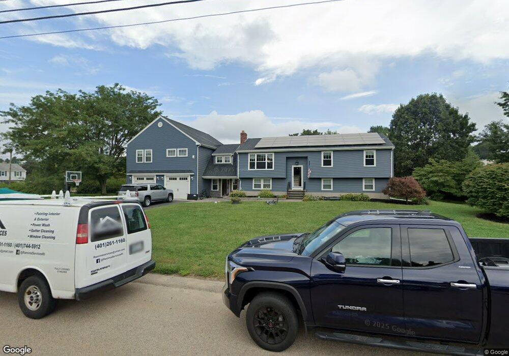
20 Fisher Rd Wrentham, MA 02093
Estimated Value: $770,000 - $898,000
3
Beds
2
Baths
2,086
Sq Ft
$398/Sq Ft
Est. Value
About This Home
This home is located at 20 Fisher Rd, Wrentham, MA 02093 and is currently estimated at $830,527, approximately $398 per square foot. 20 Fisher Rd is a home located in Norfolk County with nearby schools including Delaney Elementary School and Charles E Roderick.
Ownership History
Date
Name
Owned For
Owner Type
Purchase Details
Closed on
Jun 27, 2008
Sold by
Lee Gregory R and Lee Carine M
Bought by
Genereux John and Genereux Mary
Current Estimated Value
Home Financials for this Owner
Home Financials are based on the most recent Mortgage that was taken out on this home.
Original Mortgage
$324,000
Interest Rate
6.07%
Mortgage Type
Purchase Money Mortgage
Purchase Details
Closed on
Aug 31, 1999
Sold by
Young Robert
Bought by
Lee Gregory R and Lee Carine M
Purchase Details
Closed on
Jun 1, 1992
Sold by
Oconnor James E and Oconnor Marlene M
Bought by
Young Robert
Create a Home Valuation Report for This Property
The Home Valuation Report is an in-depth analysis detailing your home's value as well as a comparison with similar homes in the area
Home Values in the Area
Average Home Value in this Area
Purchase History
| Date | Buyer | Sale Price | Title Company |
|---|---|---|---|
| Genereux John | $360,000 | -- | |
| Lee Gregory R | $218,900 | -- | |
| Young Robert | $160,000 | -- |
Source: Public Records
Mortgage History
| Date | Status | Borrower | Loan Amount |
|---|---|---|---|
| Open | Young Robert | $312,000 | |
| Closed | Genereux John | $324,000 | |
| Previous Owner | Young Robert | $178,000 |
Source: Public Records
Tax History Compared to Growth
Tax History
| Year | Tax Paid | Tax Assessment Tax Assessment Total Assessment is a certain percentage of the fair market value that is determined by local assessors to be the total taxable value of land and additions on the property. | Land | Improvement |
|---|---|---|---|---|
| 2025 | $9,681 | $835,300 | $327,100 | $508,200 |
| 2024 | $9,158 | $763,200 | $332,100 | $431,100 |
| 2023 | $9,105 | $721,500 | $308,900 | $412,600 |
| 2022 | $8,121 | $594,100 | $249,700 | $344,400 |
| 2021 | $6,835 | $485,800 | $228,900 | $256,900 |
| 2020 | $8,873 | $622,700 | $198,500 | $424,200 |
| 2019 | $8,303 | $588,000 | $190,600 | $397,400 |
| 2018 | $7,207 | $506,100 | $190,700 | $315,400 |
| 2017 | $5,890 | $413,300 | $187,100 | $226,200 |
| 2016 | $4,735 | $331,600 | $181,600 | $150,000 |
| 2015 | $4,585 | $306,100 | $174,600 | $131,500 |
| 2014 | $4,510 | $294,600 | $168,000 | $126,600 |
Source: Public Records
Map
Nearby Homes
- 246 Forest Grove Ave
- 270 Dedham St
- 570 Franklin St
- 10 Nature View Dr
- 15 Nature View Dr
- 45 Joshua Rd
- 50 Reed Fulton Ave Unit Lot 61
- 1 Lorraine Metcalf Dr
- 3 Oak Rd
- 0 W Birch Rd
- 10 W Birch Rd
- 45 King St
- 131 Creek St Unit 7
- 3 Sparrow Rd
- 362 East St
- 11 Earle Stewart Ln
- 38 Robin Rd
- Lot 3 - 14 Earle Stewart Ln
- 11 Quail Run Rd
- 14 Essex St