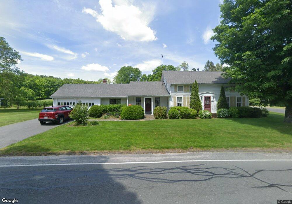
20 Fomer Rd Southampton, MA 01073
Estimated Value: $420,000 - $473,000
3
Beds
3
Baths
1,916
Sq Ft
$227/Sq Ft
Est. Value
About This Home
This home is located at 20 Fomer Rd, Southampton, MA 01073 and is currently estimated at $434,573, approximately $226 per square foot. 20 Fomer Rd is a home located in Hampshire County with nearby schools including William E Norris School, White Oak School, and Calvary Baptist Christian School.
Ownership History
Date
Name
Owned For
Owner Type
Purchase Details
Closed on
Sep 24, 2024
Sold by
Mathers Ft and Mathers
Bought by
Mathers Ft and Mathers
Current Estimated Value
Purchase Details
Closed on
May 26, 2022
Sold by
Forster Kathleen N
Bought by
Mathers Ft and Mathers
Purchase Details
Closed on
May 2, 2011
Sold by
Mathers Karen E
Bought by
Mathers Ft
Create a Home Valuation Report for This Property
The Home Valuation Report is an in-depth analysis detailing your home's value as well as a comparison with similar homes in the area
Home Values in the Area
Average Home Value in this Area
Purchase History
| Date | Buyer | Sale Price | Title Company |
|---|---|---|---|
| Mathers Ft | -- | None Available | |
| Mathers Ft | -- | None Available | |
| Mathers Ft | -- | None Available | |
| Mathers Ft | -- | None Available | |
| Mathers Ft | -- | -- | |
| Mathers Ft | -- | -- |
Source: Public Records
Mortgage History
| Date | Status | Borrower | Loan Amount |
|---|---|---|---|
| Previous Owner | Mathers Ft | $18,000 | |
| Previous Owner | Mathers Ft | $12,000 |
Source: Public Records
Tax History Compared to Growth
Tax History
| Year | Tax Paid | Tax Assessment Tax Assessment Total Assessment is a certain percentage of the fair market value that is determined by local assessors to be the total taxable value of land and additions on the property. | Land | Improvement |
|---|---|---|---|---|
| 2025 | $4,373 | $308,600 | $105,200 | $203,400 |
| 2024 | $4,265 | $299,300 | $105,200 | $194,100 |
| 2023 | $4,005 | $279,500 | $105,200 | $174,300 |
| 2022 | $3,974 | $263,700 | $105,200 | $158,500 |
| 2021 | $3,700 | $231,700 | $97,000 | $134,700 |
| 2020 | $3,665 | $231,700 | $97,000 | $134,700 |
| 2019 | $3,562 | $218,400 | $97,000 | $121,400 |
| 2018 | $3,404 | $200,600 | $87,300 | $113,300 |
| 2017 | $3,274 | $200,600 | $87,300 | $113,300 |
| 2015 | $3,073 | $195,600 | $79,000 | $116,600 |
Source: Public Records
Map
Nearby Homes
- Lot 6 Gil Farm Rd
- Lot 5 Gil Farm Rd
- 216 College Hwy
- 119 Brickyard Rd
- Lot 5 Brickyard Rd
- 40 Strong Rd
- 369 College Hwy
- 77 Crooked Ledge Rd
- 43 Pomeroy Meadow Rd
- 23 Wolcott Rd
- 7 Quigley Rd
- 68 College Hwy
- Lot 57 White Loaf Rd
- 17 Glendale Rd
- LOT 3 Brickyard Rd
- 26 Eastwood Ln
- 10 Golden Cir
- 128 Middle Rd
- 12 Golden Cir
- 38 College Hwy