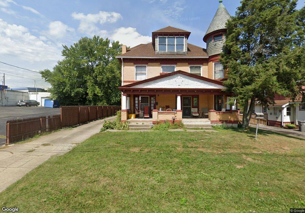
20 Gertrude Ave Unit 22 Youngstown, OH 44512
Estimated Value: $174,000 - $236,000
6
Beds
4
Baths
3,078
Sq Ft
$65/Sq Ft
Est. Value
About This Home
This home is located at 20 Gertrude Ave Unit 22, Youngstown, OH 44512 and is currently estimated at $199,032, approximately $64 per square foot. 20 Gertrude Ave Unit 22 is a home located in Mahoning County with nearby schools including Boardman Glenwood Junior High School, Boardman High School, and Horizon Science Academy - Youngstown.
Ownership History
Date
Name
Owned For
Owner Type
Purchase Details
Closed on
Jun 27, 2008
Sold by
Beal Scott R and Beal Amy E
Bought by
Soles Richard A
Current Estimated Value
Home Financials for this Owner
Home Financials are based on the most recent Mortgage that was taken out on this home.
Original Mortgage
$73,348
Outstanding Balance
$47,271
Interest Rate
6.05%
Mortgage Type
FHA
Estimated Equity
$151,761
Purchase Details
Closed on
Feb 17, 1998
Sold by
Farragher David J and Farragher Jayne
Bought by
Beal Scott R and Goodson Amy E
Purchase Details
Closed on
May 14, 1985
Bought by
Farragher David J and Farragher Jayne
Create a Home Valuation Report for This Property
The Home Valuation Report is an in-depth analysis detailing your home's value as well as a comparison with similar homes in the area
Home Values in the Area
Average Home Value in this Area
Purchase History
| Date | Buyer | Sale Price | Title Company |
|---|---|---|---|
| Soles Richard A | $74,500 | None Available | |
| Beal Scott R | $89,900 | -- | |
| Farragher David J | $43,000 | -- |
Source: Public Records
Mortgage History
| Date | Status | Borrower | Loan Amount |
|---|---|---|---|
| Open | Soles Richard A | $73,348 |
Source: Public Records
Tax History Compared to Growth
Tax History
| Year | Tax Paid | Tax Assessment Tax Assessment Total Assessment is a certain percentage of the fair market value that is determined by local assessors to be the total taxable value of land and additions on the property. | Land | Improvement |
|---|---|---|---|---|
| 2024 | $2,737 | $53,220 | $4,790 | $48,430 |
| 2023 | $2,701 | $53,220 | $4,790 | $48,430 |
| 2022 | $2,481 | $37,380 | $4,800 | $32,580 |
| 2021 | $2,483 | $37,380 | $4,800 | $32,580 |
| 2020 | $2,496 | $37,380 | $4,800 | $32,580 |
| 2019 | $2,466 | $32,790 | $4,210 | $28,580 |
| 2018 | $2,133 | $32,790 | $4,210 | $28,580 |
| 2017 | $2,115 | $32,790 | $4,210 | $28,580 |
| 2016 | $2,239 | $34,390 | $4,550 | $29,840 |
| 2015 | $2,195 | $34,390 | $4,550 | $29,840 |
| 2014 | $2,202 | $34,390 | $4,550 | $29,840 |
| 2013 | $2,175 | $34,390 | $4,550 | $29,840 |
Source: Public Records
Map
Nearby Homes
- 44 Gertrude Ave
- 169 Wolcott Dr
- 81 Melrose Ave
- 149 Argyle Ave
- 235 Wolcott Dr
- 127 Melrose Ave
- 167 Afton Ave
- 103 Wildwood Dr
- 197 Mathews Rd Unit B
- 26 Marlindale Ave
- 0 Mathews Rd Unit 5038026
- 6511 Pembrooke Place
- 272 Shields Rd
- 6001 Applecrest Dr
- 28 Terrace Dr
- 5020 Friendship Ave
- 175 Homestead Dr
- 242 Oakley Ave
- 96 Aylesboro Ave
- 83 Beechwood Dr
- 20 22 Gertrude
- 26 Gertrude Ave
- 30 Gertrude Ave
- 32 Gertrude Ave
- 19 Meadowbrook Ave
- 23 Meadowbrook Ave
- 5701 Market St
- 29 Meadowbrook Ave
- 5815 Market St
- 34 Gertrude Ave
- 31 Meadowbrook Ave
- 25 Gertrude Ave
- 29 Gertrude Ave
- 42 Gertrude Ave
- 35 Meadowbrook Ave
- 33 Gertrude Ave
- 5817 Market St
- 5900 Market St
- 39 Meadowbrook Ave
- 35 Gertrude Ave