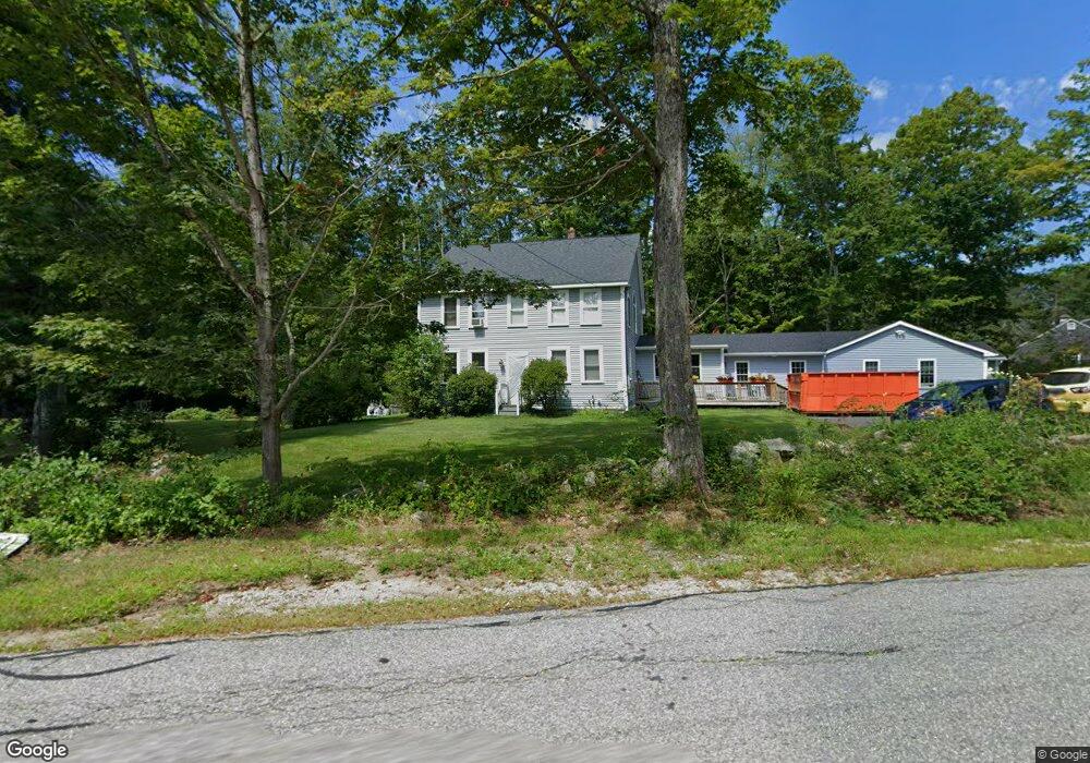
20 Hardwick Rd Petersham, MA 01366
Estimated Value: $532,000 - $644,000
3
Beds
2
Baths
2,048
Sq Ft
$282/Sq Ft
Est. Value
About This Home
This home is located at 20 Hardwick Rd, Petersham, MA 01366 and is currently estimated at $577,039, approximately $281 per square foot. 20 Hardwick Rd is a home located in Worcester County with nearby schools including Petersham Center, Ralph C Mahar Regional, and Petersham Montessori School.
Ownership History
Date
Name
Owned For
Owner Type
Purchase Details
Closed on
Dec 20, 2018
Sold by
Legare Shawn M and Legare Rebecca A
Bought by
Sonier Melissa A and Hatch Jamie J
Current Estimated Value
Home Financials for this Owner
Home Financials are based on the most recent Mortgage that was taken out on this home.
Original Mortgage
$226,816
Outstanding Balance
$200,109
Interest Rate
4.87%
Mortgage Type
FHA
Estimated Equity
$376,930
Purchase Details
Closed on
Aug 14, 2001
Sold by
Horn Howard P
Bought by
Legare Shawn M and Legare Rebecca A
Home Financials for this Owner
Home Financials are based on the most recent Mortgage that was taken out on this home.
Original Mortgage
$150,000
Interest Rate
7.1%
Mortgage Type
Purchase Money Mortgage
Create a Home Valuation Report for This Property
The Home Valuation Report is an in-depth analysis detailing your home's value as well as a comparison with similar homes in the area
Home Values in the Area
Average Home Value in this Area
Purchase History
| Date | Buyer | Sale Price | Title Company |
|---|---|---|---|
| Sonier Melissa A | $231,000 | None Available | |
| Legare Shawn M | $144,500 | -- |
Source: Public Records
Mortgage History
| Date | Status | Borrower | Loan Amount |
|---|---|---|---|
| Open | Sonier Melissa A | $226,816 | |
| Previous Owner | Legare Shawn M | $206,100 | |
| Previous Owner | Legare Shawn M | $150,000 |
Source: Public Records
Tax History Compared to Growth
Tax History
| Year | Tax Paid | Tax Assessment Tax Assessment Total Assessment is a certain percentage of the fair market value that is determined by local assessors to be the total taxable value of land and additions on the property. | Land | Improvement |
|---|---|---|---|---|
| 2025 | $8,813 | $608,200 | $61,400 | $546,800 |
| 2024 | $5,743 | $401,600 | $61,400 | $340,200 |
| 2023 | $3,523 | $223,100 | $58,600 | $164,500 |
| 2022 | $3,021 | $223,100 | $58,600 | $164,500 |
| 2021 | $3,289 | $214,800 | $53,300 | $161,500 |
| 2020 | $3,901 | $224,600 | $46,200 | $178,400 |
| 2019 | $3,718 | $219,600 | $40,500 | $179,100 |
| 2018 | $3,565 | $217,800 | $38,700 | $179,100 |
| 2017 | $3,538 | $218,500 | $41,100 | $177,400 |
| 2016 | $3,588 | $218,500 | $41,100 | $177,400 |
| 2015 | $3,680 | $216,600 | $41,000 | $175,600 |
| 2014 | $3,450 | $216,600 | $41,000 | $175,600 |
Source: Public Records
Map
Nearby Homes
- 42 New Salem Rd
- 32 West St
- 19&21 Common St
- 15 Common St
- 163 Hardwick Rd
- 27 Popple Camp Rd
- 0 Popple Camp Rd Unit 73432026
- 11-L New Athol Rd
- 12-L New Athol Rd
- 7-L New Athol Rd
- 42 Glasheen Rd
- 204 East St
- 0 Nichewaug Rd
- 32 Edward Ln
- 31 Edward Ln
- 37 Gauthier Rd
- 30 Woodward Rd
- 47 Harty Dr
- Back Lot 0 Petersham Rd
- 0 Carter Pond Rd