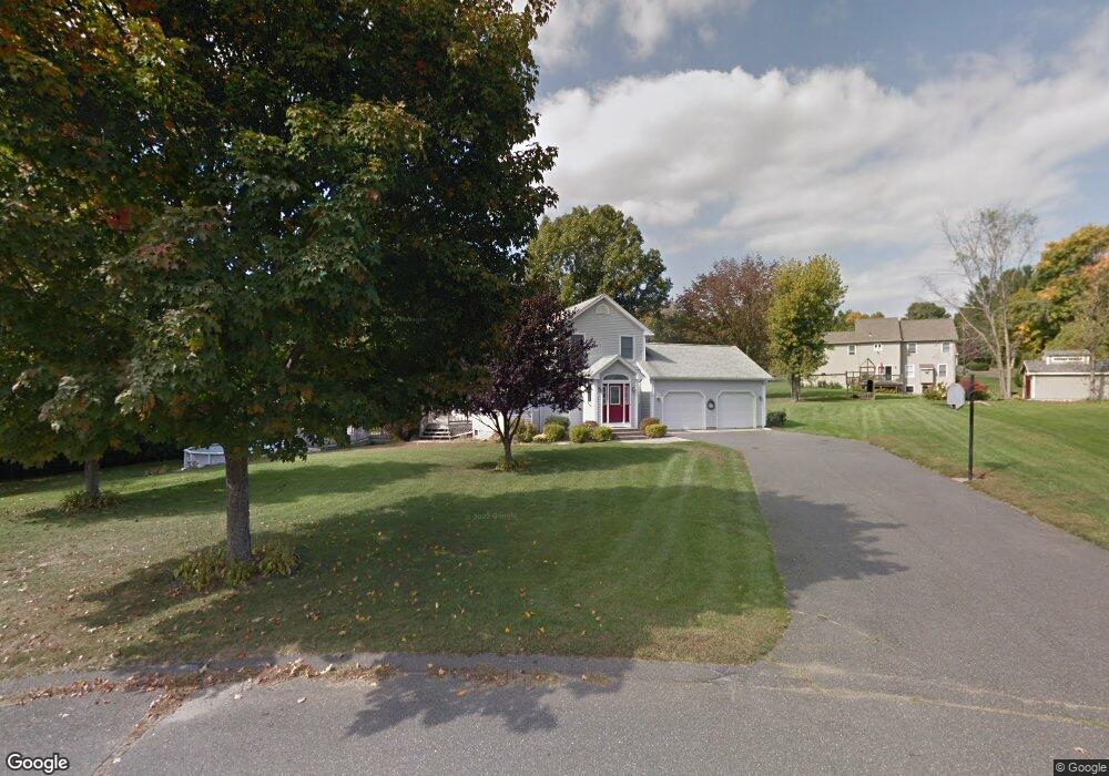
20 High Meadow Rd Hadley, MA 01035
Estimated Value: $536,452 - $675,000
3
Beds
3
Baths
1,927
Sq Ft
$303/Sq Ft
Est. Value
About This Home
This home is located at 20 High Meadow Rd, Hadley, MA 01035 and is currently estimated at $584,113, approximately $303 per square foot. 20 High Meadow Rd is a home located in Hampshire County with nearby schools including Hadley Elementary School, Hopkins Academy, and Pioneer Valley Chinese Immersion Charter School.
Ownership History
Date
Name
Owned For
Owner Type
Purchase Details
Closed on
Jan 31, 2008
Sold by
Dore C Wayne and Brennan-Dore Corinne E
Bought by
Dore C Wayne
Current Estimated Value
Home Financials for this Owner
Home Financials are based on the most recent Mortgage that was taken out on this home.
Original Mortgage
$51,202
Outstanding Balance
$32,499
Interest Rate
6.18%
Mortgage Type
Purchase Money Mortgage
Estimated Equity
$551,614
Create a Home Valuation Report for This Property
The Home Valuation Report is an in-depth analysis detailing your home's value as well as a comparison with similar homes in the area
Home Values in the Area
Average Home Value in this Area
Purchase History
| Date | Buyer | Sale Price | Title Company |
|---|---|---|---|
| Dore C Wayne | -- | -- |
Source: Public Records
Mortgage History
| Date | Status | Borrower | Loan Amount |
|---|---|---|---|
| Open | Dore C Wayne | $51,202 |
Source: Public Records
Tax History
| Year | Tax Paid | Tax Assessment Tax Assessment Total Assessment is a certain percentage of the fair market value that is determined by local assessors to be the total taxable value of land and additions on the property. | Land | Improvement |
|---|---|---|---|---|
| 2025 | $5,538 | $476,200 | $151,600 | $324,600 |
| 2024 | $5,198 | $456,400 | $151,600 | $304,800 |
| 2023 | $5,267 | $456,400 | $151,600 | $304,800 |
| 2022 | $5,253 | $431,300 | $151,600 | $279,700 |
| 2021 | $4,867 | $405,600 | $151,600 | $254,000 |
| 2020 | $4,954 | $387,600 | $151,600 | $236,000 |
| 2019 | $4,855 | $392,800 | $151,600 | $241,200 |
| 2018 | $4,749 | $392,800 | $151,600 | $241,200 |
| 2017 | $4,642 | $401,200 | $151,600 | $249,600 |
| 2016 | $4,473 | $401,200 | $151,600 | $249,600 |
| 2015 | $4,357 | $401,200 | $151,600 | $249,600 |
| 2014 | $4,269 | $401,200 | $151,600 | $249,600 |
Source: Public Records
Map
Nearby Homes
- 30 Greenleaves Dr
- 27 Greenleaves Dr Unit 726
- 26 Greenleaves Dr Unit 635
- 24 Greenleaves Dr Unit 418
- 63 Amity Place Unit 63
- 75 Amity Place Unit 75
- Lot 3 Roosevelt St
- 0 Main St
- 170 E Hadley Rd Unit 87
- 58 Main St Unit 4
- 58 Main St Unit 3
- 48 Gray St
- 141 Tracy Cir
- 11 West St
- 39 Valley Ln
- 60 Red Gate Ln
- 18 Elm St
- 0 Red Gate Ln Unit 73348273
- 0 N Branch Rd
- 83 Bay Rd
- 129 Rocky Hill Rd
- 18 High Meadow Rd
- 18 High Meadow Rd
- 19 High Meadow Rd
- 131 Rocky Hill Rd
- 133 Rocky Hill Rd
- 17 High Meadow Rd
- 16 High Meadow Rd
- 135 Rocky Hill Rd
- 127 Rocky Hill Rd
- 15 High Meadow Rd
- 132 Rocky Hill Rd
- 134 Rocky Hill Rd
- 137 Rocky Hill Rd
- 14 High Meadow Rd
- 139 Rocky Hill Rd
- 3 Kentfield Dr
- 11 High Meadow Rd
- 126 Rocky Hill Rd
- 125 Rocky Hill Rd
Your Personal Tour Guide
Ask me questions while you tour the home.