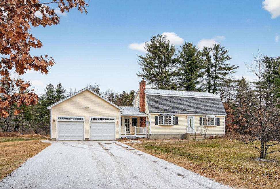
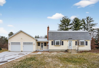

20 Jakes Ln MerriMacK, NH 03054
Estimated payment $3,764/month
Highlights
- Spa
- Wood Flooring
- Living Room
- Reeds Ferry School Rated 9+
- Patio
- Shed
About This Home
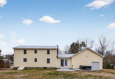
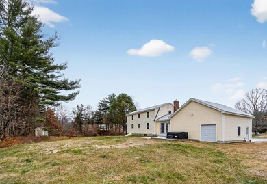
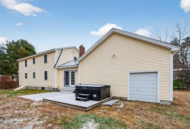
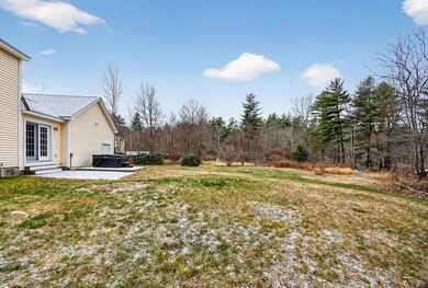
Welcome to this well-maintained home in desirable Merrimack NH. The home offers seven rooms of flexible living space, it has beautiful hardwood, wood and tiled flooring, open kitchen/dining area with pellet stove and mini split, Living room with a nice brick fireplace, updated 3/4 bath on 1st floor. 3 well-proportioned bedrooms and full bath on the 2nd floor, finished play /family room in the basement with plenty storage. 2 car garage Sitting porch, outside patio where you can enjoy your private backyard that backs up to conservation land while sitting in your hot tub or you could be tending to some chickens and getting some fresh eggs or just tending to your garden
Listing Agent
BHHS Verani Realty Methuen Brokerage Phone: 978-505-9296 License #053333 Listed on: 12/03/2025

Home Details
Home Type
- Single Family
Est. Annual Taxes
- $8,802
Year Built
- Built in 1976
Lot Details
- 0.92 Acre Lot
- Conservation Reserve Program Land
- Poultry Coop
- Garden
Parking
- 2 Car Garage
- Automatic Garage Door Opener
- Driveway
Home Design
- Gambrel Roof
- Concrete Foundation
- Vinyl Siding
Interior Spaces
- Property has 2 Levels
- Ceiling Fan
- Family Room
- Living Room
- Combination Kitchen and Dining Room
- Basement
- Interior Basement Entry
- Fire and Smoke Detector
- Dryer
Kitchen
- Microwave
- Freezer
- Dishwasher
Flooring
- Wood
- Ceramic Tile
Bedrooms and Bathrooms
- 3 Bedrooms
Outdoor Features
- Spa
- Patio
- Shed
Utilities
- Mini Split Air Conditioners
- Mini Split Heat Pump
- Generator Hookup
- Cable TV Available
Listing and Financial Details
- Tax Block 000005
- Assessor Parcel Number 00006C
Map
Home Values in the Area
Average Home Value in this Area
Tax History
| Year | Tax Paid | Tax Assessment Tax Assessment Total Assessment is a certain percentage of the fair market value that is determined by local assessors to be the total taxable value of land and additions on the property. | Land | Improvement |
|---|---|---|---|---|
| 2024 | $8,237 | $398,100 | $209,000 | $189,100 |
| 2023 | $7,743 | $398,100 | $209,000 | $189,100 |
| 2022 | $6,919 | $398,100 | $209,000 | $189,100 |
| 2021 | $6,835 | $398,100 | $209,000 | $189,100 |
| 2020 | $6,989 | $290,500 | $146,300 | $144,200 |
| 2019 | $7,010 | $290,500 | $146,300 | $144,200 |
| 2018 | $6,850 | $290,500 | $146,300 | $144,200 |
| 2017 | $6,763 | $289,400 | $146,300 | $143,100 |
| 2016 | $6,595 | $289,400 | $146,300 | $143,100 |
| 2015 | $6,583 | $266,300 | $135,900 | $130,400 |
| 2014 | $6,415 | $266,300 | $135,900 | $130,400 |
| 2013 | $6,367 | $266,300 | $135,900 | $130,400 |
Property History
| Date | Event | Price | List to Sale | Price per Sq Ft |
|---|---|---|---|---|
| 12/03/2025 12/03/25 | For Sale | $575,500 | -- | $290 / Sq Ft |
Purchase History
| Date | Type | Sale Price | Title Company |
|---|---|---|---|
| Warranty Deed | -- | None Available | |
| Warranty Deed | -- | None Available |
Mortgage History
| Date | Status | Loan Amount | Loan Type |
|---|---|---|---|
| Open | $200,000 | Adjustable Rate Mortgage/ARM | |
| Closed | $200,000 | Adjustable Rate Mortgage/ARM |
Source: PrimeMLS
MLS Number: 5071160
APN: MRMK-000006C-000005
Disclaimer: Certain information contained herein is derived from information provided by parties other than Homes.com. All information provided is deemed reliable, but is not guaranteed to be accurate and should be independently verified.
![]() Copyright 2025 PrimeMLS, Inc. All rights reserved. This information is deemed reliable, but not guaranteed. The data relating to real estate displayed on this display comes in part from the IDX Program of PrimeMLS. The information being provided is for consumers’ personal, non-commercial use and may not be used for any purpose other than to identify prospective properties consumers may be interested in purchasing.
Copyright 2025 PrimeMLS, Inc. All rights reserved. This information is deemed reliable, but not guaranteed. The data relating to real estate displayed on this display comes in part from the IDX Program of PrimeMLS. The information being provided is for consumers’ personal, non-commercial use and may not be used for any purpose other than to identify prospective properties consumers may be interested in purchasing.
- 185 Indian Rock Rd
- 24 Beacon Dr
- 4 Twin Bridge Rd
- 19A Loop Rd
- 10 Center St
- 360 Daniel Webster Hwy
- 3 Gilbert Dr
- 1 Vanderbilt Dr
- 19 Mason Rd
- 2 Executive Park Dr
- 3 Maple Ridge Dr Unit 221
- 6 Dutch Dr
- 2 Maple Ridge Dr Unit 28
- 540 Charles Bancroft Hwy Unit 4Belg
- 2 Bow Ln
- 246 Daniel Webster Hwy
- 3 Lexington Ct
- 66 Horace Greeley Rd Unit AD
- 15 Iron Horse Dr
- 49 Technology Dr