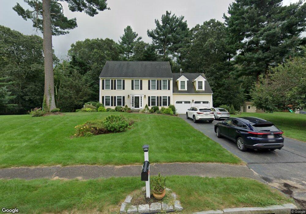
20 Kevin Joes Way Wrentham, MA 02093
Estimated Value: $946,897 - $1,102,000
4
Beds
3
Baths
3,058
Sq Ft
$340/Sq Ft
Est. Value
About This Home
This home is located at 20 Kevin Joes Way, Wrentham, MA 02093 and is currently estimated at $1,040,224, approximately $340 per square foot. 20 Kevin Joes Way is a home located in Norfolk County with nearby schools including Delaney Elementary School and Charles E Roderick.
Ownership History
Date
Name
Owned For
Owner Type
Purchase Details
Closed on
Jun 29, 2023
Sold by
Massarone Anthony R and Massarone Barbara C
Bought by
Massarone Ft and Massarone
Current Estimated Value
Purchase Details
Closed on
Apr 11, 2023
Sold by
Massarone Ft and Massarone
Bought by
Massarone Anthony R and Massarone Barbara C
Home Financials for this Owner
Home Financials are based on the most recent Mortgage that was taken out on this home.
Original Mortgage
$400,000
Interest Rate
6.5%
Mortgage Type
Stand Alone Refi Refinance Of Original Loan
Purchase Details
Closed on
Nov 1, 2022
Sold by
Massarone Anthony R and Massarone Barbara C
Bought by
Massarone Ft and Massarone
Purchase Details
Closed on
May 1, 2003
Sold by
Hsu Tau H and Hwang Wen Y
Bought by
Massarone Anthony R and Massarone Barbara C
Home Financials for this Owner
Home Financials are based on the most recent Mortgage that was taken out on this home.
Original Mortgage
$310,000
Interest Rate
5.82%
Mortgage Type
Purchase Money Mortgage
Purchase Details
Closed on
Apr 1, 2002
Sold by
Simmons Kevin L and Simmons Julie F
Bought by
Hsu Tau H
Home Financials for this Owner
Home Financials are based on the most recent Mortgage that was taken out on this home.
Original Mortgage
$245,000
Interest Rate
6.88%
Mortgage Type
Purchase Money Mortgage
Purchase Details
Closed on
Sep 24, 1996
Sold by
Oboy Kevin M and Oboy Eilen
Bought by
Simmons Kevin L and Simmons Julie F
Home Financials for this Owner
Home Financials are based on the most recent Mortgage that was taken out on this home.
Original Mortgage
$222,000
Interest Rate
7.89%
Mortgage Type
Purchase Money Mortgage
Purchase Details
Closed on
Feb 10, 1989
Sold by
Oloughlin Co Inc
Bought by
Oboy Kevin M
Create a Home Valuation Report for This Property
The Home Valuation Report is an in-depth analysis detailing your home's value as well as a comparison with similar homes in the area
Home Values in the Area
Average Home Value in this Area
Purchase History
| Date | Buyer | Sale Price | Title Company |
|---|---|---|---|
| Massarone Ft | -- | None Available | |
| Massarone Ft | -- | None Available | |
| Massarone Anthony R | -- | None Available | |
| Massarone Anthony R | -- | None Available | |
| Massarone Ft | -- | None Available | |
| Massarone Ft | -- | None Available | |
| Massarone Anthony R | $525,000 | -- | |
| Hsu Tau H | $410,000 | -- | |
| Massarone Anthony R | $525,000 | -- | |
| Hsu Tau H | $410,000 | -- | |
| Simmons Kevin L | $255,000 | -- | |
| Oboy Kevin M | $225,000 | -- |
Source: Public Records
Mortgage History
| Date | Status | Borrower | Loan Amount |
|---|---|---|---|
| Previous Owner | Massarone Anthony R | $400,000 | |
| Previous Owner | Massarone Anthony R | $310,000 | |
| Previous Owner | Hsu Tau H | $245,000 | |
| Previous Owner | Oboy Kevin M | $222,000 |
Source: Public Records
Tax History Compared to Growth
Tax History
| Year | Tax Paid | Tax Assessment Tax Assessment Total Assessment is a certain percentage of the fair market value that is determined by local assessors to be the total taxable value of land and additions on the property. | Land | Improvement |
|---|---|---|---|---|
| 2025 | $9,511 | $820,600 | $289,400 | $531,200 |
| 2024 | $9,176 | $764,700 | $289,400 | $475,300 |
| 2023 | $9,023 | $715,000 | $263,100 | $451,900 |
| 2022 | $8,557 | $626,000 | $245,500 | $380,500 |
| 2021 | $7,819 | $555,700 | $214,300 | $341,400 |
| 2020 | $8,474 | $594,700 | $190,600 | $404,100 |
| 2019 | $8,136 | $576,200 | $190,600 | $385,600 |
| 2018 | $7,637 | $536,300 | $190,700 | $345,600 |
| 2017 | $7,429 | $521,300 | $187,100 | $334,200 |
| 2016 | $7,331 | $513,400 | $181,600 | $331,800 |
| 2015 | $7,301 | $487,400 | $174,600 | $312,800 |
| 2014 | $7,183 | $469,200 | $168,000 | $301,200 |
Source: Public Records
Map
Nearby Homes
- 10 Nature View Dr
- 15 Nature View Dr
- 270 Dedham St
- 1 Lorraine Metcalf Dr
- 362 East St
- 131 Creek St Unit 7
- 570 Franklin St
- 319 Taunton St
- 246 Forest Grove Ave
- Lot 3 - 14 Earle Stewart Ln
- Lot 1 - Blueberry 2 Car Plan at King Philip Estates
- Lot 8 - Blueberry 2 Car Plan at King Philip Estates
- Lot 6 - Blueberry 3 Car Plan at King Philip Estates
- Lot 2 - Camden 2 Car Plan at King Philip Estates
- Lot 7 - Cedar Plan at King Philip Estates
- Lot 4 - Hemingway 2 Car Plan at King Philip Estates
- Lot 3 - Blueberry 2 Car Plan at King Philip Estates
- 3 Oak Rd
- 0 W Birch Rd
- 10 W Birch Rd
- 10 Kevin Joes Way
- 30 Kevin Joes Way
- 35 Kevin Joes Way
- 72 Circle Dr
- 40 Kevin Joes Way
- 25 Kevin Joes Way
- 45 Kevin Joes Way
- 15 Kevin Joes Way
- 50 Kevin Joes Way
- 158 Franklin St
- 87 Circle Dr
- 92 Circle Dr
- 95 Circle Dr
- 53 Circle Dr
- 58 Circle Dr
- LOT 25 Manchester Dr
- LOT 13 Hales Pond Ln
- LOT 23 Manchester Dr
- B Old Quarry Rd
- 60 Kevin Joes Way