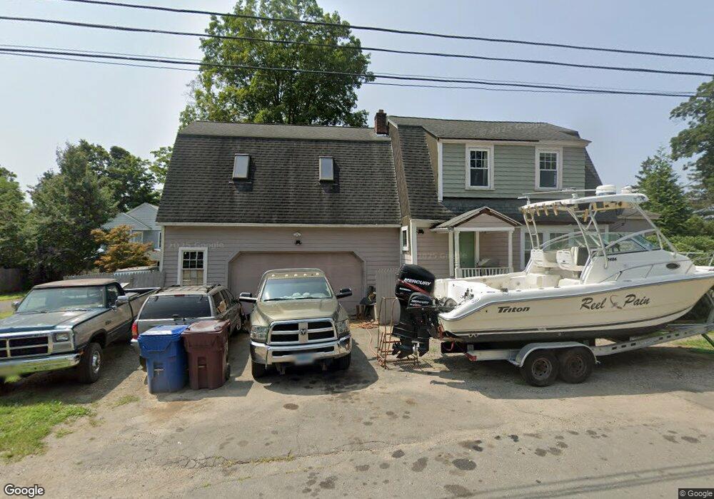
20 Keyes St Unionville, CT 06085
Estimated Value: $382,000 - $530,000
4
Beds
2
Baths
2,235
Sq Ft
$207/Sq Ft
Est. Value
About This Home
This home is located at 20 Keyes St, Unionville, CT 06085 and is currently estimated at $461,760, approximately $206 per square foot. 20 Keyes St is a home located in Hartford County with nearby schools including Union School, West Woods Upper Elementary School, and Irving A. Robbins Middle School.
Ownership History
Date
Name
Owned For
Owner Type
Purchase Details
Closed on
Oct 4, 1993
Sold by
Fuoco Robert P
Bought by
Antonson Scott C and Antonson Kristi
Current Estimated Value
Home Financials for this Owner
Home Financials are based on the most recent Mortgage that was taken out on this home.
Original Mortgage
$111,600
Interest Rate
7%
Mortgage Type
Unknown
Purchase Details
Closed on
Dec 30, 1988
Sold by
Morgan David E
Bought by
Fuoco Robert P
Create a Home Valuation Report for This Property
The Home Valuation Report is an in-depth analysis detailing your home's value as well as a comparison with similar homes in the area
Home Values in the Area
Average Home Value in this Area
Purchase History
| Date | Buyer | Sale Price | Title Company |
|---|---|---|---|
| Antonson Scott C | $117,500 | -- | |
| Fuoco Robert P | $138,000 | -- |
Source: Public Records
Mortgage History
| Date | Status | Borrower | Loan Amount |
|---|---|---|---|
| Open | Fuoco Robert P | $248,000 | |
| Closed | Fuoco Robert P | $170,250 | |
| Closed | Fuoco Robert P | $126,800 | |
| Closed | Fuoco Robert P | $111,600 |
Source: Public Records
Tax History
| Year | Tax Paid | Tax Assessment Tax Assessment Total Assessment is a certain percentage of the fair market value that is determined by local assessors to be the total taxable value of land and additions on the property. | Land | Improvement |
|---|---|---|---|---|
| 2025 | $6,106 | $229,390 | $74,830 | $154,560 |
| 2024 | $5,838 | $229,390 | $74,830 | $154,560 |
| 2023 | $5,554 | $229,390 | $74,830 | $154,560 |
| 2022 | $5,151 | $175,690 | $65,040 | $110,650 |
| 2021 | $5,062 | $175,690 | $65,040 | $110,650 |
| 2020 | $4,914 | $175,690 | $65,040 | $110,650 |
| 2019 | $4,914 | $175,690 | $65,040 | $110,650 |
| 2018 | $4,775 | $175,690 | $65,040 | $110,650 |
| 2017 | $4,474 | $167,680 | $64,680 | $103,000 |
| 2016 | $4,323 | $167,680 | $64,680 | $103,000 |
| 2015 | $4,194 | $167,680 | $64,680 | $103,000 |
| 2014 | $4,098 | $167,690 | $64,680 | $103,010 |
Source: Public Records
Map
Nearby Homes
- 23 Keyes St
- 32 Canterbury Ln
- 55 Depot Place
- 29 Crocus Ln
- 42 Keene Place
- 39 Heritage Dr Unit 39
- 18 Ledgewood Dr
- 9 Putnam Ln
- 1 Burlington Rd
- 14 Walnut Ln
- 7 Maple Ln
- 7 Chestnut Dr
- 50 Northwoods Rd
- 15 Greenwich Ln Unit 15
- 8919 Taine Mountain Rd
- 4 Strathmore Ln Unit 4
- 28 Cottonwood Dr
- 8 Old Field Rd
- 8 Gateshead Way
- 61 Litchfield Rd
- 24 Keyes St
- 12 Keyes St
- 30 Keyes St
- 14 W Avon Rd
- 26 W Avon Rd
- 11 Keyes St
- 31 Keyes St
- 34 Keyes St
- 40 Keyes St
- 1776 Farmington Ave
- 1774 Farmington Ave
- 1772 Farmington Ave
- 1772 Farmington Ave Unit 2
- 1772 Farmington Ave Unit 3
- 45 W Avon Rd
- 1766 Farmington Ave
- 1782 Farmington Ave
- 1762 Farmington Ave
- 42 W Avon Rd
- 1771 Farmington Ave
Your Personal Tour Guide
Ask me questions while you tour the home.