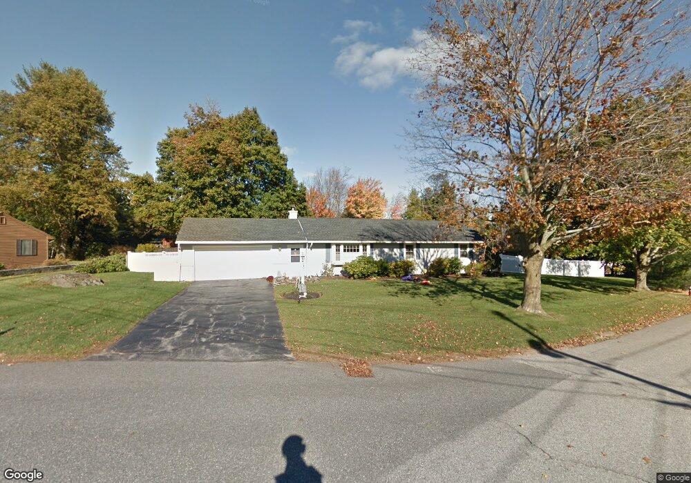
20 Kings Mountain Dr West Boylston, MA 01583
Estimated Value: $525,000 - $628,000
3
Beds
2
Baths
2,102
Sq Ft
$274/Sq Ft
Est. Value
About This Home
This home is located at 20 Kings Mountain Dr, West Boylston, MA 01583 and is currently estimated at $576,474, approximately $274 per square foot. 20 Kings Mountain Dr is a home located in Worcester County with nearby schools including Major Edwards Elementary School, West Boylston Junior/Senior High School, and Abby Kelley Foster Charter Public School.
Ownership History
Date
Name
Owned For
Owner Type
Purchase Details
Closed on
Dec 29, 2014
Sold by
Mk&Rw Llc
Bought by
Rist Lori K
Current Estimated Value
Home Financials for this Owner
Home Financials are based on the most recent Mortgage that was taken out on this home.
Original Mortgage
$177,000
Outstanding Balance
$136,469
Interest Rate
4.02%
Mortgage Type
New Conventional
Estimated Equity
$440,005
Purchase Details
Closed on
Jul 9, 2013
Sold by
Papandrea Ft
Bought by
Mk & Rw Llc
Purchase Details
Closed on
Oct 12, 2007
Sold by
Papandrea Arthur J
Bought by
Papandrea Jr Tr Arthur J and Papandrea Mary E
Create a Home Valuation Report for This Property
The Home Valuation Report is an in-depth analysis detailing your home's value as well as a comparison with similar homes in the area
Home Values in the Area
Average Home Value in this Area
Purchase History
| Date | Buyer | Sale Price | Title Company |
|---|---|---|---|
| Rist Lori K | $177,000 | -- | |
| Mk & Rw Llc | $205,000 | -- | |
| Papandrea Jr Tr Arthur J | -- | -- |
Source: Public Records
Mortgage History
| Date | Status | Borrower | Loan Amount |
|---|---|---|---|
| Open | Rist Lori K | $177,000 |
Source: Public Records
Tax History Compared to Growth
Tax History
| Year | Tax Paid | Tax Assessment Tax Assessment Total Assessment is a certain percentage of the fair market value that is determined by local assessors to be the total taxable value of land and additions on the property. | Land | Improvement |
|---|---|---|---|---|
| 2025 | $67 | $482,400 | $102,500 | $379,900 |
| 2024 | $6,471 | $437,800 | $102,500 | $335,300 |
| 2023 | $6,168 | $395,900 | $101,700 | $294,200 |
| 2022 | $5,808 | $328,500 | $101,700 | $226,800 |
| 2021 | $5,652 | $306,200 | $98,400 | $207,800 |
| 2020 | $5,552 | $298,800 | $98,400 | $200,400 |
| 2019 | $4,614 | $244,800 | $98,400 | $146,400 |
| 2018 | $4,418 | $236,000 | $98,400 | $137,600 |
| 2017 | $3,961 | $210,700 | $98,400 | $112,300 |
| 2016 | $3,638 | $197,200 | $91,800 | $105,400 |
| 2015 | $3,606 | $196,600 | $91,800 | $104,800 |
Source: Public Records
Map
Nearby Homes
- 1 Highland Ave
- 39 Davidson Rd
- 12 Birchbrush Ln
- 62 Maple St
- 54 Maple St
- 740 Burncoat St Unit B
- 156 Hillside Village Dr
- 33 Meola Ave
- 39 Meola Ave
- 152 Worcester St Unit 8
- 33 Isleboro St
- 29 Isleboro St
- 1110 W Boylston St Unit A
- 1097 W Boylston St
- 83 Hillside Village Dr
- 97 Hillside Village Dr
- 59 Santoro Rd
- 44 Dixfield St
- 22 Danielles Way
- 26 Danielles Way
- 22 Kings Mountain Dr
- 15 Fort Niagara Dr
- 21 Kings Mountain Dr
- 25 Kings Mountain Dr
- 15 Kings Mountain Dr
- 30 Kings Mountain Dr
- 50 Yorktown Rd
- 8 Fort Niagara Dr
- 14 Fort Niagara Dr
- 4 Fort Niagara Dr
- 27 Kings Mountain Dr
- 19 Fort Niagara Dr
- 3 Fort Niagara Dr
- 48 Yorktown Rd
- 34 Kings Mountain Dr
- 16 Fort Niagara Dr
- 14 Lexington Dr
- 33 Kings Mountain Dr
- 13 Trenton Ln
- 39 Yorktown Rd