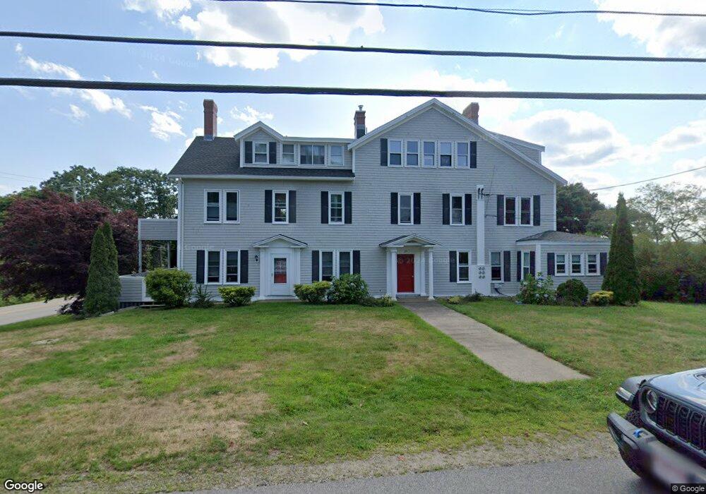
20 Lester B Orcutt Blvd Unit 5 Biddeford, ME 04006
Fortunes Rocks Neighborhood
3
Beds
2
Baths
1,421
Sq Ft
0.46
Acres
About This Home
This home is located at 20 Lester B Orcutt Blvd Unit 5, Biddeford, ME 04006. 20 Lester B Orcutt Blvd Unit 5 is a home located in York County with nearby schools including John F Kennedy Memorial School, Biddeford Primary School, and Biddeford Intermediate School.
Create a Home Valuation Report for This Property
The Home Valuation Report is an in-depth analysis detailing your home's value as well as a comparison with similar homes in the area
Home Values in the Area
Average Home Value in this Area
Tax History Compared to Growth
Map
Nearby Homes
- 111 Mile Stretch Rd
- 52 Lester B Orcutt Blvd
- 3 Fortunes Rocks Rd
- 6 Days Landing
- 88-90 Old Pool Rd
- 66 Old Pool Rd
- 2 Maddox Pond Rd
- Lot 1 Longboard Ln
- Lot 2 Longboard Ln
- 1 Willow Ridge
- Lot 3 Longboard Ln
- Lot 4 Longboard Ln
- Lot 7 Longboard Ln
- Lot 6 Longboard Ln
- 26 Reserved Ln
- 700 Pool St
- 96 Fortunes Rocks Rd
- 23 North Ave
- 9 Riverside Ave
- 12 Lower Beach Rd
- 20 Lester B Orcutt Blvd Unit 3
- 20 Lester B Orcutt Blvd Unit 1
- 20 Lester B Orcutt Blvd Unit 4
- 18 Lester B Orcutt Blvd
- 127 Mile Stretch Rd
- 19 Lester B Orcutt Blvd
- 9 Lester B Orcutt Blvd Unit 7
- 9 Lester B Orcutt Blvd Unit 1
- 7 Lester B Orcutt Blvd
- 9 Lester B Orcutt Blvd Unit 4
- 9 Lester B Orcutt Blvd Unit 2
- 9 Lester B Orcutt Blvd Unit 8
- 9 Lester B Orcutt Blvd Unit 9
- 22 Lester B Orcutt Blvd
- 1 Bayview Ave
- 21 Lester B Orcutt Blvd
- 6 Sandy Ln
- 16 Lester B Orcutt Blvd
- 125 Mile Stretch Rd