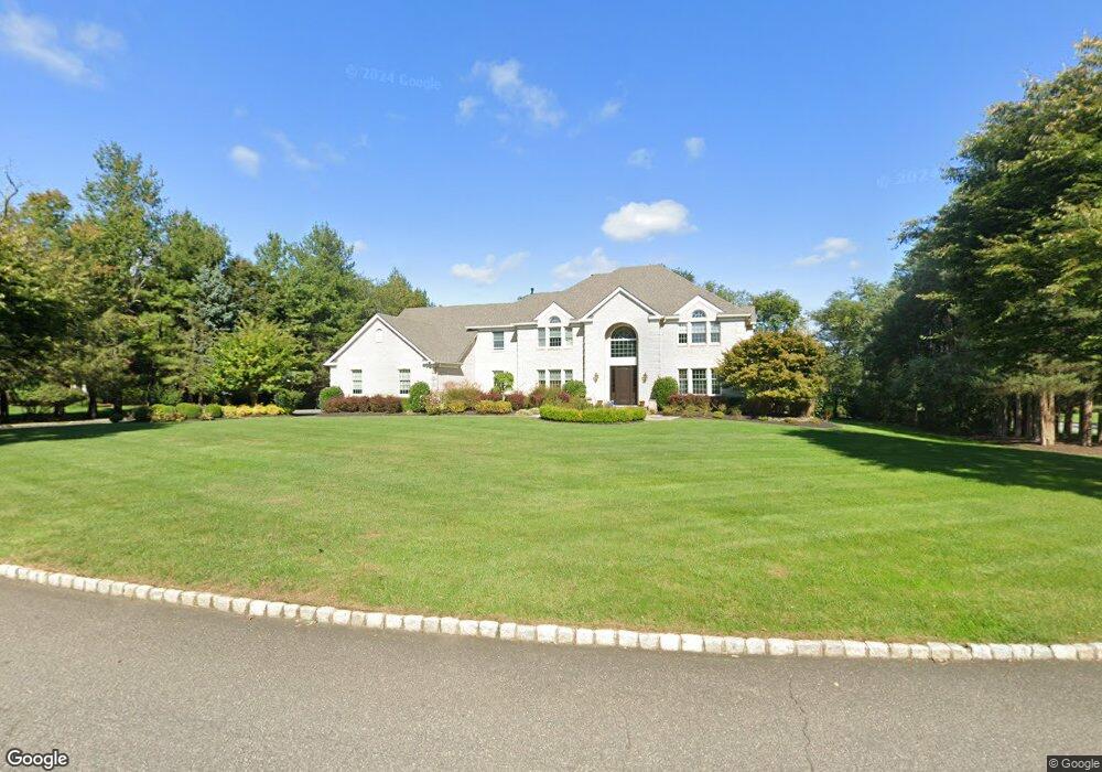
20 Liberty Knoll Colts Neck, NJ 07722
Estimated Value: $1,882,943 - $2,407,000
4
Beds
3
Baths
4,867
Sq Ft
$422/Sq Ft
Est. Value
About This Home
This home is located at 20 Liberty Knoll, Colts Neck, NJ 07722 and is currently estimated at $2,053,736, approximately $421 per square foot. 20 Liberty Knoll is a home located in Monmouth County with nearby schools including Conover Road School, Cedar Drive Middle School, and Colts Neck High School.
Ownership History
Date
Name
Owned For
Owner Type
Purchase Details
Closed on
Jul 28, 2004
Sold by
Lonardo Joseph
Bought by
Rathvon Richard and Rathvun Renee
Current Estimated Value
Home Financials for this Owner
Home Financials are based on the most recent Mortgage that was taken out on this home.
Original Mortgage
$685,000
Outstanding Balance
$344,183
Interest Rate
6.2%
Estimated Equity
$1,709,553
Purchase Details
Closed on
Mar 31, 1999
Sold by
Wagstaff John
Bought by
Lonardo Joseph and Lonardo Wendy
Home Financials for this Owner
Home Financials are based on the most recent Mortgage that was taken out on this home.
Original Mortgage
$525,000
Interest Rate
6.92%
Purchase Details
Closed on
May 6, 1996
Sold by
Aspen Building Corp
Bought by
Wagstaff John and Wagstaff Kim
Home Financials for this Owner
Home Financials are based on the most recent Mortgage that was taken out on this home.
Original Mortgage
$564,000
Interest Rate
7.67%
Create a Home Valuation Report for This Property
The Home Valuation Report is an in-depth analysis detailing your home's value as well as a comparison with similar homes in the area
Home Values in the Area
Average Home Value in this Area
Purchase History
| Date | Buyer | Sale Price | Title Company |
|---|---|---|---|
| Rathvon Richard | $1,235,000 | -- | |
| Lonardo Joseph | $820,000 | -- | |
| Wagstaff John | $705,000 | -- |
Source: Public Records
Mortgage History
| Date | Status | Borrower | Loan Amount |
|---|---|---|---|
| Open | Rathvon Richard | $685,000 | |
| Previous Owner | Lonardo Joseph | $525,000 | |
| Previous Owner | Wagstaff John | $564,000 |
Source: Public Records
Tax History Compared to Growth
Tax History
| Year | Tax Paid | Tax Assessment Tax Assessment Total Assessment is a certain percentage of the fair market value that is determined by local assessors to be the total taxable value of land and additions on the property. | Land | Improvement |
|---|---|---|---|---|
| 2025 | $23,584 | $1,536,900 | $561,700 | $975,200 |
| 2024 | $20,267 | $1,582,800 | $666,900 | $915,900 |
| 2023 | $20,267 | $1,302,500 | $436,700 | $865,800 |
| 2022 | $19,810 | $1,176,000 | $361,700 | $814,300 |
| 2021 | $19,810 | $1,134,600 | $361,700 | $772,900 |
| 2020 | $19,527 | $1,107,000 | $361,700 | $745,300 |
| 2019 | $20,563 | $1,167,700 | $431,600 | $736,100 |
| 2018 | $20,563 | $1,158,500 | $431,600 | $726,900 |
| 2017 | $20,841 | $1,178,100 | $416,600 | $761,500 |
| 2016 | $20,466 | $1,182,300 | $416,600 | $765,700 |
| 2015 | $20,433 | $1,177,700 | $423,000 | $754,700 |
| 2014 | $21,676 | $1,284,900 | $568,500 | $716,400 |
Source: Public Records
Map
Nearby Homes
- 1 Montana Dr
- 6 Willow Rd
- 17 Woods End Rd
- 249 County Road 537
- 8 Holling Rd
- 784 State Route 34
- 16 Hickory Ln
- 703 Quail Hill Rd
- 119 Lindy Ln
- 40 New St
- 98 Hockhockson Rd
- 3 Jockey Terrace N
- 660 County Route 520
- 17 High Point Rd
- 6 Bordens Brook Way
- 107 Lawley Dr
- 4 Brookside Dr
- 72 Main St
- 1497 W Front St
- 63 Eckert Dr
- 22 Liberty Knoll
- 3 Bowling Green
- 17 Liberty Knoll
- 19 Liberty Knoll
- 15 Liberty Knoll
- 21 Liberty Knoll
- 5 Bowling Green
- 11 Liberty Knoll
- 24 Liberty Knoll
- 23 Liberty Knoll
- 4 Bowling Green
- 9 Liberty Knoll
- 2 Fireside Dr
- 1 Fireside Dr
- 15 Seedling Dr
- 19 Seedling Dr
- 23 Seedling Dr
- 6 Fireside Dr
- 3 Fireside Dr
- 143 Phalanx Rd