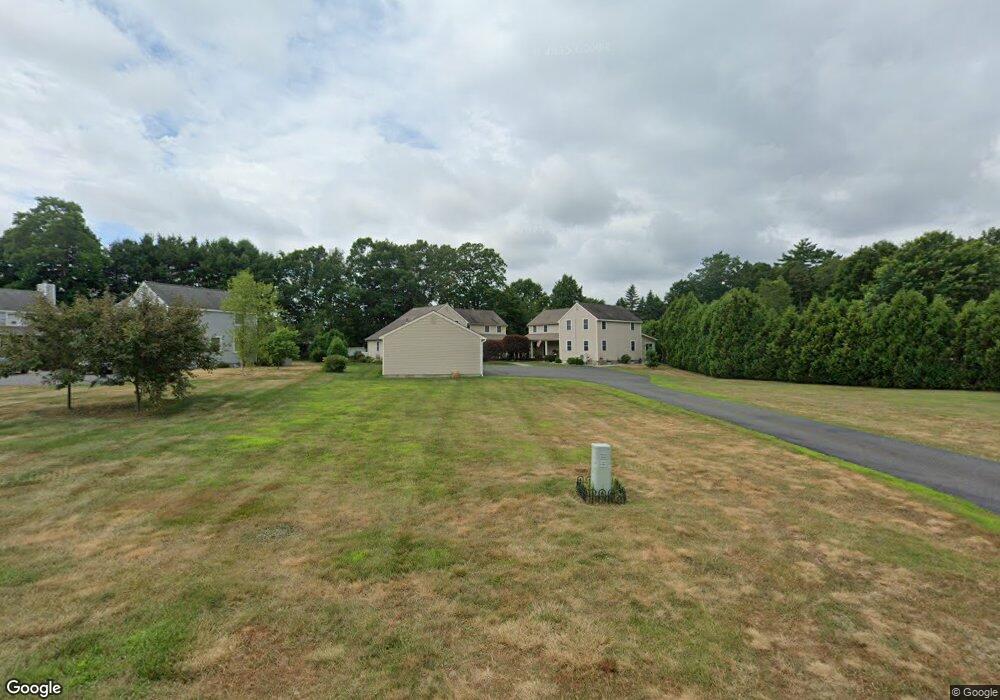
20 Lillians Way Erving, MA 01344
Estimated Value: $259,000 - $372,000
3
Beds
2
Baths
1,436
Sq Ft
$205/Sq Ft
Est. Value
About This Home
This home is located at 20 Lillians Way, Erving, MA 01344 and is currently estimated at $293,892, approximately $204 per square foot. 20 Lillians Way is a home located in Franklin County with nearby schools including Erving Elementary School, Four Winds School, and Kemsley Academy.
Ownership History
Date
Name
Owned For
Owner Type
Purchase Details
Closed on
Jun 23, 2005
Sold by
Stafford Elaine
Bought by
Galvis Jacqueline M
Current Estimated Value
Home Financials for this Owner
Home Financials are based on the most recent Mortgage that was taken out on this home.
Original Mortgage
$80,000
Outstanding Balance
$41,926
Interest Rate
5.82%
Mortgage Type
Purchase Money Mortgage
Estimated Equity
$251,966
Purchase Details
Closed on
Aug 31, 1999
Sold by
Pekalski Joel E and Pekalski Pamela E
Bought by
Stafford Elaine
Create a Home Valuation Report for This Property
The Home Valuation Report is an in-depth analysis detailing your home's value as well as a comparison with similar homes in the area
Home Values in the Area
Average Home Value in this Area
Purchase History
| Date | Buyer | Sale Price | Title Company |
|---|---|---|---|
| Galvis Jacqueline M | $195,000 | -- | |
| Stafford Elaine | $114,000 | -- |
Source: Public Records
Mortgage History
| Date | Status | Borrower | Loan Amount |
|---|---|---|---|
| Open | Galvis Jacqueline M | $80,000 |
Source: Public Records
Tax History Compared to Growth
Tax History
| Year | Tax Paid | Tax Assessment Tax Assessment Total Assessment is a certain percentage of the fair market value that is determined by local assessors to be the total taxable value of land and additions on the property. | Land | Improvement |
|---|---|---|---|---|
| 2025 | $2,102 | $225,800 | $0 | $225,800 |
| 2024 | $1,988 | $215,600 | $0 | $215,600 |
| 2023 | $1,737 | $217,100 | $0 | $217,100 |
| 2022 | $1,717 | $217,300 | $0 | $217,300 |
| 2021 | $1,603 | $211,200 | $0 | $211,200 |
| 2020 | $1,592 | $211,200 | $0 | $211,200 |
| 2019 | $1,563 | $212,700 | $0 | $212,700 |
| 2018 | $1,308 | $182,900 | $0 | $182,900 |
| 2017 | $1,273 | $182,900 | $0 | $182,900 |
| 2016 | $1,236 | $182,900 | $0 | $182,900 |
| 2015 | $1,565 | $181,600 | $0 | $181,600 |
Source: Public Records
Map
Nearby Homes
- Lots 1-4 Kavanaugh Ln
- 5 Bridge St
- 8 Craig Ave
- 2 Pisgah Mountain Rd
- 183 Millers Falls Rd
- 0 State Rd
- 2 Alice St
- 202 Turnpike Rd
- 182 Main Rd
- 45 Millers Falls Rd
- 114 Montague St
- 21 Hillside Ave
- 0 Old Farley Rd
- 89 Montague St
- 0 Millers Falls Rd Unit 73034825
- 55 A + B Randall Rd
- 30 Park St
- 0 Meadow View Ln & Pine Meadow
- 10 W Main St
- 64 Main St
- 24 Lillians Way
- 22 Lillians Way
- 24 Lillians Way
- 16 Lillians Way
- 10 Lillians Way
- 14 Lillians Way
- 14 Lillians Way Unit 14
- 18 Lillians Way
- 18 Lillians Way Unit 18
- 20 Lillian's Way Unit 20
- 26 Lillians Way
- 12 Lillians Way
- 17 Lillians Way
- 13 Lillians Way
- 19 Lillians Way
- 8 Lillians Way
- 6 Lillians Way
- 8 Lillian's Way
- 4 Lillian's Way
- 65 French King Hwy Unit 2