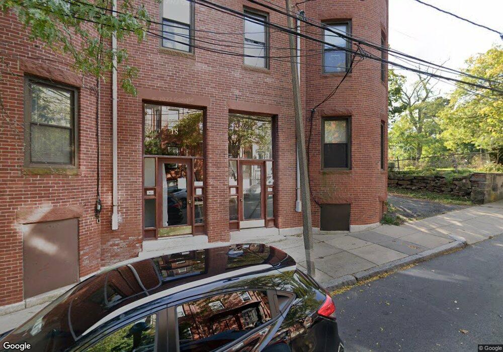
20 Linwood St Unit 2 Roxbury, MA 02119
Fort Hill NeighborhoodEstimated Value: $469,000 - $639,000
3
Beds
1
Bath
1,128
Sq Ft
$481/Sq Ft
Est. Value
About This Home
This home is located at 20 Linwood St Unit 2, Roxbury, MA 02119 and is currently estimated at $542,071, approximately $480 per square foot. 20 Linwood St Unit 2 is a home located in Suffolk County with nearby schools including City on a Hill Charter Public School, Paige Academy, and Malik Academy.
Ownership History
Date
Name
Owned For
Owner Type
Purchase Details
Closed on
Apr 12, 2004
Sold by
Powell Jose W
Bought by
Powell Jose W and Powell Marselis
Current Estimated Value
Home Financials for this Owner
Home Financials are based on the most recent Mortgage that was taken out on this home.
Original Mortgage
$225,080
Outstanding Balance
$105,476
Interest Rate
5.6%
Mortgage Type
Purchase Money Mortgage
Estimated Equity
$436,595
Purchase Details
Closed on
Sep 14, 1999
Sold by
Dfjr Llc
Bought by
Espolong E O and Espolong Susana D
Home Financials for this Owner
Home Financials are based on the most recent Mortgage that was taken out on this home.
Original Mortgage
$118,750
Interest Rate
7.65%
Mortgage Type
Purchase Money Mortgage
Create a Home Valuation Report for This Property
The Home Valuation Report is an in-depth analysis detailing your home's value as well as a comparison with similar homes in the area
Home Values in the Area
Average Home Value in this Area
Purchase History
| Date | Buyer | Sale Price | Title Company |
|---|---|---|---|
| Powell Jose W | -- | -- | |
| Espolong E O | $125,000 | -- |
Source: Public Records
Mortgage History
| Date | Status | Borrower | Loan Amount |
|---|---|---|---|
| Open | Espolong E O | $225,080 | |
| Previous Owner | Espolong E O | $118,750 |
Source: Public Records
Tax History Compared to Growth
Tax History
| Year | Tax Paid | Tax Assessment Tax Assessment Total Assessment is a certain percentage of the fair market value that is determined by local assessors to be the total taxable value of land and additions on the property. | Land | Improvement |
|---|---|---|---|---|
| 2025 | $5,195 | $448,600 | $0 | $448,600 |
| 2024 | $5,072 | $465,300 | $0 | $465,300 |
| 2023 | $4,850 | $451,600 | $0 | $451,600 |
| 2022 | $4,679 | $430,100 | $0 | $430,100 |
| 2021 | $4,589 | $430,100 | $0 | $430,100 |
| 2020 | $3,843 | $363,900 | $0 | $363,900 |
| 2019 | $3,551 | $336,900 | $0 | $336,900 |
| 2018 | $3,271 | $312,100 | $0 | $312,100 |
| 2017 | $3,088 | $291,600 | $0 | $291,600 |
| 2016 | $2,970 | $270,000 | $0 | $270,000 |
| 2015 | $2,780 | $229,600 | $0 | $229,600 |
| 2014 | $2,648 | $210,500 | $0 | $210,500 |
Source: Public Records
Map
Nearby Homes
- 10 Linwood St
- 31 Dorr St
- 59 Fort Ave
- 49 Norfolk St
- 249 Roxbury St Unit 1
- 4 Fort Ave Unit 2
- 27 Dudley St
- 51 Beech Glen St Unit 3
- 38 Juniper St
- 63 Beech Glen St
- 743 Parker St Unit 3
- 9 W Cedar St Unit 1
- 22 Fisher Ave
- 51 Saint James St
- 9-45 Vale St
- 64 Alpine St Unit 104
- 64 Alpine St Unit 304
- 37 Regent St Unit 2
- 2856 Washington St
- 8 Brinton St Unit 2
- 20 Linwood St Unit 3
- 20 Linwood St Unit 1
- 14 Linwood St Unit 3
- 14 Linwood St Unit 2
- 14 Linwood St Unit 1
- 16 Linwood St Unit 3
- 16 Linwood St Unit 2
- 16 Linwood St Unit 1
- 18 Linwood St Unit 3
- 18 Linwood St Unit 2
- 18 Linwood St Unit 1
- 21 Linwood St
- 21 Linwood St Unit 1a
- 10 Linwood St Unit 3
- 10 Linwood St Unit 2
- 10 Linwood St Unit 4
- 23 Linwood St
- 23 Linwood St Unit 2
- 23 Linwood St Unit 1
- 23 Linwood St Unit 3