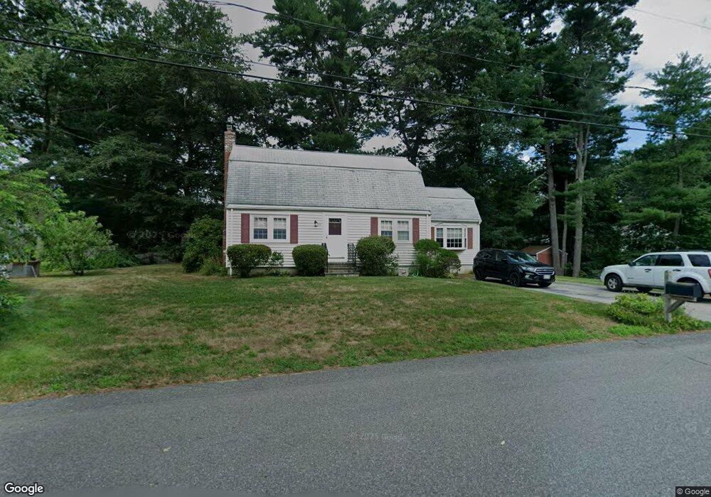
20 Lydon Ln Kingston, MA 02364
Estimated Value: $599,000 - $648,000
3
Beds
2
Baths
1,760
Sq Ft
$352/Sq Ft
Est. Value
About This Home
This home is located at 20 Lydon Ln, Kingston, MA 02364 and is currently estimated at $618,851, approximately $351 per square foot. 20 Lydon Ln is a home located in Plymouth County with nearby schools including Silver Lake Regional High School, Kingston Elementary School, and Kingston Intermediate School.
Ownership History
Date
Name
Owned For
Owner Type
Purchase Details
Closed on
Apr 4, 2022
Sold by
Tuberosa Nicholas R and Tuberosa Martha E
Bought by
Tuberosa Ft
Current Estimated Value
Purchase Details
Closed on
Dec 21, 1970
Bought by
Tuberosa Nicholas R and Tuberosa Martha E
Create a Home Valuation Report for This Property
The Home Valuation Report is an in-depth analysis detailing your home's value as well as a comparison with similar homes in the area
Home Values in the Area
Average Home Value in this Area
Purchase History
| Date | Buyer | Sale Price | Title Company |
|---|---|---|---|
| Tuberosa Ft | -- | None Available | |
| Tuberosa Nicholas R | -- | -- |
Source: Public Records
Mortgage History
| Date | Status | Borrower | Loan Amount |
|---|---|---|---|
| Previous Owner | Tuberosa Nicholas R | $104,994 | |
| Previous Owner | Tuberosa Nicholas R | $89,000 | |
| Previous Owner | Tuberosa Nicholas R | $100,000 | |
| Previous Owner | Tuberosa Nicholas R | $120,000 |
Source: Public Records
Tax History Compared to Growth
Tax History
| Year | Tax Paid | Tax Assessment Tax Assessment Total Assessment is a certain percentage of the fair market value that is determined by local assessors to be the total taxable value of land and additions on the property. | Land | Improvement |
|---|---|---|---|---|
| 2025 | $6,974 | $537,700 | $201,200 | $336,500 |
| 2024 | $6,504 | $511,700 | $201,200 | $310,500 |
| 2023 | $6,290 | $470,800 | $201,200 | $269,600 |
| 2022 | $6,040 | $414,300 | $178,400 | $235,900 |
| 2021 | $5,895 | $366,600 | $164,200 | $202,400 |
| 2020 | $5,851 | $359,400 | $164,200 | $195,200 |
| 2019 | $5,758 | $349,800 | $164,200 | $185,600 |
| 2018 | $5,397 | $328,100 | $164,200 | $163,900 |
| 2017 | $5,297 | $321,000 | $159,500 | $161,500 |
| 2016 | $4,961 | $281,700 | $150,900 | $130,800 |
| 2015 | $4,809 | $283,900 | $150,900 | $133,000 |
| 2014 | $4,689 | $281,100 | $145,900 | $135,200 |
Source: Public Records
Map
Nearby Homes