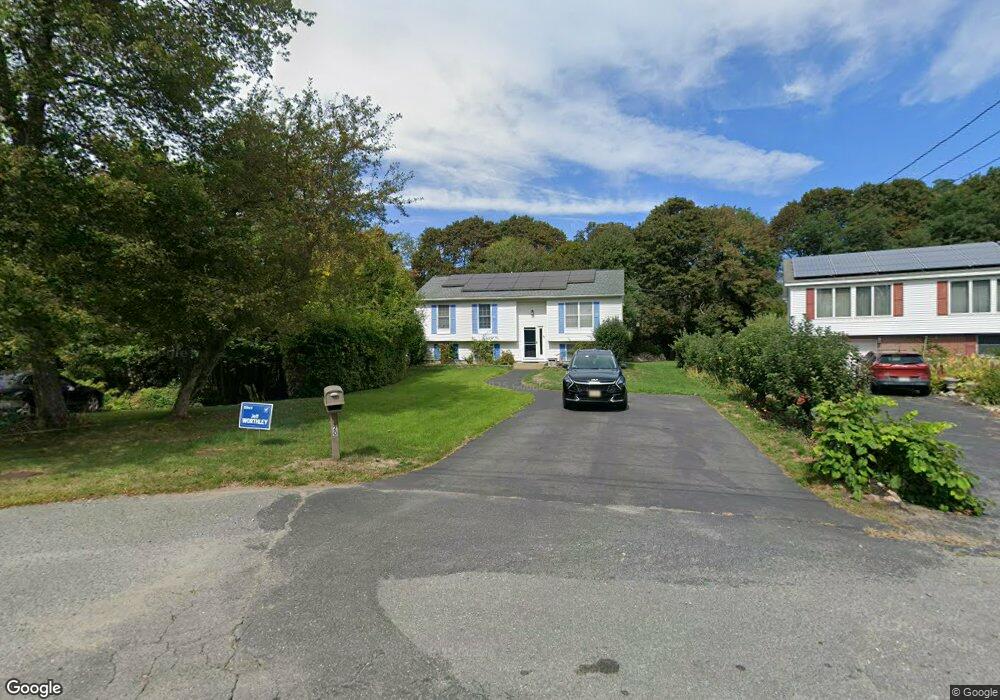
20 Macomber Rd Gloucester, MA 01930
Estimated Value: $658,000 - $858,000
4
Beds
2
Baths
1,002
Sq Ft
$753/Sq Ft
Est. Value
About This Home
This home is located at 20 Macomber Rd, Gloucester, MA 01930 and is currently estimated at $754,523, approximately $753 per square foot. 20 Macomber Rd is a home located in Essex County with nearby schools including Beeman Memorial, Ralph B O'maley Middle School, and Gloucester High School.
Ownership History
Date
Name
Owned For
Owner Type
Purchase Details
Closed on
Dec 3, 1991
Sold by
Mccarthy John J and Mccarth Christopher
Bought by
Ingersoll Lawrence H and Campbell Annette
Current Estimated Value
Create a Home Valuation Report for This Property
The Home Valuation Report is an in-depth analysis detailing your home's value as well as a comparison with similar homes in the area
Purchase History
| Date | Buyer | Sale Price | Title Company |
|---|---|---|---|
| Ingersoll Lawrence H | $156,000 | -- |
Source: Public Records
Mortgage History
| Date | Status | Borrower | Loan Amount |
|---|---|---|---|
| Open | Ingersoll Lawrence H | $220,825 | |
| Closed | Ingersoll Lawrence H | $25,000 | |
| Closed | Ingersoll Lawrence H | $232,000 |
Source: Public Records
Tax History Compared to Growth
Tax History
| Year | Tax Paid | Tax Assessment Tax Assessment Total Assessment is a certain percentage of the fair market value that is determined by local assessors to be the total taxable value of land and additions on the property. | Land | Improvement |
|---|---|---|---|---|
| 2025 | $5,863 | $603,200 | $227,300 | $375,900 |
| 2024 | $5,988 | $615,400 | $216,500 | $398,900 |
| 2023 | $5,669 | $535,300 | $193,200 | $342,100 |
| 2022 | $5,317 | $453,300 | $168,100 | $285,200 |
| 2021 | $5,215 | $419,200 | $152,900 | $266,300 |
| 2020 | $4,938 | $400,500 | $152,900 | $247,600 |
| 2019 | $4,983 | $392,700 | $152,900 | $239,800 |
| 2018 | $4,727 | $365,600 | $152,900 | $212,700 |
| 2017 | $4,478 | $339,500 | $145,600 | $193,900 |
| 2016 | $4,472 | $328,600 | $151,900 | $176,700 |
| 2015 | $4,348 | $318,500 | $151,900 | $166,600 |
Source: Public Records
Map
Nearby Homes
- 2 Finch Ln
- 672 Washington St
- 78 Grove St
- 98 Maplewood Ave
- 16 Cleveland Place Unit 11
- 6 Monroe Ct
- 145 Essex St Unit 622
- 40 Sargent St
- 196 Washington St
- 226 Atlantic St
- 33 Maplewood Ave Unit 16
- 10 Oak St Unit 3
- 29 Harrison Ave
- 15 Harvard St
- 4 Mount Vernon St
- 22 Taylor St Unit 1
- 118 Prospect St
- 9 & 11 Helens Way
- 84 Centennial Ave
- 20 Beacon St Unit 2