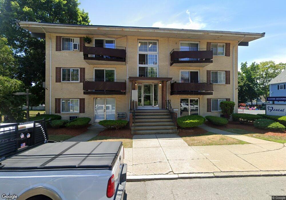
20 Main St Saugus, MA 01906
Downtown Saugus Neighborhood
1
Bed
1
Bath
680
Sq Ft
11,369
Sq Ft Lot
About This Home
This home is located at 20 Main St, Saugus, MA 01906. 20 Main St is a home located in Essex County with nearby schools including Saugus High School, Pioneer Charter School Of Science II, and Sacred Heart School.
Ownership History
Date
Name
Owned For
Owner Type
Purchase Details
Closed on
Aug 31, 2018
Sold by
Forest Realty Enterpri
Bought by
Park Towers 5 Llc
Home Financials for this Owner
Home Financials are based on the most recent Mortgage that was taken out on this home.
Original Mortgage
$11,220,000
Outstanding Balance
$9,682,958
Interest Rate
4.5%
Mortgage Type
Commercial
Purchase Details
Closed on
Aug 21, 1981
Bought by
Procopio Constr Co Inc
Create a Home Valuation Report for This Property
The Home Valuation Report is an in-depth analysis detailing your home's value as well as a comparison with similar homes in the area
Home Values in the Area
Average Home Value in this Area
Purchase History
| Date | Buyer | Sale Price | Title Company |
|---|---|---|---|
| Park Towers 5 Llc | $14,025,000 | -- | |
| Park Towers 5 Llc | $14,025,000 | -- | |
| Procopio Constr Co Inc | -- | -- |
Source: Public Records
Mortgage History
| Date | Status | Borrower | Loan Amount |
|---|---|---|---|
| Open | Park Towers 5 Llc | $11,220,000 | |
| Closed | Park Towers 5 Llc | $11,220,000 | |
| Previous Owner | Procopio Constr Co Inc | $1,000,000 | |
| Previous Owner | Procopio Constr Co Inc | $352,000 | |
| Previous Owner | Procopio Constr Co Inc | $300,000 |
Source: Public Records
Tax History
| Year | Tax Paid | Tax Assessment Tax Assessment Total Assessment is a certain percentage of the fair market value that is determined by local assessors to be the total taxable value of land and additions on the property. | Land | Improvement |
|---|---|---|---|---|
| 2025 | -- | $2,021,600 | $630,000 | $1,391,600 |
| 2024 | -- | $1,919,800 | $567,000 | $1,352,800 |
| 2023 | $0 | $1,774,000 | $513,000 | $1,261,000 |
| 2022 | $0 | $1,564,900 | $450,000 | $1,114,900 |
| 2021 | $0 | $1,447,600 | $405,000 | $1,042,600 |
| 2020 | $0 | $1,169,500 | $270,000 | $899,500 |
| 2019 | $0 | $1,056,700 | $225,000 | $831,700 |
| 2018 | $0 | $1,041,700 | $225,000 | $816,700 |
| 2017 | $0 | $888,000 | $146,100 | $741,900 |
| 2016 | -- | $888,000 | $146,100 | $741,900 |
| 2015 | -- | $881,000 | $139,100 | $741,900 |
| 2014 | -- | $900,500 | $139,100 | $761,400 |
Source: Public Records
Map
Nearby Homes
- 20 Main St Unit 33
- 20 Main St Unit 11
- 20 Main St Unit 23
- 20 Main St Unit 22
- 20 Main St Unit 20
- 20 Main St Unit 21
- 20 Main St Unit 32
- 24 Main St
- 1-3 Main St
- 0 Non Unit 73291670
- 72 Bristol St Unit 1
- 1008 Sherwood Unit 1008
- 11 Columbus Ave
- 11 Columbus Ave Unit 1
- 15 Columbus Ave
- 9 Columbus Ave
- 5 Columbus Ave
- 19 Columbus Ave
- 34 Taylor St
- 9 Main St
Your Personal Tour Guide
Ask me questions while you tour the home.