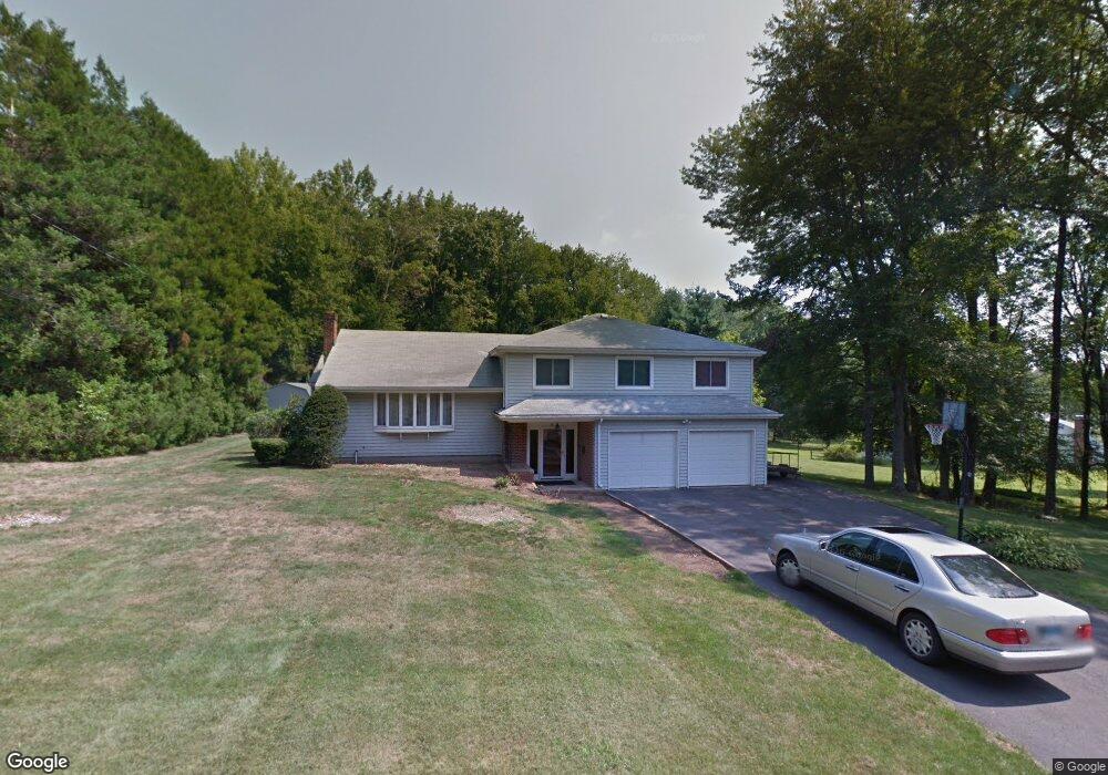
20 Mallard Dr Bloomfield, CT 06002
Estimated Value: $400,000 - $451,000
About This Home
This home is located at 20 Mallard Dr, Bloomfield, CT 06002 and is currently estimated at $424,530, approximately $228 per square foot. 20 Mallard Dr is a home located in Hartford County with nearby schools including Laurel School, Carmen Arace Intermediate School, and Metacomet School.
Ownership History
We collect this data history from publicly available records. To have your information removed, we recommend requesting removal directly through your county’s website.
Purchase Details
Home Financials for this Owner
Home Financials are based on the most recent Mortgage that was taken out on this home.Home Values in the Area
Average Home Value in this Area
Purchase History
We collect this data history from publicly available records. To have your information removed, we recommend requesting removal directly through your county’s website.
| Date | Buyer | Sale Price | Title Company |
|---|---|---|---|
| $164,000 | -- | ||
| $164,000 | -- |
Mortgage History
We collect this data history from publicly available records. To have your information removed, we recommend requesting removal directly through your county’s website.
| Date | Status | Borrower | Loan Amount |
|---|---|---|---|
| Closed | $26,673 | ||
| Closed | $226,500 | ||
| Closed | $138,983 | ||
| Closed | $155,800 |
Tax History
We collect this data history from publicly available records. To have your information removed, we recommend requesting removal directly through your county’s website.
| Year | Tax Paid | Tax Assessment Tax Assessment Total Assessment is a certain percentage of the fair market value that is determined by local assessors to be the total taxable value of land and additions on the property. | Land | Improvement |
|---|---|---|---|---|
| 2025 | $10,555 | $281,470 | $61,880 | $219,590 |
| 2024 | $6,752 | $172,060 | $51,870 | $120,190 |
| 2023 | $6,629 | $172,060 | $51,870 | $120,190 |
| 2022 | $6,199 | $172,060 | $51,870 | $120,190 |
| 2021 | $6,337 | $172,060 | $51,870 | $120,190 |
| 2020 | $6,239 | $172,060 | $51,870 | $120,190 |
| 2019 | $6,611 | $171,010 | $51,870 | $119,140 |
| 2018 | $5,996 | $155,260 | $51,800 | $103,460 |
| 2017 | $5,987 | $155,260 | $51,800 | $103,460 |
| 2016 | $5,846 | $155,260 | $51,800 | $103,460 |
| 2015 | $5,737 | $155,260 | $51,800 | $103,460 |
| 2014 | $5,757 | $161,070 | $52,220 | $108,850 |
Map
- 10 Cliffmount Dr
- 78 Silo Way
- 20 Reed Ct Unit 20
- 174 Thistle Pond Dr Unit 174
- 29 Burr Rd
- 36 Bay Hill Dr Unit 36
- 4 Spy Glass Cir Unit 4
- 6 Spy Glass Cir
- 19 Cherry Hills Cir
- 10 Breezy Knoll Dr
- 2 Schuyler Ln
- 13 Juniper Rd
- 7 Woodland Ave Unit C
- 21 Juniper Rd
- 79 Prospect St
- 32 Juniper Rd
- 28 Prospect St
- 10 Linden Ct Unit 10
- 32 Brentwood Dr
- 22 Terry Plains Rd
Ask me questions while you tour the home.