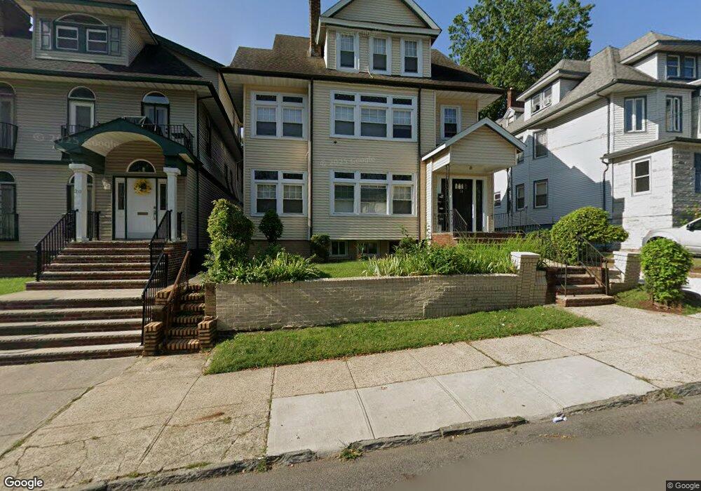
20 Mapes Ave Unit 22 Newark, NJ 07112
Weequahic NeighborhoodEstimated Value: $594,000 - $737,000
--
Bed
--
Bath
3,338
Sq Ft
$192/Sq Ft
Est. Value
About This Home
This home is located at 20 Mapes Ave Unit 22, Newark, NJ 07112 and is currently estimated at $640,655, approximately $191 per square foot. 20 Mapes Ave Unit 22 is a home located in Essex County with nearby schools including Peshine Avenue Elementary School, Belmont Runyon School, and Chancellor Avenue School.
Ownership History
Date
Name
Owned For
Owner Type
Purchase Details
Closed on
Mar 31, 2024
Sold by
Young Charlene Cooper and Young Bobby
Bought by
Young Charlene Cooper and Cooper Chanard
Current Estimated Value
Purchase Details
Closed on
Jul 17, 2006
Purchase Details
Closed on
Jan 7, 1993
Sold by
Newman Eleanor
Bought by
Childs Charlotta
Create a Home Valuation Report for This Property
The Home Valuation Report is an in-depth analysis detailing your home's value as well as a comparison with similar homes in the area
Home Values in the Area
Average Home Value in this Area
Purchase History
| Date | Buyer | Sale Price | Title Company |
|---|---|---|---|
| Young Charlene Cooper | -- | None Listed On Document | |
| -- | -- | -- | |
| Childs Charlotta | -- | -- |
Source: Public Records
Tax History Compared to Growth
Tax History
| Year | Tax Paid | Tax Assessment Tax Assessment Total Assessment is a certain percentage of the fair market value that is determined by local assessors to be the total taxable value of land and additions on the property. | Land | Improvement |
|---|---|---|---|---|
| 2025 | $7,273 | $195,100 | $20,600 | $174,500 |
| 2024 | $7,273 | $195,100 | $20,600 | $174,500 |
| 2022 | $7,289 | $195,100 | $20,600 | $174,500 |
| 2021 | $7,285 | $195,100 | $20,600 | $174,500 |
| 2020 | $7,414 | $195,100 | $20,600 | $174,500 |
| 2019 | $7,338 | $195,100 | $20,600 | $174,500 |
| 2018 | $7,205 | $195,100 | $20,600 | $174,500 |
| 2017 | $6,946 | $195,100 | $20,600 | $174,500 |
| 2016 | $6,711 | $195,100 | $20,600 | $174,500 |
| 2015 | $6,456 | $195,100 | $20,600 | $174,500 |
| 2014 | $6,050 | $195,100 | $20,600 | $174,500 |
Source: Public Records
Map
Nearby Homes
- 29 Mapes Ave
- 13-15 Lehigh Ave
- 26-28 Scheerer Ave
- 28 Scheerer Ave
- 52-54 Lehigh Ave
- 73 Mapes Ave
- 77 Shephard Ave Unit 81
- 59-61 Stengel Ave
- 59 61 Stengel Ave
- 30-32 Custer Ave
- 90 Lehigh Ave Unit 92
- 19 Lyons Ave Unit 409
- 19-31 Lyons Ave Unit 409
- 1041 Hunterdon St
- 137 Renner Ave
- 116-118 Shephard Ave
- 117 Lehigh Ave
- 1075 Bergen St
- 253 Meeker Ave
- 134 Lehigh Ave
- 18 Mapes Ave
- 24 Mapes Ave Unit 26
- 24 Mapes Ave Unit 2
- 24-26 Mapes Ave Unit 2
- 16 Mapes Ave
- 28 Mapes Ave Unit 30
- 9 Lehigh Ave Unit 11
- 9 Lehigh Ave Unit 2
- 9 Lehigh Ave Unit 1
- 13 Lehigh Ave Unit 15
- 565 Elizabeth Ave
- 565-571 Elizabeth Ave
- 32 Mapes Ave Unit 34
- 32-34 Mapes Ave
- 561 Elizabeth Ave
- 561 Elizabeth Ave Unit 561
- 19 Mapes Ave Unit 21
- 13 Mapes Ave Unit 17
- 21 Lehigh Ave Unit 23
- 36 Mapes Ave