Estimated Value: $477,000 - $548,000
2
Beds
3
Baths
1,092
Sq Ft
$457/Sq Ft
Est. Value
About This Home
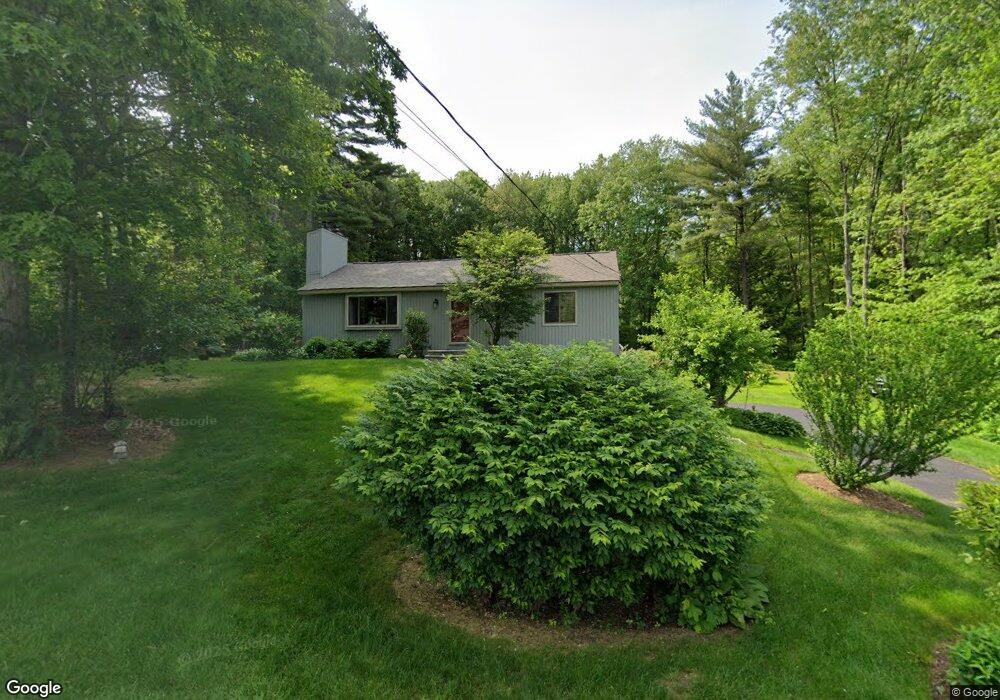
This home is located at 20 Maxwell Dr, Derry, NH 03038 and is currently estimated at $499,112, approximately $457 per square foot. 20 Maxwell Dr is a home located in Rockingham County with nearby schools including East Derry Memorial Elementary School, West Running Brook Middle School, and Pinkerton Academy.
Create a Home Valuation Report for This Property
The Home Valuation Report is an in-depth analysis detailing your home's value as well as a comparison with similar homes in the area
Home Values in the Area
Average Home Value in this Area
Tax History
We collect this data history from publicly available records. To have your information removed, we recommend requesting removal directly through your county’s website.
| Year | Tax Paid | Tax Assessment Tax Assessment Total Assessment is a certain percentage of the fair market value that is determined by local assessors to be the total taxable value of land and additions on the property. | Land | Improvement |
|---|---|---|---|---|
| 2025 | $6,876 | $362,100 | $185,800 | $176,300 |
| 2024 | $6,768 | $362,100 | $185,800 | $176,300 |
| 2023 | $6,568 | $317,600 | $157,900 | $159,700 |
| 2022 | $6,047 | $317,600 | $157,900 | $159,700 |
| 2021 | $5,962 | $240,800 | $121,800 | $119,000 |
| 2020 | $5,861 | $240,800 | $121,800 | $119,000 |
| 2019 | $5,595 | $214,200 | $95,200 | $119,000 |
| 2018 | $5,576 | $214,200 | $95,200 | $119,000 |
| 2017 | $5,489 | $190,200 | $88,900 | $101,300 |
| 2016 | $5,147 | $190,200 | $88,900 | $101,300 |
| 2015 | $5,215 | $178,400 | $88,900 | $89,500 |
| 2014 | $5,249 | $178,400 | $88,900 | $89,500 |
| 2013 | $5,174 | $164,300 | $79,800 | $84,500 |
Source: Public Records
Map
Nearby Homes
- 29 Cunningham Dr
- 40 Sheldon Rd
- 7 Cameron Ct Unit 7
- 1 Cameron Ct Unit 1
- 55 Kristin Dr
- 3 Richardson Dr Unit R
- 1 Jessica Ln
- 5 Richardson Dr Unit L
- 32 Kristin Dr
- 222 Hampstead Rd
- 55 Page Ln
- 146 Wheel Wright Rd
- 206 Hampstead Rd
- 22 Collettes Grove Rd
- 210 Kent Farm Rd Unit 2
- 2 Remington Ct
- 2 Dubeau Dr
- 41 Drew Woods Dr
- 27 Saint John Ln
- 92 Lantern Dr
Your Personal Tour Guide
Ask me questions while you tour the home.