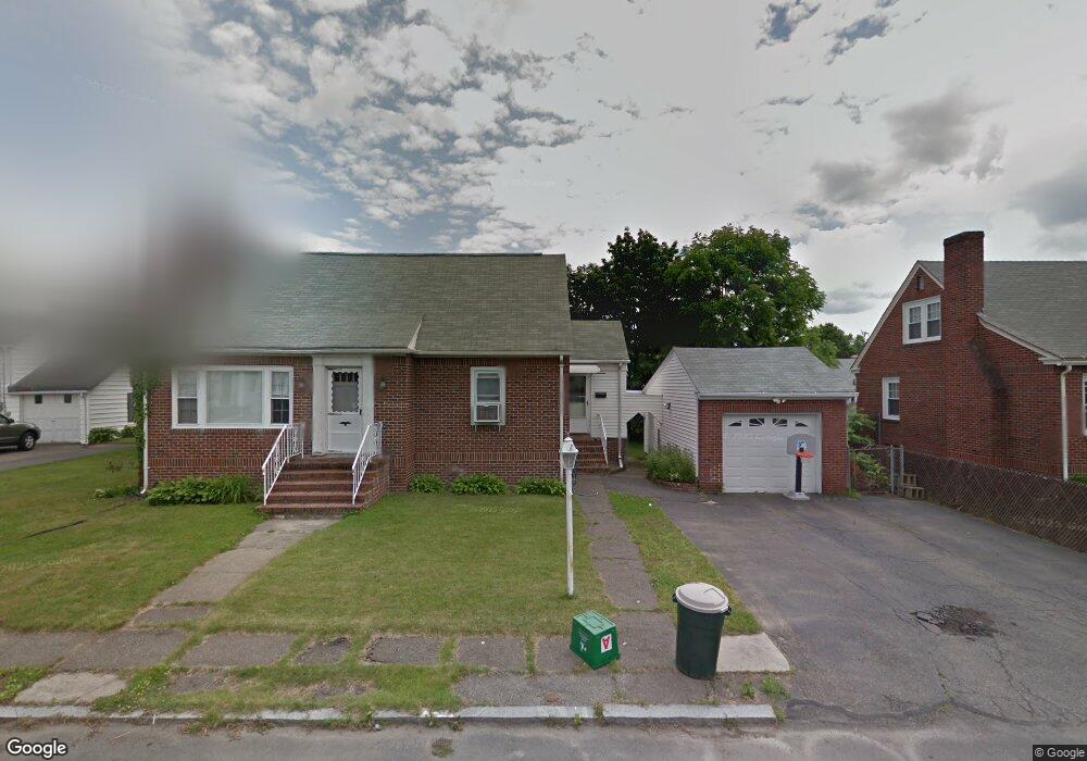
20 Meadowbrook Rd Methuen, MA 01844
The East End NeighborhoodEstimated Value: $584,000 - $600,000
3
Beds
2
Baths
2,000
Sq Ft
$296/Sq Ft
Est. Value
About This Home
This home is located at 20 Meadowbrook Rd, Methuen, MA 01844 and is currently estimated at $591,457, approximately $295 per square foot. 20 Meadowbrook Rd is a home located in Essex County with nearby schools including Timony Grammar School, Methuen High School, and Community Day Charter Public School - Gateway.
Ownership History
Date
Name
Owned For
Owner Type
Purchase Details
Closed on
Sep 12, 2025
Sold by
Tufts Tyrone K and Tufts Cheryl M
Bought by
Tyrone & Cheryl Tufts Ret and Tufts
Current Estimated Value
Purchase Details
Closed on
Oct 12, 2004
Sold by
Mansor George E
Bought by
Tufts Tyrone K and Tufts Cheryl M
Home Financials for this Owner
Home Financials are based on the most recent Mortgage that was taken out on this home.
Original Mortgage
$285,421
Interest Rate
5.84%
Mortgage Type
Purchase Money Mortgage
Create a Home Valuation Report for This Property
The Home Valuation Report is an in-depth analysis detailing your home's value as well as a comparison with similar homes in the area
Home Values in the Area
Average Home Value in this Area
Purchase History
| Date | Buyer | Sale Price | Title Company |
|---|---|---|---|
| Tyrone & Cheryl Tufts Ret | -- | -- | |
| Tufts Tyrone K | $289,900 | -- | |
| Tufts Tyrone K | $289,900 | -- |
Source: Public Records
Mortgage History
| Date | Status | Borrower | Loan Amount |
|---|---|---|---|
| Previous Owner | Tufts Tyrone K | $197,000 | |
| Previous Owner | Tufts Tyrone K | $285,421 | |
| Previous Owner | Tufts Tyrone K | $52,500 | |
| Previous Owner | Tufts Tyrone K | $64,000 |
Source: Public Records
Tax History
| Year | Tax Paid | Tax Assessment Tax Assessment Total Assessment is a certain percentage of the fair market value that is determined by local assessors to be the total taxable value of land and additions on the property. | Land | Improvement |
|---|---|---|---|---|
| 2025 | $5,304 | $501,300 | $195,700 | $305,600 |
| 2024 | $5,261 | $484,400 | $178,500 | $305,900 |
| 2023 | $4,901 | $418,900 | $158,600 | $260,300 |
| 2022 | $4,637 | $355,300 | $132,200 | $223,100 |
| 2021 | $4,404 | $333,900 | $125,600 | $208,300 |
| 2020 | $4,407 | $327,900 | $125,600 | $202,300 |
| 2019 | $4,196 | $295,700 | $112,400 | $183,300 |
| 2018 | $4,091 | $286,700 | $112,400 | $174,300 |
| 2017 | $3,938 | $268,800 | $112,400 | $156,400 |
| 2016 | $3,663 | $247,300 | $105,800 | $141,500 |
| 2015 | $3,440 | $235,600 | $105,800 | $129,800 |
Source: Public Records
Map
Nearby Homes
- 18 Erhardt Terrace
- 7 Erhardt Terrace
- 32 Josephine Ave
- 106 Leroy Ave
- 12 Annette St
- 264 E Haverhill St Unit 2
- 39 Swan Ave
- 68 Ashford St
- 14 Court St
- 1 Riverview Blvd Unit 8-203
- 109 Ferry St
- 65 Arthur St
- 2 Leslie St
- 25-27 Bicknell Ave
- 37 Albion St
- 5 Kendrick St
- 192 Union St
- 173 Jackson St
- 27 Woodland Ct
- 30 Anderson Dr
- 24 Meadowbrook Rd
- 14 Meadowbrook Rd
- 16 Linwood Ave
- 12 Linwood Ave
- 17 Meadowbrook Rd
- 21 Meadowbrook Rd
- 13 Meadowbrook Rd
- 20 Linwood Ave
- 8 Linwood Ave
- 28 Meadowbrook Rd
- 0 Linwood Ave
- 4 Meadowbrook Rd
- 14 Ridge Rd
- 18 Ridge Rd
- 24 Linwood Ave
- 10 Ridge Rd
- 22 Ridge Rd
- 15 Linwood Ave
- 5 Meadowbrook Rd
- 2 Linwood Ave
Your Personal Tour Guide
Ask me questions while you tour the home.