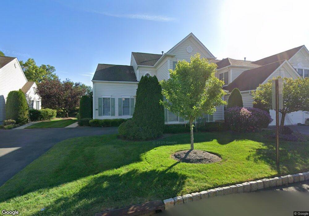
20 Mulberry Ct Paramus, NJ 07652
Estimated Value: $984,216 - $1,051,000
Studio
--
Bath
2,308
Sq Ft
$445/Sq Ft
Est. Value
About This Home
This home is located at 20 Mulberry Ct, Paramus, NJ 07652 and is currently estimated at $1,026,054, approximately $444 per square foot. 20 Mulberry Ct is a home located in Bergen County with nearby schools including Paramus High School, Yeshivat Noam School, and Yavneh Academy.
Ownership History
Date
Name
Owned For
Owner Type
Purchase Details
Closed on
May 15, 2013
Sold by
Kim Young S
Bought by
Kim Edward N and Kim Young S
Current Estimated Value
Purchase Details
Closed on
Jan 22, 2008
Sold by
Kim Nam Jim and Nkim Edward N
Bought by
Kim Young S
Purchase Details
Closed on
Jul 2, 2002
Sold by
Pulte Home Corp Of The Delawar
Bought by
Kim Nam J and Kim Young S
Home Financials for this Owner
Home Financials are based on the most recent Mortgage that was taken out on this home.
Original Mortgage
$272,000
Interest Rate
6.79%
Create a Home Valuation Report for This Property
The Home Valuation Report is an in-depth analysis detailing your home's value as well as a comparison with similar homes in the area
Home Values in the Area
Average Home Value in this Area
Purchase History
| Date | Buyer | Sale Price | Title Company |
|---|---|---|---|
| Kim Edward N | -- | -- | |
| Kim Young S | -- | -- | |
| Kim Nam J | $567,585 | -- |
Source: Public Records
Mortgage History
| Date | Status | Borrower | Loan Amount |
|---|---|---|---|
| Previous Owner | Kim Nam J | $272,000 |
Source: Public Records
Tax History
| Year | Tax Paid | Tax Assessment Tax Assessment Total Assessment is a certain percentage of the fair market value that is determined by local assessors to be the total taxable value of land and additions on the property. | Land | Improvement |
|---|---|---|---|---|
| 2025 | $13,210 | $930,100 | $400,000 | $530,100 |
| 2024 | $12,844 | $872,500 | $367,500 | $505,000 |
| 2023 | $12,092 | $837,300 | $350,000 | $487,300 |
| 2022 | $12,092 | $779,100 | $320,000 | $459,100 |
| 2021 | $11,953 | $722,700 | $300,000 | $422,700 |
| 2020 | $11,441 | $717,300 | $300,000 | $417,300 |
| 2019 | $10,577 | $569,900 | $275,000 | $294,900 |
| 2018 | $10,446 | $569,900 | $275,000 | $294,900 |
| 2017 | $10,264 | $569,900 | $275,000 | $294,900 |
| 2016 | $9,985 | $569,900 | $275,000 | $294,900 |
| 2015 | $9,882 | $569,900 | $275,000 | $294,900 |
| 2014 | $9,797 | $569,900 | $275,000 | $294,900 |
Source: Public Records
Map
Nearby Homes
- 114 White Pine Ct
- 4-21 Saddle River Rd
- 211 Denver Rd
- 70 S Paramus Rd
- 15 Wyckoff Terrace
- 219 N Farview Ave
- 39-16 Northern Dr
- 298 Buttonwood Dr
- 64 E Century Rd
- 39-01 Broadway Unit B
- 3901 Broadway Unit B
- 39-02 Taylor Rd
- 105 Circle Dr
- 0- 54 Yost Place
- 054 Yost Place
- 311 N Farview Ave
- 368 Elmwood Dr
- 90 Arnot Place
- 121 Circle Dr
- 1-37 34th St
Your Personal Tour Guide
Ask me questions while you tour the home.