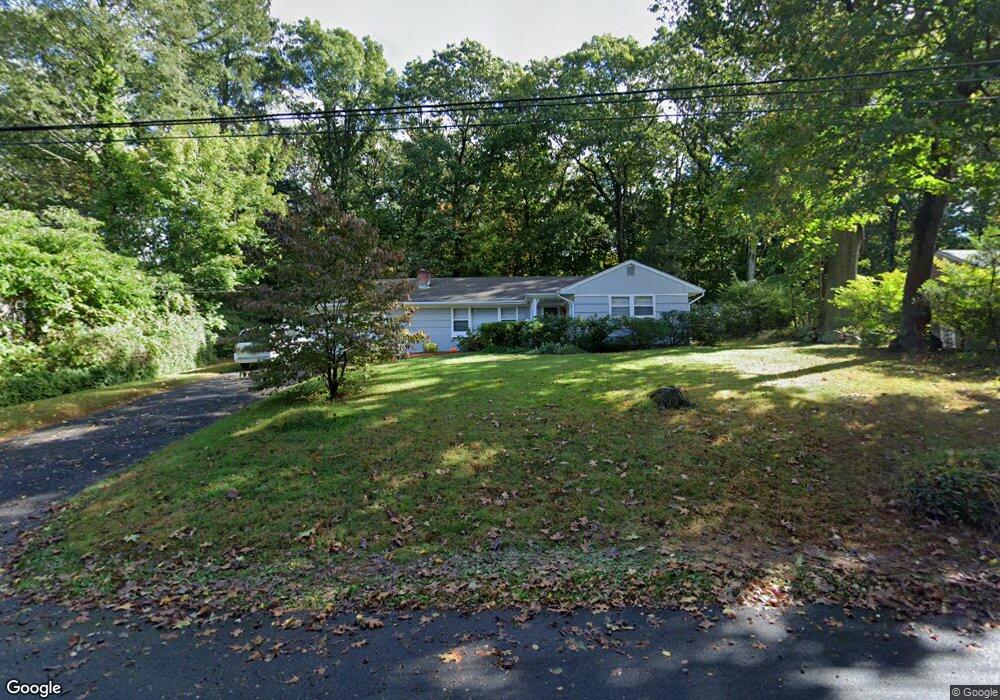
20 Overbrook Rd Norwalk, CT 06851
Wolfpit NeighborhoodEstimated Value: $690,017 - $757,000
3
Beds
2
Baths
1,610
Sq Ft
$449/Sq Ft
Est. Value
About This Home
This home is located at 20 Overbrook Rd, Norwalk, CT 06851 and is currently estimated at $722,754, approximately $448 per square foot. 20 Overbrook Rd is a home located in Fairfield County with nearby schools including Wolfpit School, Nathan Hale Middle School, and Norwalk High School.
Ownership History
Date
Name
Owned For
Owner Type
Purchase Details
Closed on
May 4, 1998
Sold by
Vallerie Ida P Est
Bought by
Potochney Steven P and Potochney Kim L
Current Estimated Value
Home Financials for this Owner
Home Financials are based on the most recent Mortgage that was taken out on this home.
Original Mortgage
$170,000
Interest Rate
7.04%
Mortgage Type
Unknown
Purchase Details
Closed on
Aug 21, 1992
Sold by
Mader Elsie and Shea Robert
Bought by
Vallerie Ida
Create a Home Valuation Report for This Property
The Home Valuation Report is an in-depth analysis detailing your home's value as well as a comparison with similar homes in the area
Home Values in the Area
Average Home Value in this Area
Purchase History
| Date | Buyer | Sale Price | Title Company |
|---|---|---|---|
| Potochney Steven P | $226,000 | -- | |
| Potochney Steven P | $226,000 | -- | |
| Vallerie Ida | $206,000 | -- | |
| Vallerie Ida | $206,000 | -- |
Source: Public Records
Mortgage History
| Date | Status | Borrower | Loan Amount |
|---|---|---|---|
| Closed | Vallerie Ida | $10,000 | |
| Open | Vallerie Ida | $180,750 | |
| Closed | Vallerie Ida | $170,000 |
Source: Public Records
Tax History Compared to Growth
Tax History
| Year | Tax Paid | Tax Assessment Tax Assessment Total Assessment is a certain percentage of the fair market value that is determined by local assessors to be the total taxable value of land and additions on the property. | Land | Improvement |
|---|---|---|---|---|
| 2025 | $8,439 | $352,410 | $179,680 | $172,730 |
| 2024 | $8,314 | $352,410 | $179,680 | $172,730 |
| 2023 | $6,282 | $249,690 | $143,220 | $106,470 |
| 2022 | $6,165 | $249,690 | $143,220 | $106,470 |
| 2021 | $6,005 | $249,690 | $143,220 | $106,470 |
| 2020 | $6,002 | $249,690 | $143,220 | $106,470 |
| 2019 | $5,834 | $249,690 | $143,220 | $106,470 |
| 2018 | $6,507 | $244,040 | $154,620 | $89,420 |
| 2017 | $6,283 | $244,040 | $154,620 | $89,420 |
| 2016 | $6,223 | $244,040 | $154,620 | $89,420 |
| 2015 | $6,206 | $244,040 | $154,620 | $89,420 |
| 2014 | $6,125 | $244,040 | $154,620 | $89,420 |
Source: Public Records
Map
Nearby Homes
- 9 Trailside Dr
- 30 Honeysuckle Dr
- 33 Assisi Way
- 38 Saddle Rd
- 142 Wolfpit Ave
- 7 Peaceful Ln
- 9 Allen Ct
- 13 Orchard Hill Rd
- 11 Mark Dr
- 2 Wildgoose Ln
- 100 Wolfpit Ave Unit 2
- 100 Wolfpit Ave Unit 17
- 65 Wolfpit Ave Unit 5C
- 71 Saddle Rd
- 341 Strawberry Hill Ave
- 4 Frank St
- 505 Westport Ave
- 1 Blue Mountain Ridge
- 33 Pequot Trail
- 8 Stonecrop Rd
- 22 Overbrook Rd
- 18 Overbrook Rd
- 65 Overbrook Rd
- 19 Overbrook Rd
- 17 Overbrook Rd
- 3 Breezy Ln
- 24 Overbrook Rd
- 23 Overbrook Rd
- 14 Overbrook Rd
- 17 Trailside Dr
- 15 Overbrook Rd
- 1 Breezy Ln
- 14 Knobhill Rd
- 16 Knobhill Rd
- 15 Trailside Dr
- 12 Knobhill Rd
- 25 Overbrook Rd
- 18 Trailside Dr
- 2 Breezy Ln
- 11 Overbrook Rd