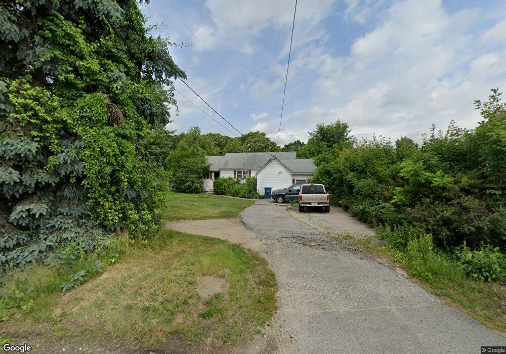
20 Providence Rd Sutton, MA 01590
Estimated Value: $386,275 - $479,000
2
Beds
1
Bath
1,166
Sq Ft
$363/Sq Ft
Est. Value
About This Home
This home is located at 20 Providence Rd, Sutton, MA 01590 and is currently estimated at $423,319, approximately $363 per square foot. 20 Providence Rd is a home located in Worcester County with nearby schools including Sutton Elementary School, Sutton Middle School, and Sutton High School.
Ownership History
Date
Name
Owned For
Owner Type
Purchase Details
Closed on
Apr 27, 1998
Sold by
Jacques James J and Jacques Debra A
Bought by
Otto Patricia M
Current Estimated Value
Purchase Details
Closed on
Jan 10, 1991
Sold by
Usa Dept Hsg Urban Dev
Bought by
Jacques James A and Jacques Debra A
Home Financials for this Owner
Home Financials are based on the most recent Mortgage that was taken out on this home.
Original Mortgage
$61,700
Interest Rate
9.83%
Mortgage Type
Purchase Money Mortgage
Purchase Details
Closed on
Jul 17, 1990
Sold by
Rcr Services Inc
Bought by
U S A Dept Housing Urb
Create a Home Valuation Report for This Property
The Home Valuation Report is an in-depth analysis detailing your home's value as well as a comparison with similar homes in the area
Home Values in the Area
Average Home Value in this Area
Purchase History
| Date | Buyer | Sale Price | Title Company |
|---|---|---|---|
| Otto Patricia M | $95,000 | -- | |
| Jacques James A | $65,000 | -- | |
| U S A Dept Housing Urb | $123,613 | -- |
Source: Public Records
Mortgage History
| Date | Status | Borrower | Loan Amount |
|---|---|---|---|
| Previous Owner | U S A Dept Housing Urb | $70,000 | |
| Previous Owner | U S A Dept Housing Urb | $61,700 | |
| Previous Owner | U S A Dept Housing Urb | $5,743 |
Source: Public Records
Tax History
| Year | Tax Paid | Tax Assessment Tax Assessment Total Assessment is a certain percentage of the fair market value that is determined by local assessors to be the total taxable value of land and additions on the property. | Land | Improvement |
|---|---|---|---|---|
| 2025 | $3,950 | $317,000 | $150,700 | $166,300 |
| 2024 | $4,078 | $316,400 | $144,200 | $172,200 |
| 2023 | $3,496 | $248,300 | $130,300 | $118,000 |
| 2022 | $3,517 | $226,600 | $104,300 | $122,300 |
| 2021 | $3,276 | $200,600 | $104,300 | $96,300 |
| 2020 | $3,280 | $200,600 | $104,300 | $96,300 |
| 2019 | $3,153 | $185,900 | $100,400 | $85,500 |
| 2018 | $2,815 | $165,500 | $85,400 | $80,100 |
| 2017 | $3,331 | $156,700 | $74,400 | $82,300 |
| 2016 | $2,655 | $154,800 | $74,400 | $80,400 |
| 2015 | $2,574 | $150,500 | $74,400 | $76,100 |
| 2014 | $2,576 | $147,700 | $72,300 | $75,400 |
Source: Public Records
Map
Nearby Homes
- 66 Buttonwood Ave
- 5 Wildflower Dr
- 19 Fitzpatrick Rd
- 109 Main St
- 8 Autumn Gate Cir
- 64 Fisherville Terrace
- 62 Fisherville Terrace
- 79 Fisherville Terrace
- 53 Fisherville Terrace
- 55 Fisherville Terrace
- 58 Fisherville Terrace
- 44 Fisherville Terrace
- Lot 1 Cooper Rd
- 175 Armsby Rd
- 229 Worcester-Providence Turnpike
- 9 Danielle Dr
- 5 Mogren Dr
- 46 Lexington Rd
- 191 Hartness Rd
- 2 Jessica j Dr
- 18 Providence Rd
- 22 Providence Rd
- 16 Providence Rd
- 26 Providence Rd
- 15 Providence Rd Unit I
- 15 Providence Rd
- 4 Old Providence Rd
- 25 Providence Rd
- 4 Church St
- 13 Providence Rd
- 13 Providence Rd Unit C
- 1 Old Providence Rd
- 11 D Church St Unit 11D
- 11 D Church St Unit D
- 11 Providence Rd
- 11 Church St Unit D
- 11 Church St Unit C
- 11 Church St Unit B
- 11 Church St Unit A
- 11 Church St Unit 11B
Your Personal Tour Guide
Ask me questions while you tour the home.