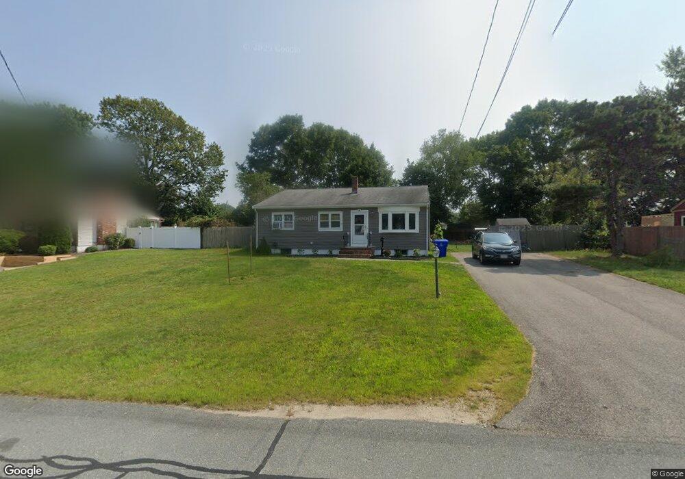
20 Queens Bay Ln Bourne, MA 2532
Buzzards Bay NeighborhoodEstimated Value: $564,000 - $593,694
3
Beds
2
Baths
1,406
Sq Ft
$414/Sq Ft
Est. Value
About This Home
This home is located at 20 Queens Bay Ln, Bourne, MA 2532 and is currently estimated at $581,924, approximately $413 per square foot. 20 Queens Bay Ln is a home located in Barnstable County with nearby schools including Bourne High School and St Margaret Regional School.
Ownership History
Date
Name
Owned For
Owner Type
Purchase Details
Closed on
Mar 18, 2022
Sold by
Maedel Eileen P
Bought by
Mackenzie Nicholas and Mackenzie Evelyn
Current Estimated Value
Home Financials for this Owner
Home Financials are based on the most recent Mortgage that was taken out on this home.
Original Mortgage
$490,000
Outstanding Balance
$454,134
Interest Rate
3.55%
Mortgage Type
Purchase Money Mortgage
Estimated Equity
$127,790
Purchase Details
Closed on
Aug 23, 2001
Sold by
Rowe Frank E
Bought by
Miksch Eileen P
Purchase Details
Closed on
Dec 31, 1998
Sold by
Ledwidge Eamonnp and Ledwidge Susan L
Bought by
Rowe Frank E
Purchase Details
Closed on
May 31, 1989
Sold by
Pesta Roy R
Bought by
Ledwidge Eamons P
Purchase Details
Closed on
Oct 3, 1988
Sold by
Degan David
Bought by
Pesta Roy R
Create a Home Valuation Report for This Property
The Home Valuation Report is an in-depth analysis detailing your home's value as well as a comparison with similar homes in the area
Home Values in the Area
Average Home Value in this Area
Purchase History
| Date | Buyer | Sale Price | Title Company |
|---|---|---|---|
| Mackenzie Nicholas | $490,000 | None Available | |
| Mackenzie Nicholas | $490,000 | None Available | |
| Miksch Eileen P | $225,000 | -- | |
| Miksch Eileen P | $225,000 | -- | |
| Rowe Frank E | $129,000 | -- | |
| Rowe Frank E | $129,000 | -- | |
| Ledwidge Eamons P | $106,000 | -- | |
| Ledwidge Eamons P | $106,000 | -- | |
| Pesta Roy R | $15,000 | -- |
Source: Public Records
Mortgage History
| Date | Status | Borrower | Loan Amount |
|---|---|---|---|
| Open | Mackenzie Nicholas | $490,000 | |
| Closed | Mackenzie Nicholas | $490,000 | |
| Previous Owner | Pesta Roy R | $163,000 | |
| Previous Owner | Pesta Roy R | $180,000 |
Source: Public Records
Tax History Compared to Growth
Tax History
| Year | Tax Paid | Tax Assessment Tax Assessment Total Assessment is a certain percentage of the fair market value that is determined by local assessors to be the total taxable value of land and additions on the property. | Land | Improvement |
|---|---|---|---|---|
| 2025 | $4,064 | $520,300 | $182,700 | $337,600 |
| 2024 | $3,973 | $495,400 | $174,000 | $321,400 |
| 2023 | $3,765 | $427,400 | $154,000 | $273,400 |
| 2022 | $3,260 | $323,100 | $136,300 | $186,800 |
| 2021 | $3,166 | $294,000 | $124,000 | $170,000 |
| 2020 | $3,057 | $284,600 | $122,800 | $161,800 |
| 2019 | $2,896 | $275,500 | $122,800 | $152,700 |
| 2018 | $2,627 | $249,200 | $111,100 | $138,100 |
| 2017 | $2,621 | $254,500 | $110,100 | $144,400 |
| 2016 | $2,362 | $232,500 | $98,500 | $134,000 |
| 2015 | $2,341 | $232,500 | $98,500 | $134,000 |
Source: Public Records
Map
Nearby Homes
- 17 Maple St
- 3 Wolf Rd
- 34 Washington Ave
- 41 Lewis Point Rd
- 151 - 153 Main St
- 46 Holt Rd
- 46 Holt Rd Unit A
- 16 Washington Ave
- 0 Lewis Point Rd
- 65 Lewis Point Rd
- 162 Puritan Rd
- 73 Lewis Point Rd
- 171 Puritan Rd
- 56 Rip Van Winkle Way
- 304 Main St
- 4 Knob Ln
- 38 Old Bridge Rd
- 9 Hideaway Rd Unit F
- 27 Baker Ln Unit 27H
- 13 Hideaway Village Unit G
- 20 Queens Bay Ln
- 22 Queens Bay Ln
- 18 Queens Bay Ln
- 21 Kayajan Ave
- 21 Kayajan Ave
- 21 Queens Bay Ln
- 21 Queens Bay Ln
- 19 Queens Bay Ln
- 23 Kayajan Ave
- 19 Queens Bay Ln
- 23 Kayajan Ave
- 19 Kayajan Ave
- 19 Kayajan Ave
- 23 Queens Bay Ln
- 11 Colonial Rd
- 16 Queens Bay Ln
- 9 Colonial Rd
- 11 Colonial Rd
- 23 Queens Bay Ln
- 16 Queens Bay Ln