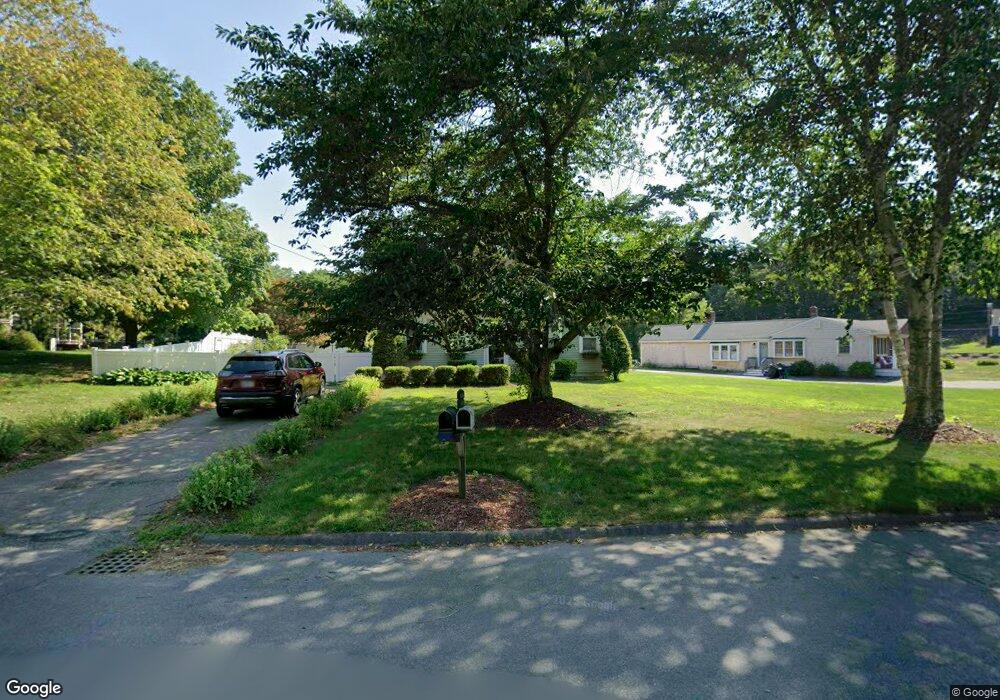
20 Queens Guard Waye Marshfield, MA 02050
Estimated Value: $624,000 - $808,000
4
Beds
2
Baths
1,557
Sq Ft
$471/Sq Ft
Est. Value
About This Home
This home is located at 20 Queens Guard Waye, Marshfield, MA 02050 and is currently estimated at $732,812, approximately $470 per square foot. 20 Queens Guard Waye is a home located in Plymouth County with nearby schools including Governor Edward Winslow School, Furnace Brook Middle School, and Marshfield High School.
Ownership History
Date
Name
Owned For
Owner Type
Purchase Details
Closed on
May 20, 1994
Sold by
Burns Robert F and Burns Janet M
Bought by
Seamon Walter E and Seamon Mary A
Current Estimated Value
Home Financials for this Owner
Home Financials are based on the most recent Mortgage that was taken out on this home.
Original Mortgage
$135,200
Interest Rate
8.44%
Mortgage Type
Purchase Money Mortgage
Purchase Details
Closed on
May 29, 1987
Sold by
Parsons David A
Bought by
Burns Robt F
Home Financials for this Owner
Home Financials are based on the most recent Mortgage that was taken out on this home.
Original Mortgage
$136,000
Interest Rate
10.25%
Mortgage Type
Purchase Money Mortgage
Create a Home Valuation Report for This Property
The Home Valuation Report is an in-depth analysis detailing your home's value as well as a comparison with similar homes in the area
Home Values in the Area
Average Home Value in this Area
Purchase History
| Date | Buyer | Sale Price | Title Company |
|---|---|---|---|
| Seamon Walter E | $169,000 | -- | |
| Burns Robt F | $170,000 | -- |
Source: Public Records
Mortgage History
| Date | Status | Borrower | Loan Amount |
|---|---|---|---|
| Open | Burns Robt F | $172,000 | |
| Closed | Burns Robt F | $135,200 | |
| Previous Owner | Burns Robt F | $136,000 |
Source: Public Records
Tax History Compared to Growth
Tax History
| Year | Tax Paid | Tax Assessment Tax Assessment Total Assessment is a certain percentage of the fair market value that is determined by local assessors to be the total taxable value of land and additions on the property. | Land | Improvement |
|---|---|---|---|---|
| 2025 | $6,066 | $612,700 | $303,000 | $309,700 |
| 2024 | $5,948 | $572,500 | $288,500 | $284,000 |
| 2023 | $5,825 | $516,700 | $267,900 | $248,800 |
| 2022 | $5,825 | $449,800 | $237,000 | $212,800 |
| 2021 | $5,643 | $427,800 | $237,000 | $190,800 |
| 2020 | $5,428 | $407,200 | $216,400 | $190,800 |
| 2019 | $5,290 | $395,400 | $216,400 | $179,000 |
| 2018 | $5,173 | $386,900 | $216,400 | $170,500 |
| 2017 | $5,107 | $372,200 | $216,400 | $155,800 |
| 2016 | $5,072 | $365,400 | $216,400 | $149,000 |
| 2015 | $4,856 | $365,400 | $216,400 | $149,000 |
| 2014 | $4,778 | $359,500 | $216,400 | $143,100 |
Source: Public Records
Map
Nearby Homes
- 5 Adelaide Way
- 90 Presidential Cir
- 184 King Phillips Pathe
- 713 Webster St
- 32 Gratto Rd
- 431 Moraine St
- 106 Careswell St
- 30 Chandler Dr
- 74 Abrams Hill Rd
- 68 Abrams Hill Rd
- 71 Gurnet Rd
- 33 Herring Weir Rd
- 78 Tower Ave
- 5 Maple Ln Unit 5
- 9 S Pasture Ln
- 387 Lot 2A Old Cove Rd
- 387 Lot 3A Old Cove Rd
- 387 Lot 4A Old Cove Rd
- 39 Bay Pond Rd
- 15 Lady Slipper Ln
- 6 Queens Guard Waye
- 6 Queen Guard Waye
- 34 Queens Guard Waye
- 21 Queens Guard Waye
- 57 Pilgrim Trail
- 27 Queens Guard Waye
- 13 Queens Guard Waye
- 41 Red Brick Farm Rd
- 23 Pilgrim Trail
- 37 Queens Guard Waye
- 211 Webster St
- 201 Webster St
- 7 Signal Hill Rd
- 191 Webster St
- 231 Webster St
- 27 Pilgrim Trail
- 56 Pilgrim Trail
- 181 Webster St
- 73 Pilgrim Trail
- 20 Pilgrim Trail