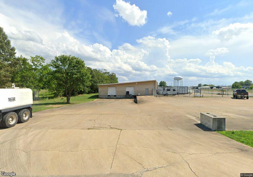
20 Remke Ln Lawrenceburg, TN 38464
--
Bed
--
Bath
4,800
Sq Ft
2.25
Acres
About This Home
This home is located at 20 Remke Ln, Lawrenceburg, TN 38464. 20 Remke Ln is a home located in Lawrence County with nearby schools including Ingram Sowell Elementary School, Ethridge Elementary School, and Lawrenceburg Public Elementary School.
Ownership History
Date
Name
Owned For
Owner Type
Purchase Details
Closed on
Sep 28, 2016
Sold by
Wayne County Bank
Bought by
Simmons Bobby
Purchase Details
Closed on
Aug 16, 2010
Bought by
Wayne County Bank
Purchase Details
Closed on
Apr 12, 2010
Bought by
Wayne County Bank
Purchase Details
Closed on
Mar 18, 2005
Bought by
White Michael W and White Jessica
Purchase Details
Closed on
Nov 5, 2003
Sold by
Keith Ray
Bought by
Hudson Industries Inc
Home Financials for this Owner
Home Financials are based on the most recent Mortgage that was taken out on this home.
Original Mortgage
$165,000
Interest Rate
5.93%
Mortgage Type
Commercial
Purchase Details
Closed on
Feb 1, 1999
Sold by
Gene Ray Donald
Bought by
Keith Ray
Purchase Details
Closed on
Apr 27, 1995
Bought by
Ray Donald Gene and Ray Faye
Create a Home Valuation Report for This Property
The Home Valuation Report is an in-depth analysis detailing your home's value as well as a comparison with similar homes in the area
Home Values in the Area
Average Home Value in this Area
Purchase History
| Date | Buyer | Sale Price | Title Company |
|---|---|---|---|
| Simmons Bobby | $138,000 | -- | |
| Wayne County Bank | -- | -- | |
| Wayne County Bank | -- | -- | |
| White Michael W | -- | -- | |
| Hudson Industries Inc | $166,464 | -- | |
| Keith Ray | $200,900 | -- | |
| Ray Donald Gene | $80,000 | -- |
Source: Public Records
Mortgage History
| Date | Status | Borrower | Loan Amount |
|---|---|---|---|
| Previous Owner | Ray Donald Gene | $165,000 |
Source: Public Records
Tax History Compared to Growth
Tax History
| Year | Tax Paid | Tax Assessment Tax Assessment Total Assessment is a certain percentage of the fair market value that is determined by local assessors to be the total taxable value of land and additions on the property. | Land | Improvement |
|---|---|---|---|---|
| 2025 | $2,268 | $72,960 | $0 | $0 |
| 2024 | $2,268 | $72,960 | $35,920 | $37,040 |
| 2023 | $2,268 | $72,960 | $35,920 | $37,040 |
| 2022 | $2,311 | $74,360 | $37,320 | $37,040 |
| 2021 | $3,576 | $81,360 | $39,600 | $41,760 |
| 2020 | $3,576 | $81,360 | $39,600 | $41,760 |
| 2019 | $3,576 | $81,360 | $39,600 | $41,760 |
| 2018 | $3,576 | $81,360 | $39,600 | $41,760 |
| 2017 | $3,576 | $81,360 | $39,600 | $41,760 |
| 2016 | $3,576 | $81,360 | $39,600 | $41,760 |
| 2015 | $3,386 | $81,360 | $39,600 | $41,760 |
| 2014 | $3,381 | $81,240 | $36,000 | $45,240 |
Source: Public Records
Map
Nearby Homes
- 2763 Highway 43 N
- 0 Woodland Cir Unit RTC3033314
- 48 Woodland Cir
- 413 Kirk St
- 335 Robins St
- 56 Mattox Rd
- 4951 Weakley Creek Rd
- 975 Weakley Creek Rd
- 4000 Weakley Creek Rd
- 31 Community Rd
- 1050 Baylee Cir
- 1216 Poplar Dr
- 1306 Hart Ave
- 717 Toben Terrace
- 446 Treetop Trail
- 132 Sundance Dr
- 314 Avon St
- 1303 5th Ave
- 301 Simpson St
- 1088 Mattox Town Rd
- 21 Remke Ln
- 0 Mattoxtown Rd Unit RTC1861455
- 0 Mattoxtown Rd Unit RTC1732883
- 0 Mattoxtown Rd Unit RTC2081237
- 0 Mattoxtown Rd Unit RTC2140223
- 0 Mattoxtown Rd Unit RTC2379020
- 0 Mattoxtown Rd Unit RTC2215427
- 0 Mattoxtown Rd
- 41 Remke Ln
- 2640 Highway 43 N
- 351 Mattox Town Rd
- 61 Remke Ln
- 331 Mattox Town Rd
- 421 Mattox Town Rd
- 2462 Highway 43 N
- 2398 Highway 43 N
- 456 Mattox Town Rd
- 2457 Highway 43 N
- 2144 N Locust Ave
- 2134 N Locust Ave