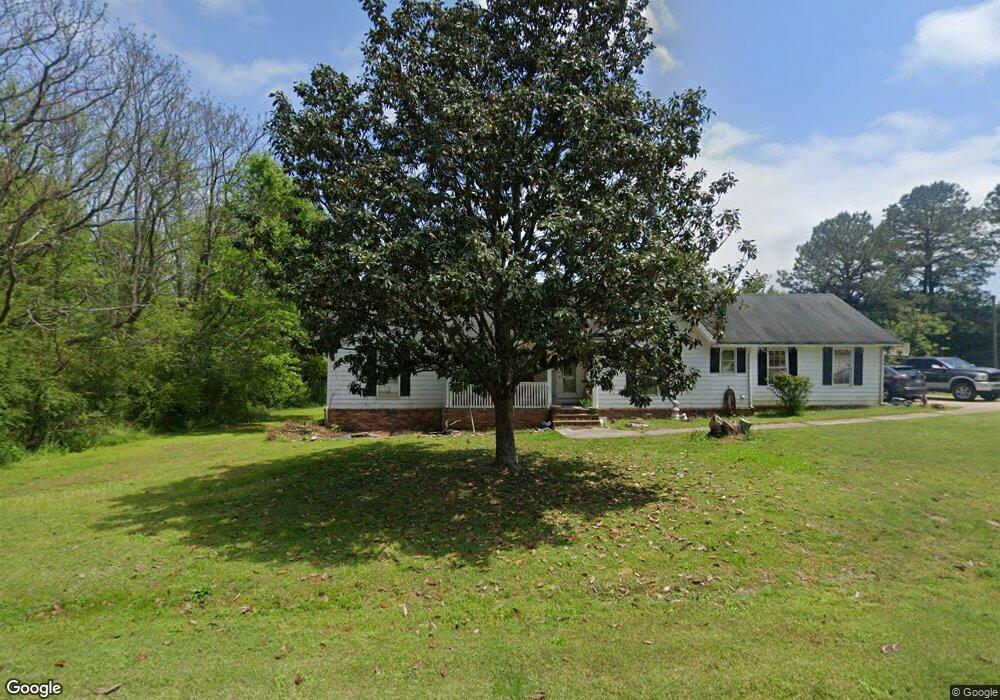
20 Riverbend Dr Covington, GA 30014
Estimated Value: $242,008 - $283,000
Studio
2
Baths
1,624
Sq Ft
$163/Sq Ft
Est. Value
About This Home
This home is located at 20 Riverbend Dr, Covington, GA 30014 and is currently estimated at $264,002, approximately $162 per square foot. 20 Riverbend Dr is a home located in Newton County with nearby schools including Flint Hill Elementary School, Cousins Middle School, and Eastside High School.
Ownership History
Date
Name
Owned For
Owner Type
Purchase Details
Closed on
Jul 24, 1998
Sold by
Newton Federal Savings & Loan Assoc
Bought by
Loyd Paul Ricky and Loyd Lynn M
Current Estimated Value
Home Financials for this Owner
Home Financials are based on the most recent Mortgage that was taken out on this home.
Original Mortgage
$69,314
Outstanding Balance
$13,355
Interest Rate
6.94%
Mortgage Type
New Conventional
Estimated Equity
$250,647
Purchase Details
Closed on
Jul 7, 1998
Sold by
Hays Theron and Norton Wm
Bought by
Newton Federal Savings & Loan
Home Financials for this Owner
Home Financials are based on the most recent Mortgage that was taken out on this home.
Original Mortgage
$69,314
Outstanding Balance
$13,355
Interest Rate
6.94%
Mortgage Type
New Conventional
Estimated Equity
$250,647
Purchase Details
Closed on
Nov 8, 1993
Sold by
Payton Roger D
Bought by
Fuller Phillip S and Burton Beverly
Create a Home Valuation Report for This Property
The Home Valuation Report is an in-depth analysis detailing your home's value as well as a comparison with similar homes in the area
Home Values in the Area
Average Home Value in this Area
Purchase History
| Date | Buyer | Sale Price | Title Company |
|---|---|---|---|
| Loyd Paul Ricky | $71,900 | -- | |
| Newton Federal Savings & Loan | -- | -- | |
| Fuller Phillip S | $5,200 | -- |
Source: Public Records
Mortgage History
| Date | Status | Borrower | Loan Amount |
|---|---|---|---|
| Open | Loyd Paul Ricky | $69,314 | |
| Closed | Fuller Phillip S | -- |
Source: Public Records
Tax History
| Year | Tax Paid | Tax Assessment Tax Assessment Total Assessment is a certain percentage of the fair market value that is determined by local assessors to be the total taxable value of land and additions on the property. | Land | Improvement |
|---|---|---|---|---|
| 2025 | $2,555 | $102,680 | $16,000 | $86,680 |
| 2024 | $2,414 | $95,280 | $16,000 | $79,280 |
| 2023 | $2,612 | $96,280 | $8,800 | $87,480 |
| 2022 | $2,002 | $73,800 | $8,800 | $65,000 |
| 2021 | $1,705 | $56,240 | $6,200 | $50,040 |
| 2020 | $1,445 | $43,000 | $6,200 | $36,800 |
| 2019 | $1,487 | $43,600 | $6,200 | $37,400 |
| 2018 | $1,386 | $40,360 | $6,200 | $34,160 |
| 2017 | $1,035 | $30,160 | $4,400 | $25,760 |
| 2016 | $1,035 | $30,160 | $4,400 | $25,760 |
| 2015 | $861 | $25,080 | $4,400 | $20,680 |
| 2014 | $725 | $21,200 | $0 | $0 |
Source: Public Records
Map
Nearby Homes
- 265 Riverbend Dr
- 235 Riverbend Dr
- 11817 Rizvan Place
- 13158 Greywolf Ln
- 11828 Neely Ln
- 11884 Rizvan Place
- 11864 Rizvan Place
- 11872 Rizvan Place
- 11878 Rizvan Place
- 11138 Suria Dr
- 11098 Suria Dr
- 11124 Suria Dr
- 13466 Whitman Ln SE
- 13280 Tolstoy Dr SE
- 13622 Whitman Ln SE
- 13304 Tolstoy Dr SE
- 13628 Whitman Ln SE
- 13611 Whitman Ln SE
- 13274 Tolstoy Dr SE
- 13478 Whitman Ln SE
- 10 Riverbend Dr
- 25 Riverbend Dr
- 15 Riverbend Dr
- 40 Riverbend Dr
- 60 Riverbend Dr
- 60 Riverbend Dr Unit N/A
- 55 Riverbend Dr
- 70 Riverbend Dr
- 220 McGuirts Bridge Rd
- 65 Riverbend Dr
- 80 Riverbend Dr
- 75 Riverbend Dr
- 90 Riverbend Dr
- 85 Riverbend Dr
- 95 Riverbend Dr
- 100 Riverbend Dr
- 100 Riverbend Dr Unit 9
- 105 Riverbend Dr
- 110 Riverbend Dr
- 150 McGuirts Bridge Rd
Your Personal Tour Guide
Ask me questions while you tour the home.