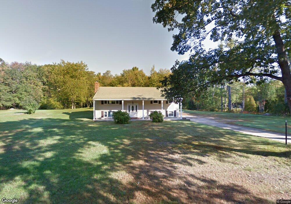
20 Rowes Corner Ln Hooksett, NH 03106
Estimated Value: $434,000 - $502,000
3
Beds
2
Baths
1,248
Sq Ft
$372/Sq Ft
Est. Value
About This Home
This home is located at 20 Rowes Corner Ln, Hooksett, NH 03106 and is currently estimated at $464,287, approximately $372 per square foot. 20 Rowes Corner Ln is a home located in Merrimack County with nearby schools including Fred C. Underhill School, Hooksett Memorial School, and David R. Cawley Middle School.
Ownership History
Date
Name
Owned For
Owner Type
Purchase Details
Closed on
Dec 20, 1991
Bought by
Rutherford John P and Rutherford Elaine J
Current Estimated Value
Create a Home Valuation Report for This Property
The Home Valuation Report is an in-depth analysis detailing your home's value as well as a comparison with similar homes in the area
Home Values in the Area
Average Home Value in this Area
Purchase History
| Date | Buyer | Sale Price | Title Company |
|---|---|---|---|
| Rutherford John P | $91,500 | -- |
Source: Public Records
Mortgage History
| Date | Status | Borrower | Loan Amount |
|---|---|---|---|
| Open | Rutherford John P | $156,000 | |
| Closed | Rutherford John P | $45,000 | |
| Closed | Rutherford John P | $98,000 |
Source: Public Records
Tax History
| Year | Tax Paid | Tax Assessment Tax Assessment Total Assessment is a certain percentage of the fair market value that is determined by local assessors to be the total taxable value of land and additions on the property. | Land | Improvement |
|---|---|---|---|---|
| 2024 | $6,326 | $373,000 | $116,000 | $257,000 |
| 2023 | $5,961 | $373,000 | $113,300 | $259,700 |
| 2022 | $5,642 | $234,600 | $77,600 | $157,000 |
| 2021 | $5,213 | $234,600 | $77,600 | $157,000 |
| 2020 | $0 | $234,600 | $77,600 | $157,000 |
| 2019 | $5,056 | $234,600 | $77,600 | $157,000 |
| 2018 | $5,189 | $234,600 | $77,600 | $157,000 |
| 2017 | $0 | $188,300 | $78,200 | $110,100 |
| 2016 | $0 | $188,300 | $78,200 | $110,100 |
| 2015 | $4,667 | $188,300 | $78,200 | $110,100 |
| 2014 | $4,675 | $188,300 | $78,200 | $110,100 |
| 2013 | $4,377 | $186,400 | $78,200 | $108,200 |
Source: Public Records
Map
Nearby Homes
- 347 and 26 Whitehall Road and Chester Turnpike
- 909 High St
- 0 N Candia Rd Unit 21 5039875
- 843 High St Unit 13A
- 199 Whitehall Rd
- 197-199 Whitehall Rd
- 197 Whitehall Rd
- 669 High St
- 733 North Rd
- 11 Barberry St
- 9 Quarry Rd
- 5 Thistle Ln
- 10 Harvard Ave
- 9 Berry Hill Rd
- 32 Lindsay Rd
- 192 Londonderry Turnpike
- 0 Chester Turnpike Unit 18
- 267 Londonderry Turnpike
- 22 Sunrise Cir
- 14 Overlook Cir
- 16 Rowes Corner Ln
- 366 Whitehall Rd
- 17 Rowes Corner Ln
- 370 Whitehall Rd
- 365 Whitehall Rd
- 359 Whitehall Rd
- 367 Whitehall Rd
- 375 Whitehall Rd
- 17 Chester Turnpike
- 6 Andrea Ave
- 4 Andrea Ave
- 30 Chester Turnpike
- 61 Chester Turnpike
- 2 Andrea Ave
- 96 Clay St
- 10 Andrea Ave
- 381 Whitehall Rd
- 12 Andrea Ave
- 5 Andrea Ave
- 1 Andrea Ave
Your Personal Tour Guide
Ask me questions while you tour the home.