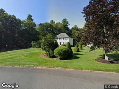
20 Russells Way Westford, MA 01886
Estimated Value: $984,000 - $1,124,000
4
Beds
3
Baths
2,464
Sq Ft
$418/Sq Ft
Est. Value
About This Home
This home is located at 20 Russells Way, Westford, MA 01886 and is currently estimated at $1,029,745, approximately $417 per square foot. 20 Russells Way is a home located in Middlesex County with nearby schools including Rita E. Miller Elementary School, Day Elementary School, and Stony Brook School.
Ownership History
Date
Name
Owned For
Owner Type
Purchase Details
Closed on
May 2, 2016
Sold by
Green Donald J and Green Mariangela D
Bought by
Green Mariangela D
Current Estimated Value
Purchase Details
Closed on
Apr 17, 1998
Sold by
Greystone Llc
Bought by
Green Donald J and Green Mariangela D
Home Financials for this Owner
Home Financials are based on the most recent Mortgage that was taken out on this home.
Original Mortgage
$231,920
Interest Rate
7.11%
Mortgage Type
Purchase Money Mortgage
Create a Home Valuation Report for This Property
The Home Valuation Report is an in-depth analysis detailing your home's value as well as a comparison with similar homes in the area
Home Values in the Area
Average Home Value in this Area
Purchase History
| Date | Buyer | Sale Price | Title Company |
|---|---|---|---|
| Green Mariangela D | -- | -- | |
| Green Donald J | $289,900 | -- |
Source: Public Records
Mortgage History
| Date | Status | Borrower | Loan Amount |
|---|---|---|---|
| Previous Owner | Green Donald J | $174,000 | |
| Previous Owner | Green Donald J | $189,700 | |
| Previous Owner | Green Donald J | $50,000 | |
| Previous Owner | Green Donald J | $221,200 | |
| Previous Owner | Green Donald J | $231,920 |
Source: Public Records
Tax History Compared to Growth
Tax History
| Year | Tax Paid | Tax Assessment Tax Assessment Total Assessment is a certain percentage of the fair market value that is determined by local assessors to be the total taxable value of land and additions on the property. | Land | Improvement |
|---|---|---|---|---|
| 2025 | $11,769 | $854,700 | $348,100 | $506,600 |
| 2024 | $11,769 | $854,700 | $348,100 | $506,600 |
| 2023 | $11,305 | $765,900 | $331,700 | $434,200 |
| 2022 | $11,468 | $711,400 | $274,600 | $436,800 |
| 2021 | $10,796 | $648,800 | $274,600 | $374,200 |
| 2020 | $10,637 | $651,400 | $274,600 | $376,800 |
| 2019 | $9,818 | $592,900 | $274,600 | $318,300 |
| 2018 | $9,593 | $592,900 | $274,600 | $318,300 |
| 2017 | $9,221 | $561,900 | $274,600 | $287,300 |
| 2016 | $8,983 | $551,100 | $262,200 | $288,900 |
| 2015 | $8,822 | $543,200 | $253,500 | $289,700 |
| 2014 | $8,835 | $532,200 | $253,900 | $278,300 |
Source: Public Records
Map
Nearby Homes
- 38 Russells Way
- 103 Forrest Rd
- 415 & 427 Groton Rd
- 33 Stone Ridge Rd
- 55 Lawson Rd
- 6 Gassett Rd
- 6 Rockwell Rd
- 36 Elm Rd
- 17 White Pine Knoll Unit 17
- 13 Lazy Day Dr Unit 13
- 15 Lazy Day Dr Unit 15
- 225 Groton Rd
- 24 Summer Village Rd Unit 24
- 5 Lazy Day Dr Unit 5
- 42 Lovett Ln
- 11 Big Rock Trail
- 23 Fox Run Unit 23
- 2 Acorn Ln Unit 2
- 66 Clover Hill Cir
- 9 Whispering Pines Rd Unit 9
- 20 Russells Way
- 22 Russells Way
- 17 Russells Way
- 24 Russells Way
- 15 Russells Way
- 22 Briarwood Dr
- 24 Briarwood Dr
- 19 Russells Way
- 26 Russells Way
- 20 Briarwood Dr
- 21 Russells Way
- 28 Russells Way
- 15 Briarwood Dr
- 15 Briarwood Dr Unit 1
- 3 Sherburne Ln
- 18 Briarwood Dr
- 23 Russells Way
- 13 Briarwood Dr
- 9 Briarwood Dr
- 30 Russells Way