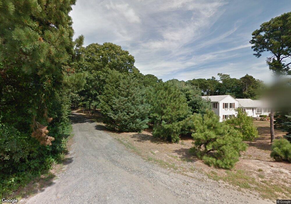
20 Sands Rd Eastham, MA 02642
Estimated Value: $628,323 - $677,000
2
Beds
2
Baths
1,267
Sq Ft
$524/Sq Ft
Est. Value
About This Home
This home is located at 20 Sands Rd, Eastham, MA 02642 and is currently estimated at $664,331, approximately $524 per square foot. 20 Sands Rd is a home located in Barnstable County with nearby schools including Eastham Elementary School, Nauset Regional Middle School, and Nauset Regional High School.
Ownership History
Date
Name
Owned For
Owner Type
Purchase Details
Closed on
Oct 15, 2020
Sold by
Mjd Rt
Bought by
Demetri Alana L
Current Estimated Value
Purchase Details
Closed on
Dec 16, 2011
Sold by
Young John J and Young Diane L
Bought by
Young John J and Young Diana L
Purchase Details
Closed on
Apr 15, 2011
Sold by
Iucopilla Alma and Castagna Patricia
Bought by
Young John J and Young Diane L
Purchase Details
Closed on
Dec 13, 2000
Sold by
Zellmer Henry G and Zellmer Mary M
Bought by
Iucopilla Alma and Castagna Patricia
Purchase Details
Closed on
Aug 28, 1996
Sold by
Akumal Rt and Goodrich Carl A
Bought by
Zellmer Henry G and Zellmer Mary M
Home Financials for this Owner
Home Financials are based on the most recent Mortgage that was taken out on this home.
Original Mortgage
$87,000
Interest Rate
8.18%
Mortgage Type
Purchase Money Mortgage
Create a Home Valuation Report for This Property
The Home Valuation Report is an in-depth analysis detailing your home's value as well as a comparison with similar homes in the area
Home Values in the Area
Average Home Value in this Area
Purchase History
We collect this data history from publicly available records. To have your information removed, we recommend requesting removal directly through your county’s website.
| Date | Buyer | Sale Price | Title Company |
|---|---|---|---|
| Demetri Alana L | -- | None Available | |
| Young John J | -- | -- | |
| Young John J | $328,000 | -- | |
| Iucopilla Alma | $233,000 | -- | |
| Zellmer Henry G | $127,100 | -- |
Source: Public Records
Mortgage History
We collect this data history from publicly available records. To have your information removed, we recommend requesting removal directly through your county’s website.
| Date | Status | Borrower | Loan Amount |
|---|---|---|---|
| Previous Owner | Zellmer Henry G | $87,000 |
Source: Public Records
Tax History
| Year | Tax Paid | Tax Assessment Tax Assessment Total Assessment is a certain percentage of the fair market value that is determined by local assessors to be the total taxable value of land and additions on the property. | Land | Improvement |
|---|---|---|---|---|
| 2025 | $4,676 | $606,500 | $0 | $606,500 |
| 2024 | $3,431 | $489,500 | $0 | $489,500 |
| 2023 | $3,178 | $439,000 | $0 | $439,000 |
| 2022 | $2,934 | $341,900 | $0 | $341,900 |
| 2021 | $2,877 | $313,400 | $0 | $313,400 |
| 2020 | $2,742 | $314,500 | $0 | $314,500 |
| 2019 | $2,520 | $305,500 | $0 | $305,500 |
| 2018 | $2,513 | $301,000 | $0 | $301,000 |
| 2017 | $2,360 | $298,700 | $0 | $298,700 |
| 2016 | $2,117 | $284,500 | $0 | $284,500 |
| 2015 | $1,987 | $279,900 | $0 | $279,900 |
Source: Public Records
Map
Nearby Homes
- 655 Herring Brook Rd
- 20 Priscilla Cir
- 10 Cartway N
- 40 Uncle Nate's Way
- 1690 Herring Brook Rd
- 20 Stone Ct
- 163 Samoset Rd
- 1145 Kingsbury Beach Rd
- 600 Kingsbury Beach Rd
- 1975 State Hwy Unit 1
- 1975 State Hwy Unit 9
- 10 Polly Seabury Way
- 21 Locust Rd
- 5 Weir Rd
- 3315 State Hwy
- 65 Whitney Rd
- 40 Bayview Rd
- 90 Whitney Rd
- 3098 State Hwy
- 12 Settlers Trace
- 20 Sands Rd Unit 2
- 22 Sands Rd
- 22 Sands Rd Unit 1
- 20 Sand's Unit 2
- 2 Sandy Meadow Way
- 30 Sands Rd
- 780 Herring Brook Rd
- 800 Herring Brook Rd
- 700 Herring Brook Rd
- 720 Herring Brook Rd
- 35 Sands Rd
- 35 E Sands
- 40 Sands Rd
- 820 Herring Brook Rd
- 0 Sands Rd Unit 20B
- 795 Herring Brook Rd
- 735 Herring Brook Rd
- 835 Herring Brook Rd
- 40 Fife Ct
- 45 Sands Rd
Your Personal Tour Guide
Ask me questions while you tour the home.