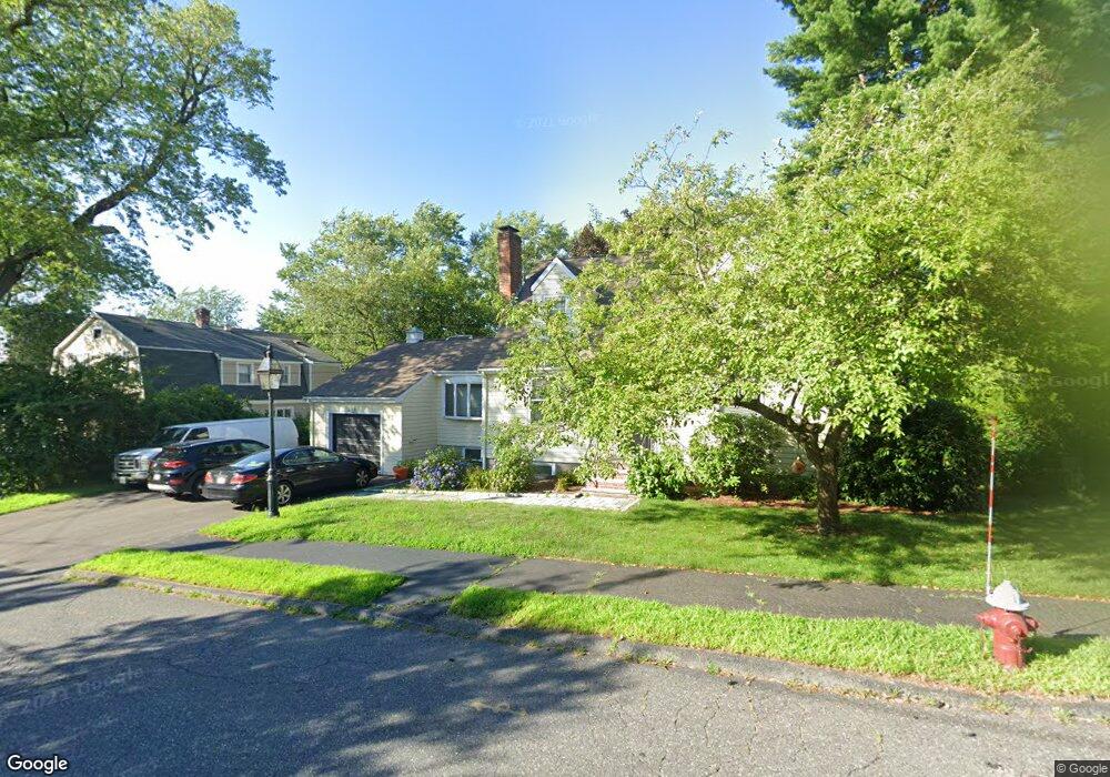
20 Sassamon Ave Milton, MA 02186
Hillside Street NeighborhoodEstimated Value: $1,006,000 - $1,200,000
3
Beds
3
Baths
1,660
Sq Ft
$659/Sq Ft
Est. Value
About This Home
This home is located at 20 Sassamon Ave, Milton, MA 02186 and is currently estimated at $1,093,230, approximately $658 per square foot. 20 Sassamon Ave is a home located in Norfolk County with nearby schools including Milton High School, St. Mary of the Hills School, and Milton Academy.
Ownership History
Date
Name
Owned For
Owner Type
Purchase Details
Closed on
Oct 26, 2001
Sold by
Davis Demetrios P and Davis Melanie H
Bought by
Cooke Ralph B and Cooke Joyce E
Current Estimated Value
Home Financials for this Owner
Home Financials are based on the most recent Mortgage that was taken out on this home.
Original Mortgage
$334,400
Outstanding Balance
$132,048
Interest Rate
6.86%
Mortgage Type
Purchase Money Mortgage
Estimated Equity
$961,182
Purchase Details
Closed on
Apr 1, 1998
Sold by
Mcgreal Carol S
Bought by
Davis Demetrios P and Davis Melanie H
Home Financials for this Owner
Home Financials are based on the most recent Mortgage that was taken out on this home.
Original Mortgage
$180,000
Interest Rate
6.89%
Mortgage Type
Purchase Money Mortgage
Purchase Details
Closed on
Jan 8, 1987
Sold by
Connolly Thomas P
Bought by
Mcgreal William G
Create a Home Valuation Report for This Property
The Home Valuation Report is an in-depth analysis detailing your home's value as well as a comparison with similar homes in the area
Home Values in the Area
Average Home Value in this Area
Purchase History
| Date | Buyer | Sale Price | Title Company |
|---|---|---|---|
| Cooke Ralph B | $418,000 | -- | |
| Davis Demetrios P | $232,000 | -- | |
| Mcgreal William G | $229,000 | -- |
Source: Public Records
Mortgage History
| Date | Status | Borrower | Loan Amount |
|---|---|---|---|
| Open | Cooke Ralph B | $334,400 | |
| Previous Owner | Mcgreal William G | $180,000 | |
| Previous Owner | Mcgreal William G | $142,500 | |
| Previous Owner | Mcgreal William G | $156,000 |
Source: Public Records
Tax History Compared to Growth
Tax History
| Year | Tax Paid | Tax Assessment Tax Assessment Total Assessment is a certain percentage of the fair market value that is determined by local assessors to be the total taxable value of land and additions on the property. | Land | Improvement |
|---|---|---|---|---|
| 2025 | $9,465 | $853,500 | $471,800 | $381,700 |
| 2024 | $9,161 | $838,900 | $449,400 | $389,500 |
| 2023 | $8,906 | $781,200 | $428,200 | $353,000 |
| 2022 | $8,764 | $702,800 | $428,200 | $274,600 |
| 2021 | $8,436 | $642,500 | $380,800 | $261,700 |
| 2020 | $8,920 | $679,900 | $410,400 | $269,500 |
| 2019 | $8,701 | $660,200 | $398,500 | $261,700 |
| 2018 | $8,014 | $580,300 | $318,700 | $261,600 |
| 2017 | $7,500 | $553,100 | $303,500 | $249,600 |
| 2016 | $7,008 | $519,100 | $274,600 | $244,500 |
| 2015 | $7,084 | $508,200 | $252,900 | $255,300 |
Source: Public Records
Map
Nearby Homes
- 6 Brewster Rd
- 73 Sassamon Ave
- 161 Sassamon Ave
- 79 Hillside St
- 407 Highland St
- 80 Brierbrook St
- 675 Randolph Ave
- 50 Marine Rd
- 540 Harland St
- 403405 Reedsdale Rd
- 111-113 Pleasant St
- 40 Lyman Rd
- 29 Maitland St
- 7 Preacher Rd
- 651 Canton Ave
- 418 Pleasant St
- 54 Elm St
- 375 Atherton St
- 3 Stone Bridge Ln
- 19 Lantern Ln
- 14 Sassamon Ave
- 26 Sassamon Ave
- 17 Sassamon Ave
- 32 Sassamon Ave
- 33 Nahanton Ave
- 37 Nahanton Ave
- 29 Nahanton Ave
- 31 Sassamon Ave
- 41 Nahanton Ave
- 25 Nahanton Ave
- 1028 Randolph Ave
- 38 Sassamon Ave
- 37 Sassamon Ave
- 1006 Randolph Ave
- 1036 Randolph Ave
- 34 Nahanton Ave
- 32 Nahanton Ave
- 30 Nahanton Ave
- 40 Nahanton Ave
- 15 Nahanton Ave