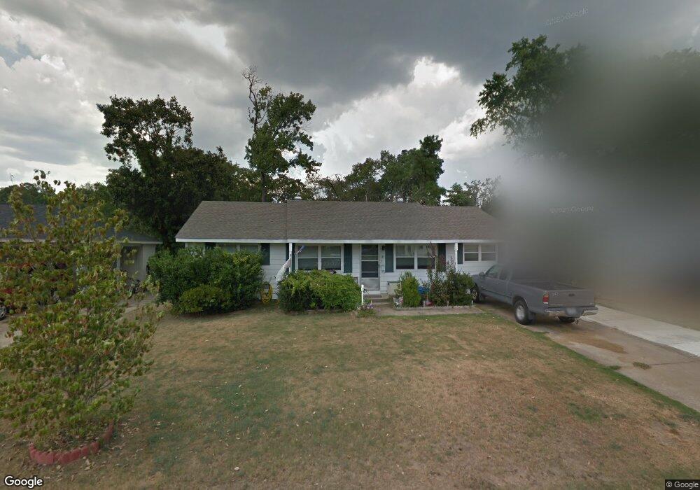
20 Serenity Dr Little Rock, AR 72205
West Markham NeighborhoodEstimated Value: $154,452 - $176,000
--
Bed
3
Baths
1,581
Sq Ft
$105/Sq Ft
Est. Value
About This Home
This home is located at 20 Serenity Dr, Little Rock, AR 72205 and is currently estimated at $165,613, approximately $104 per square foot. 20 Serenity Dr is a home located in Pulaski County with nearby schools including McDermott Elementary School, J.A. Fair K8 Preparatory School, and Henderson Middle School.
Ownership History
Date
Name
Owned For
Owner Type
Purchase Details
Closed on
Jun 19, 2003
Sold by
Pruden William Wayne and Gertrude Barnes Revocable Livi
Bought by
Dubose Larry
Current Estimated Value
Home Financials for this Owner
Home Financials are based on the most recent Mortgage that was taken out on this home.
Original Mortgage
$85,000
Outstanding Balance
$35,853
Interest Rate
5.27%
Mortgage Type
Purchase Money Mortgage
Estimated Equity
$129,760
Purchase Details
Closed on
Oct 4, 2000
Sold by
Barnes Gertrude Pruden
Bought by
Barnes Gertrude
Purchase Details
Closed on
Apr 22, 1997
Sold by
Howington Timothy Wayne and Howington Terri Lynne
Bought by
Barnes Gertrude Pruden
Home Financials for this Owner
Home Financials are based on the most recent Mortgage that was taken out on this home.
Original Mortgage
$52,500
Interest Rate
7.82%
Mortgage Type
Purchase Money Mortgage
Create a Home Valuation Report for This Property
The Home Valuation Report is an in-depth analysis detailing your home's value as well as a comparison with similar homes in the area
Home Values in the Area
Average Home Value in this Area
Purchase History
| Date | Buyer | Sale Price | Title Company |
|---|---|---|---|
| Dubose Larry | $85,000 | Transcontinental Title Co | |
| Barnes Gertrude | -- | -- | |
| Barnes Gertrude Pruden | $73,000 | American Abstract & Title Co |
Source: Public Records
Mortgage History
| Date | Status | Borrower | Loan Amount |
|---|---|---|---|
| Open | Dubose Larry | $85,000 | |
| Previous Owner | Barnes Gertrude Pruden | $52,500 |
Source: Public Records
Tax History Compared to Growth
Tax History
| Year | Tax Paid | Tax Assessment Tax Assessment Total Assessment is a certain percentage of the fair market value that is determined by local assessors to be the total taxable value of land and additions on the property. | Land | Improvement |
|---|---|---|---|---|
| 2025 | $1,462 | $24,254 | $5,800 | $18,454 |
| 2024 | $1,462 | $24,254 | $5,800 | $18,454 |
| 2023 | $1,462 | $24,254 | $5,800 | $18,454 |
| 2022 | $1,462 | $24,254 | $5,800 | $18,454 |
| 2021 | $1,473 | $20,890 | $3,050 | $17,840 |
| 2020 | $1,087 | $20,890 | $3,050 | $17,840 |
| 2019 | $1,087 | $20,890 | $3,050 | $17,840 |
| 2018 | $1,112 | $20,890 | $3,050 | $17,840 |
| 2017 | $1,112 | $20,890 | $3,050 | $17,840 |
| 2016 | $1,435 | $20,500 | $3,800 | $16,700 |
| 2015 | $1,431 | $20,500 | $3,800 | $16,700 |
| 2014 | $1,431 | $20,417 | $3,800 | $16,617 |
Source: Public Records
Map
Nearby Homes
- 423 Brookside Dr
- 15 Brooklawn Dr
- 4 Brookridge Cove
- 41 Brookridge Dr
- 7 Brookfield Cove
- 9 Brookfield Cove
- 8806 Mayflower Rd
- 411 Burnside Dr
- 814 Shea Dr
- 8815 Cloverhill Rd
- 22 Nob Hill Cove
- 8306 Louwanda Dr
- 73 Reservoir Heights Dr
- 9605 Brooks Ct
- 22 Nob View Cir
- 10 Reservoir Heights Dr
- 409 Sunnymeade Dr
- 9320 Cloverhill Rd
- 3 Edgestone Dr
- 9516 Wiggins Place
- 22 Serenity Dr
- 18 Serenity Dr
- 24 Serenity Dr
- 16 Serenity Dr
- 303 Brookside Dr
- 309 Brookside Dr
- 17 Serenity Dr
- 221 Brookside Dr
- 0 Serenity Unit 20038635
- 0 Serenity Unit 17002445
- 0 Serenity Unit 17007269
- 0 Serenity Unit 17024354
- 20 Brookhaven Dr
- 315 Brookside Dr
- 14 Serenity Dr
- 26 Serenity Dr
- 215 Brookside Dr
- 15 Serenity Dr
- 323 Brookside Dr
- 25 Serenity Dr