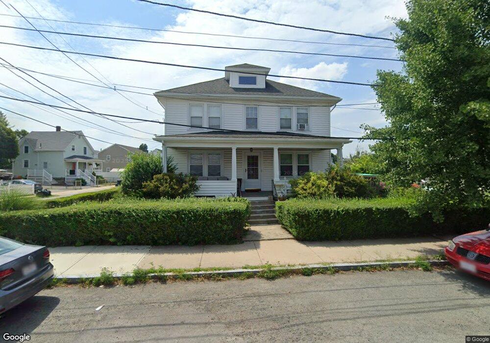
20 Shamrock St Peabody, MA 01960
Peabody Town Center NeighborhoodEstimated Value: $659,583 - $761,000
4
Beds
2
Baths
1,920
Sq Ft
$361/Sq Ft
Est. Value
About This Home
This home is located at 20 Shamrock St, Peabody, MA 01960 and is currently estimated at $693,646, approximately $361 per square foot. 20 Shamrock St is a home located in Essex County with nearby schools including Peabody Veterans Memorial High School, St John The Baptist School, and The Phoenix School.
Ownership History
Date
Name
Owned For
Owner Type
Purchase Details
Closed on
Oct 27, 2020
Sold by
Tomaz-Gomes Deolinda M and Tomaz Fernando M
Bought by
Mccormick Kathleen A and Tomaz Fernando M
Current Estimated Value
Purchase Details
Closed on
Jul 23, 2020
Sold by
Maria Tomaz 2017 Irt and Tomaz
Bought by
Tomaz-Gomes Deolinda M and Tomaz Fernando M
Purchase Details
Closed on
Dec 28, 2017
Sold by
Tomaz Maria
Bought by
Maria Tomaz 2017 Irt and Tomaz
Purchase Details
Closed on
Aug 8, 1963
Bought by
Tomaz Joao and Guia Maria
Create a Home Valuation Report for This Property
The Home Valuation Report is an in-depth analysis detailing your home's value as well as a comparison with similar homes in the area
Home Values in the Area
Average Home Value in this Area
Purchase History
| Date | Buyer | Sale Price | Title Company |
|---|---|---|---|
| Mccormick Kathleen A | $205,000 | None Available | |
| Mccormick Kathleen A | $205,000 | None Available | |
| Tomaz-Gomes Deolinda M | -- | None Available | |
| Tomaz-Gomes Deolinda M | -- | None Available | |
| Tomaz-Gomes Deolinda M | -- | None Available | |
| Maria Tomaz 2017 Irt | -- | -- | |
| Maria Tomaz 2017 Irt | -- | -- | |
| Maria Tomaz 2017 Irt | -- | -- | |
| Tomaz Joao | -- | -- |
Source: Public Records
Tax History Compared to Growth
Tax History
| Year | Tax Paid | Tax Assessment Tax Assessment Total Assessment is a certain percentage of the fair market value that is determined by local assessors to be the total taxable value of land and additions on the property. | Land | Improvement |
|---|---|---|---|---|
| 2025 | $5,607 | $605,500 | $199,400 | $406,100 |
| 2024 | $5,682 | $623,000 | $199,400 | $423,600 |
| 2023 | $4,953 | $520,300 | $173,400 | $346,900 |
| 2022 | $4,878 | $483,000 | $154,800 | $328,200 |
| 2021 | $4,525 | $431,400 | $140,800 | $290,600 |
| 2020 | $4,364 | $406,300 | $140,800 | $265,500 |
| 2019 | $4,033 | $366,300 | $140,800 | $225,500 |
| 2018 | $3,737 | $326,100 | $132,800 | $193,300 |
| 2017 | $3,534 | $300,500 | $132,800 | $167,700 |
| 2016 | $3,464 | $290,600 | $132,800 | $157,800 |
| 2015 | $3,301 | $268,400 | $132,800 | $135,600 |
Source: Public Records
Map
Nearby Homes
- 25 Northend St
- 4 Northend St
- 14 Margin St
- 8 Newcastle Rd
- 19 Cushing St
- 26 Elm St
- 46 Walnut St
- 8R Elm St Unit 2
- 36 Irving St Unit B
- 4 Elm St Unit 3
- 8 Walnut St Unit 209
- 26 Colonial Rd
- 11 A Endicott St Unit 3
- 10 Elliott Place Unit 1R
- 170 North St
- 145 Boston St
- 27 Appleton St
- 55 Pulaski St
- 128 Boston St Unit 4
- 8 Crowninshield St Unit 111
- 22 Shamrock St
- 18 Shamrock St
- 16 Collins St
- 21 Shamrock St
- 17 Collins St
- 16 Shamrock St
- 19 Shamrock St
- 57 Northend St
- 57A Northend St
- 18 Collins St
- 19 Collins St
- 55 Northend St
- 14 Shamrock St
- 25 Shamrock St
- 17 Shamrock St
- 14 Collins St Unit 24
- 14 Collins St Unit 23
- 14 Collins St Unit 22
- 14 Collins St Unit 21
- 14 Collins St Unit 20