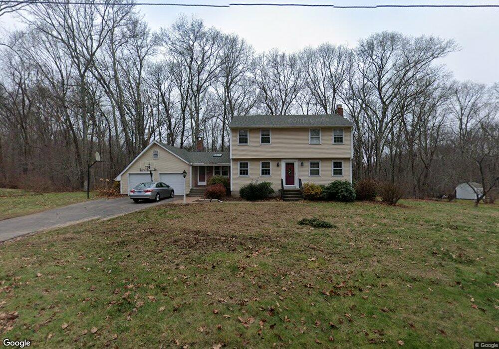
20 Slicer Dr Amston, CT 06231
Estimated Value: $432,893 - $533,000
4
Beds
2
Baths
1,936
Sq Ft
$245/Sq Ft
Est. Value
About This Home
This home is located at 20 Slicer Dr, Amston, CT 06231 and is currently estimated at $473,973, approximately $244 per square foot. 20 Slicer Dr is a home located in Tolland County with nearby schools including Gilead Hill School, Hebron Elementary School, and RHAM Middle School.
Ownership History
Date
Name
Owned For
Owner Type
Purchase Details
Closed on
Jul 29, 2005
Sold by
Parzych Robert and Parzych Nancy
Bought by
Averso James
Current Estimated Value
Home Financials for this Owner
Home Financials are based on the most recent Mortgage that was taken out on this home.
Original Mortgage
$184,925
Interest Rate
5.67%
Create a Home Valuation Report for This Property
The Home Valuation Report is an in-depth analysis detailing your home's value as well as a comparison with similar homes in the area
Home Values in the Area
Average Home Value in this Area
Purchase History
| Date | Buyer | Sale Price | Title Company |
|---|---|---|---|
| Averso James | $334,900 | -- |
Source: Public Records
Mortgage History
| Date | Status | Borrower | Loan Amount |
|---|---|---|---|
| Open | Averso James | $189,500 | |
| Closed | Averso James | $40,000 | |
| Closed | Averso James | $184,925 | |
| Previous Owner | Averso James | $10,000 |
Source: Public Records
Tax History Compared to Growth
Tax History
| Year | Tax Paid | Tax Assessment Tax Assessment Total Assessment is a certain percentage of the fair market value that is determined by local assessors to be the total taxable value of land and additions on the property. | Land | Improvement |
|---|---|---|---|---|
| 2025 | $7,122 | $193,270 | $49,140 | $144,130 |
| 2024 | $6,668 | $193,270 | $49,140 | $144,130 |
| 2023 | $6,415 | $193,270 | $49,140 | $144,130 |
| 2022 | $6,127 | $193,270 | $49,140 | $144,130 |
| 2021 | $6,171 | $169,850 | $49,140 | $120,710 |
| 2020 | $6,171 | $169,850 | $49,140 | $120,710 |
| 2019 | $6,293 | $169,850 | $49,140 | $120,710 |
| 2018 | $6,359 | $169,850 | $49,140 | $120,710 |
| 2017 | $6,284 | $169,850 | $49,140 | $120,710 |
| 2016 | $6,359 | $178,430 | $87,360 | $91,070 |
| 2015 | $6,423 | $178,430 | $87,360 | $91,070 |
| 2014 | $6,296 | $176,120 | $87,360 | $88,760 |
Source: Public Records
Map
Nearby Homes
- 40 Cannon Dr
- 218 Hope Valley Rd
- 65 Attawanhood Trail
- 14 Jeremy Way Unit 14
- 1 Church St
- 2 Church St
- 255 Millstream Rd
- 20 Mohegan Ln
- 25 Smith Farm Rd
- 22 Gilbert Ln Unit 22
- 80 Wellswood Rd Unit 9
- 65 Wellswood Rd
- 64 Loveland Rd
- 00 Zola Rd
- 0 Deepwood Dr
- 222 Gilead St
- 249 Wall St
- 6 Deepwood Dr
- 18 Spring Hill Rd
- 14 Woodside Rd
- 26 Slicer Dr
- 12 Slicer Dr
- 50 Brennan Rd
- 51 Hope Valley Rd
- 34 Slicer Dr
- 67 Hope Valley Rd
- 65 Hope Valley Rd
- 44 Brennan Rd
- 69 Hope Valley Rd
- 45 Hope Valley Rd
- 51 Brennan Rd
- 75 Hope Valley Rd
- 40 Slicer Dr
- 38 Brennan Rd
- 39 Hope Valley Rd
- 47 Brennan Rd
- 62 Hope Valley Rd
- 68 Hope Valley Rd
- 68 Hope Valley Rd
- 32 Brennan Rd