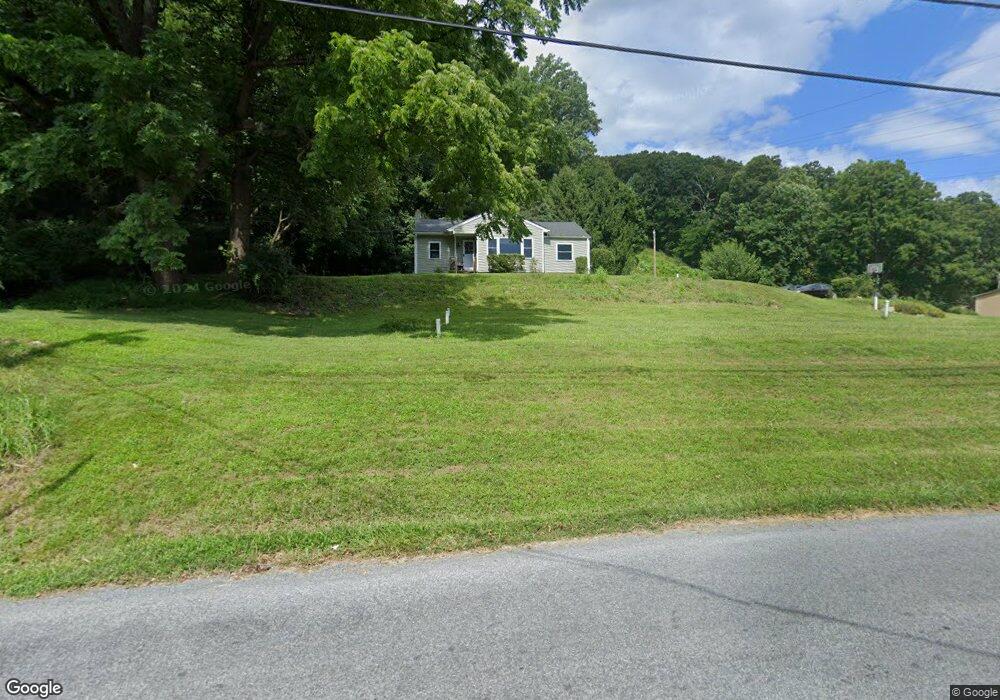
20 Springfield Rd Easton, PA 18042
Estimated Value: $268,604 - $466,000
3
Beds
1
Bath
1,044
Sq Ft
$316/Sq Ft
Est. Value
About This Home
This home is located at 20 Springfield Rd, Easton, PA 18042 and is currently estimated at $329,901, approximately $315 per square foot. 20 Springfield Rd is a home located in Northampton County with nearby schools including Wilson Area High School.
Ownership History
Date
Name
Owned For
Owner Type
Purchase Details
Closed on
Nov 2, 2018
Sold by
Haas Bryan F and Haas Stacey
Bought by
Haas Bryan F and Naylor Jenny R
Current Estimated Value
Home Financials for this Owner
Home Financials are based on the most recent Mortgage that was taken out on this home.
Original Mortgage
$161,000
Outstanding Balance
$101,418
Interest Rate
4.7%
Mortgage Type
New Conventional
Estimated Equity
$228,483
Purchase Details
Closed on
Jun 25, 2001
Bought by
Haas Donna L
Create a Home Valuation Report for This Property
The Home Valuation Report is an in-depth analysis detailing your home's value as well as a comparison with similar homes in the area
Home Values in the Area
Average Home Value in this Area
Purchase History
| Date | Buyer | Sale Price | Title Company |
|---|---|---|---|
| Haas Bryan F | -- | Associated Abstract Service | |
| Haas Donna L | $108,900 | -- |
Source: Public Records
Mortgage History
| Date | Status | Borrower | Loan Amount |
|---|---|---|---|
| Open | Haas Bryan F | $161,000 |
Source: Public Records
Tax History Compared to Growth
Tax History
| Year | Tax Paid | Tax Assessment Tax Assessment Total Assessment is a certain percentage of the fair market value that is determined by local assessors to be the total taxable value of land and additions on the property. | Land | Improvement |
|---|---|---|---|---|
| 2025 | $510 | $47,200 | $19,200 | $28,000 |
| 2024 | $3,442 | $47,200 | $19,200 | $28,000 |
| 2023 | $3,332 | $47,200 | $19,200 | $28,000 |
| 2022 | $3,414 | $47,200 | $19,200 | $28,000 |
| 2021 | $3,433 | $47,200 | $19,200 | $28,000 |
| 2020 | $3,433 | $47,200 | $19,200 | $28,000 |
| 2019 | $3,379 | $47,200 | $19,200 | $28,000 |
| 2018 | $3,297 | $47,200 | $19,200 | $28,000 |
| 2017 | $3,216 | $47,200 | $19,200 | $28,000 |
| 2016 | -- | $47,200 | $19,200 | $28,000 |
| 2015 | -- | $47,200 | $19,200 | $28,000 |
| 2014 | -- | $47,200 | $19,200 | $28,000 |
Source: Public Records
Map
Nearby Homes
- 60 Melchor Dr
- 20 Ava Way
- 70 Kate Ct
- 450 Buttermilk Rd
- 15 Lillian Ct Unit 11
- 325 Raubsville Rd
- 25 Lillian Ct Unit 10
- 45 Charles Ct Unit 4
- 35 Lilian Ct Unit 9
- 55 Charles Ct
- 77 Tumble Creek Rd Unit 14
- 135 Coffeetown Rd
- Maverick Plan at Tumble Creek Estates
- Juniper Plan at Tumble Creek Estates
- Sienna Plan at Tumble Creek Estates
- Preakness Plan at Tumble Creek Estates
- Breckenridge Grande Plan at Tumble Creek Estates
- Folino Plan at Tumble Creek Estates
- Churchill Plan at Tumble Creek Estates
- Morgan Plan at Tumble Creek Estates