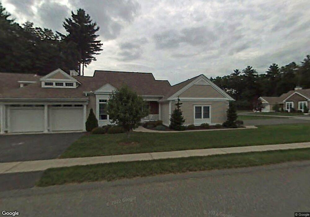
20 Spruce Dr Wilbraham, MA 01095
Estimated Value: $529,000 - $545,147
3
Beds
3
Baths
1,928
Sq Ft
$279/Sq Ft
Est. Value
About This Home
This home is located at 20 Spruce Dr, Wilbraham, MA 01095 and is currently estimated at $537,049, approximately $278 per square foot. 20 Spruce Dr is a home located in Hampden County with nearby schools including Minnechaug Regional High School and Wilbraham & Monson Academy.
Ownership History
Date
Name
Owned For
Owner Type
Purchase Details
Closed on
Sep 17, 2015
Sold by
Connery Edward R and Connery Sandra M
Bought by
Swiatlowski Richard M and Swiatlowski Evelyn B
Current Estimated Value
Home Financials for this Owner
Home Financials are based on the most recent Mortgage that was taken out on this home.
Original Mortgage
$231,000
Outstanding Balance
$175,606
Interest Rate
3%
Mortgage Type
New Conventional
Estimated Equity
$361,443
Purchase Details
Closed on
Dec 23, 1999
Sold by
Woods At Wilbraham Llc
Bought by
Connery Edward R and Connery Sandra M
Create a Home Valuation Report for This Property
The Home Valuation Report is an in-depth analysis detailing your home's value as well as a comparison with similar homes in the area
Home Values in the Area
Average Home Value in this Area
Purchase History
| Date | Buyer | Sale Price | Title Company |
|---|---|---|---|
| Swiatlowski Richard M | $330,000 | -- | |
| Connery Edward R | $218,900 | -- |
Source: Public Records
Mortgage History
| Date | Status | Borrower | Loan Amount |
|---|---|---|---|
| Open | Swiatlowski Richard M | $231,000 | |
| Previous Owner | Connery Edward R | $152,000 |
Source: Public Records
Tax History Compared to Growth
Tax History
| Year | Tax Paid | Tax Assessment Tax Assessment Total Assessment is a certain percentage of the fair market value that is determined by local assessors to be the total taxable value of land and additions on the property. | Land | Improvement |
|---|---|---|---|---|
| 2025 | $8,159 | $456,300 | $0 | $456,300 |
| 2024 | $7,002 | $378,500 | $0 | $378,500 |
| 2023 | $7,059 | $369,900 | $0 | $369,900 |
| 2022 | $7,059 | $344,500 | $0 | $344,500 |
| 2021 | $7,129 | $310,500 | $0 | $310,500 |
| 2020 | $6,949 | $310,500 | $0 | $310,500 |
| 2019 | $6,769 | $310,500 | $0 | $310,500 |
| 2018 | $6,944 | $306,700 | $0 | $306,700 |
| 2017 | $6,747 | $306,700 | $0 | $306,700 |
| 2016 | $5,756 | $266,500 | $0 | $266,500 |
| 2015 | $5,565 | $266,500 | $0 | $266,500 |
Source: Public Records
Map
Nearby Homes
- 54 High Pine Cir
- 79 High Pine Cir
- 69 High Pine Cir
- 35 Lake Dr
- 4 Hillcrest Dr
- 2 Vista Rd
- 46 Washington Rd
- 28 Decorie Dr
- 20 Old Orchard Rd
- 2 Bayberry Dr Unit 51
- 182 Mountain Rd
- 8 Patriot Ridge Ln
- 474-480 Mountain Rd
- 19 Linwood Dr
- 474 Mountain Rd
- 6 Teak Terrace Unit 24
- 99 Sandalwood Dr Unit site 00
- 103 Sandalwood Dr Unit site 00
- 57 Sandalwood Dr Unit site 61
- 88-90 Miller St
- 16 Spruce Dr
- 16 Spruce Dr Unit 16
- 20 Spruce Dr Unit 20
- 18 Spruce Dr
- 52 High Pine Cir
- 50 High Pine Cir
- 12 Spruce Dr
- 14 Spruce Dr
- 10 Spruce Dr
- 17 Spruce Dr
- 15 Spruce Dr
- 11 Spruce Dr
- 11 Spruce Dr
- 11 Spruce Dr Unit 11
- 9 Spruce Dr
- 46 High Pine Cir
- 44 High Pine Cir
- 42 High Pine Cir
- 40 High Pine Cir
- 46 High Pine Cir Unit 46