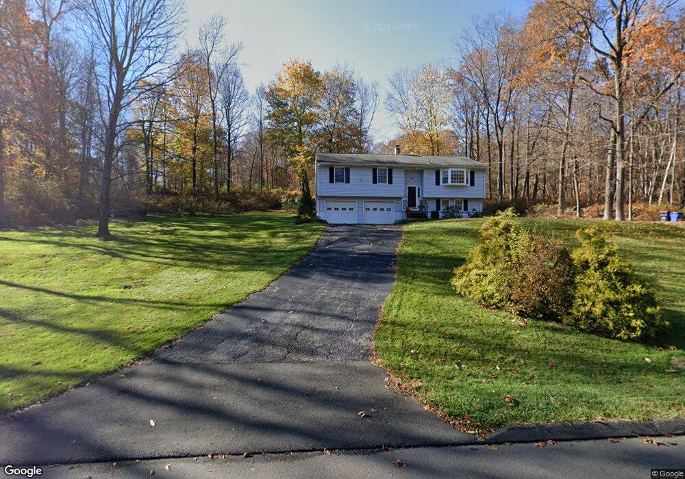
20 Stage Rd Brookfield, CT 06804
Estimated Value: $470,000 - $544,000
3
Beds
3
Baths
1,334
Sq Ft
$379/Sq Ft
Est. Value
About This Home
This home is located at 20 Stage Rd, Brookfield, CT 06804 and is currently estimated at $505,238, approximately $378 per square foot. 20 Stage Rd is a home located in Fairfield County with nearby schools including Whisconier Middle School, Brookfield High School, and Montessori Community School at Brookfield.
Ownership History
Date
Name
Owned For
Owner Type
Purchase Details
Closed on
Nov 13, 1992
Sold by
Beeh Denise
Bought by
Matula Paul and Matula Danielle
Current Estimated Value
Purchase Details
Closed on
Dec 3, 1990
Sold by
Latham William
Bought by
Oliverio Michael
Create a Home Valuation Report for This Property
The Home Valuation Report is an in-depth analysis detailing your home's value as well as a comparison with similar homes in the area
Home Values in the Area
Average Home Value in this Area
Purchase History
| Date | Buyer | Sale Price | Title Company |
|---|---|---|---|
| Matula Paul | $180,000 | -- | |
| Matula Paul | $180,000 | -- | |
| Oliverio Michael | $252,500 | -- |
Source: Public Records
Mortgage History
| Date | Status | Borrower | Loan Amount |
|---|---|---|---|
| Open | Oliverio Michael | $35,000 | |
| Open | Oliverio Michael | $225,000 | |
| Closed | Oliverio Michael | $238,000 |
Source: Public Records
Tax History
| Year | Tax Paid | Tax Assessment Tax Assessment Total Assessment is a certain percentage of the fair market value that is determined by local assessors to be the total taxable value of land and additions on the property. | Land | Improvement |
|---|---|---|---|---|
| 2025 | $7,262 | $251,010 | $92,990 | $158,020 |
| 2024 | $7,003 | $251,010 | $92,990 | $158,020 |
| 2023 | $6,742 | $251,010 | $92,990 | $158,020 |
| 2022 | $6,496 | $251,010 | $92,990 | $158,020 |
| 2021 | $3,558 | $217,340 | $103,320 | $114,020 |
| 2020 | $3,558 | $217,340 | $103,320 | $114,020 |
| 2019 | $6,333 | $217,340 | $103,320 | $114,020 |
| 2018 | $6,159 | $217,340 | $103,320 | $114,020 |
| 2017 | $5,931 | $217,340 | $103,320 | $114,020 |
| 2016 | $6,056 | $229,410 | $112,470 | $116,940 |
| 2015 | $5,896 | $229,410 | $112,470 | $116,940 |
| 2014 | $5,896 | $229,410 | $112,470 | $116,940 |
Source: Public Records
Map
Nearby Homes
- 23 Farrell Rd
- 16 Farrell Rd
- 23 Sunset Hill Rd
- 5 Woodland Hills Terrace
- 112 A Stony Hill Rd
- 63 Parmalee Hill Rd
- 19 A Apache Dr
- 29 Ledgewood Dr
- 1 Essex Ct Unit 1
- 23 Woods Ln Unit 23
- 603 Brookside Ct Unit 603
- 433 Brookside Ct Unit 433
- 70 Obtuse Hill Rd
- 4 Arlington Ct
- 95 Obtuse Rd S
- 2 Old Grays Bridge Rd
- 54 Redwood Dr
- 16 Homestead Ln
- 2 Autumn's Way
- 99 Obtuse Hill Rd
Your Personal Tour Guide
Ask me questions while you tour the home.