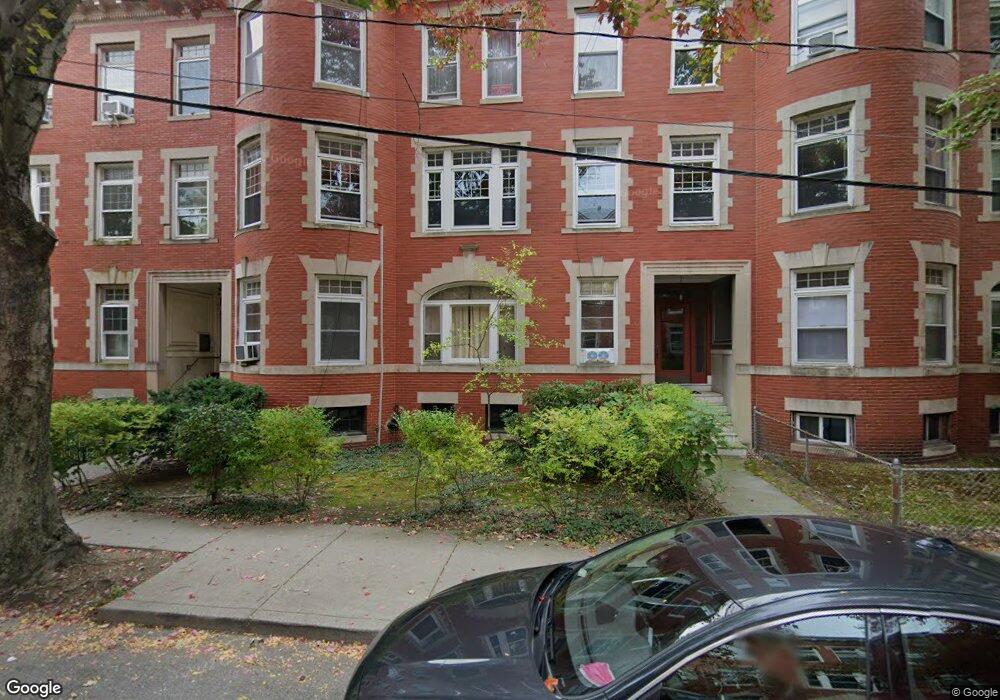
20 Strathmore Rd Unit 1 Brookline, MA 02445
Cleveland Circle NeighborhoodEstimated Value: $947,663 - $1,088,000
4
Beds
1
Bath
9,999
Sq Ft
$104/Sq Ft
Est. Value
About This Home
This home is located at 20 Strathmore Rd Unit 1, Brookline, MA 02445 and is currently estimated at $1,037,416, approximately $103 per square foot. 20 Strathmore Rd Unit 1 is a home located in Norfolk County with nearby schools including John D. Runkle School, Torah Academy, and Bais Yaakov Of Boston High School.
Ownership History
Date
Name
Owned For
Owner Type
Purchase Details
Closed on
Aug 28, 2012
Sold by
Tsirelson Boris and Tsirelson Vera
Bought by
Tsirelson Ret
Current Estimated Value
Purchase Details
Closed on
Jun 16, 1986
Bought by
Tsirelson Boris and Tsirelson Vera
Create a Home Valuation Report for This Property
The Home Valuation Report is an in-depth analysis detailing your home's value as well as a comparison with similar homes in the area
Home Values in the Area
Average Home Value in this Area
Purchase History
| Date | Buyer | Sale Price | Title Company |
|---|---|---|---|
| Tsirelson Ret | -- | -- | |
| Tsirelson Boris | $125,000 | -- |
Source: Public Records
Mortgage History
| Date | Status | Borrower | Loan Amount |
|---|---|---|---|
| Previous Owner | Tsirelson Boris | $158,000 | |
| Previous Owner | Tsirelson Boris | $60,000 |
Source: Public Records
Tax History Compared to Growth
Tax History
| Year | Tax Paid | Tax Assessment Tax Assessment Total Assessment is a certain percentage of the fair market value that is determined by local assessors to be the total taxable value of land and additions on the property. | Land | Improvement |
|---|---|---|---|---|
| 2025 | $8,569 | $868,200 | $0 | $868,200 |
| 2024 | $8,316 | $851,200 | $0 | $851,200 |
| 2023 | $8,256 | $828,100 | $0 | $828,100 |
| 2022 | $8,273 | $811,900 | $0 | $811,900 |
| 2021 | $7,878 | $803,900 | $0 | $803,900 |
| 2020 | $7,521 | $795,900 | $0 | $795,900 |
| 2019 | $7,102 | $758,000 | $0 | $758,000 |
| 2018 | $6,751 | $713,600 | $0 | $713,600 |
| 2017 | $6,528 | $660,700 | $0 | $660,700 |
| 2016 | $6,258 | $600,600 | $0 | $600,600 |
| 2015 | $5,831 | $546,000 | $0 | $546,000 |
| 2014 | $5,662 | $497,100 | $0 | $497,100 |
Source: Public Records
Map
Nearby Homes
- 17 Strathmore Rd Unit 2
- 8 Strathmore Rd Unit G
- 1880 Beacon St Unit 6
- 1856 Beacon St Unit 2C
- 3 Englewood Ave Unit 9
- 19-21 Orkney Rd
- 47 Englewood Ave
- 9 Willard Rd
- 37 Englewood Ave Unit 3
- 31 Orkney Rd Unit 54
- 41 Orkney Rd
- 44 Orkney Rd Unit 3
- 65 Strathmore Rd Unit 49
- 38 Kilsyth Rd Unit 21
- 6 Sutherland Rd Unit 41
- 140 Kilsyth Rd Unit 8
- 1778 Beacon St Unit 302
- 24 Selkirk Rd Unit 24-4
- 15 Colliston Rd Unit 6
- 1763 Beacon St Unit A
- 20 Strathmore Rd Unit 3
- 20 Strathmore Rd Unit 2
- 20 Strathmore Rd Unit 9
- 20 Strathmore Rd
- 20 Strathmore Rd Unit 527
- 20 Strathmore Rd Unit 526
- 20 Strathmore Rd Unit 525
- 20 Strathmore Rd Unit 522
- 20 Strathmore Rd Unit 520
- 20 Strathmore Rd Unit 514
- 20 Strathmore Rd Unit 510
- 20 Strathmore Rd Unit 512
- 20 Strathmore Rd Unit 511
- 20 Strathmore Rd Unit 508
- 20 Strathmore Rd Unit 503
- 20 Strathmore Rd Unit 581
- 20 Strathmore Rd Unit 577
- 20 Strathmore Rd Unit 576
- 20 Strathmore Rd Unit 575
- 20 Strathmore Rd Unit 574