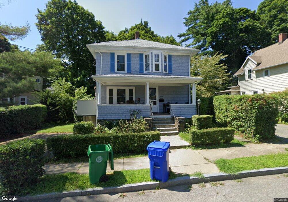
20 Taft Ave West Newton, MA 02465
West Newton NeighborhoodEstimated Value: $1,088,902 - $1,345,000
3
Beds
2
Baths
1,954
Sq Ft
$614/Sq Ft
Est. Value
About This Home
This home is located at 20 Taft Ave, West Newton, MA 02465 and is currently estimated at $1,200,226, approximately $614 per square foot. 20 Taft Ave is a home located in Middlesex County with nearby schools including Franklin Elementary School, Horace Mann Elementary School, and F.A. Day Middle School.
Create a Home Valuation Report for This Property
The Home Valuation Report is an in-depth analysis detailing your home's value as well as a comparison with similar homes in the area
Home Values in the Area
Average Home Value in this Area
Tax History Compared to Growth
Tax History
| Year | Tax Paid | Tax Assessment Tax Assessment Total Assessment is a certain percentage of the fair market value that is determined by local assessors to be the total taxable value of land and additions on the property. | Land | Improvement |
|---|---|---|---|---|
| 2025 | $9,288 | $947,800 | $782,100 | $165,700 |
| 2024 | $8,981 | $920,200 | $759,300 | $160,900 |
| 2023 | $8,522 | $837,100 | $571,500 | $265,600 |
| 2022 | $8,154 | $775,100 | $529,200 | $245,900 |
| 2021 | $7,868 | $731,200 | $499,200 | $232,000 |
| 2020 | $7,634 | $731,200 | $499,200 | $232,000 |
| 2019 | $7,418 | $709,900 | $484,700 | $225,200 |
| 2018 | $7,043 | $650,900 | $438,900 | $212,000 |
| 2017 | $6,829 | $614,100 | $414,100 | $200,000 |
| 2016 | $6,531 | $573,900 | $387,000 | $186,900 |
| 2015 | $6,228 | $536,400 | $361,700 | $174,700 |
Source: Public Records
Map
Nearby Homes
- 76 Harding St
- 76 Taft Ave Unit 1
- 76 Taft Ave
- 76 Taft Ave Unit 2
- 75 Cherry St
- 33 Joseph Rd
- 9 John St
- 162 Myrtle St Unit 1
- 1 Farwell Cir
- 138 Myrtle St Unit 2
- 39 Clinton St Unit 2
- 39 Clinton St Unit 1
- 41 Kilburn Rd
- 287 Cherry St Unit 2
- 308 Newton St Unit 1
- 24 Tolman St Unit A
- 312 Newton St Unit 1A
- 321 Albemarle Rd
- 56 Dearborn St
- 176 River St