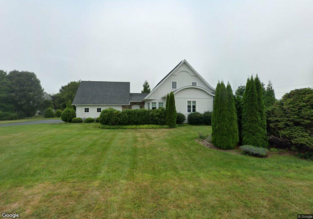
20 Tara Way Wakefield, RI 02879
Estimated Value: $1,310,290 - $1,690,000
2
Beds
3
Baths
2,217
Sq Ft
$700/Sq Ft
Est. Value
About This Home
This home is located at 20 Tara Way, Wakefield, RI 02879 and is currently estimated at $1,551,573, approximately $699 per square foot. 20 Tara Way is a home with nearby schools including South Kingstown High School.
Ownership History
Date
Name
Owned For
Owner Type
Purchase Details
Closed on
Dec 2, 2021
Sold by
Dewell Glenn K and Dewell Paula K
Bought by
Dimeo Family Ret
Current Estimated Value
Purchase Details
Closed on
Feb 6, 2015
Sold by
Es Gallogly Florence E
Bought by
Dewell Glenn and Dewell Paula
Create a Home Valuation Report for This Property
The Home Valuation Report is an in-depth analysis detailing your home's value as well as a comparison with similar homes in the area
Home Values in the Area
Average Home Value in this Area
Purchase History
| Date | Buyer | Sale Price | Title Company |
|---|---|---|---|
| Dimeo Family Ret | -- | None Available | |
| Dewell Glenn | $204,500 | -- |
Source: Public Records
Mortgage History
| Date | Status | Borrower | Loan Amount |
|---|---|---|---|
| Previous Owner | Dewell Glenn | $200,000 | |
| Previous Owner | Dewell Glenn | $390,000 | |
| Previous Owner | Dewell Glenn | $350,000 | |
| Previous Owner | Dewell Glenn | $150,000 |
Source: Public Records
Tax History Compared to Growth
Tax History
| Year | Tax Paid | Tax Assessment Tax Assessment Total Assessment is a certain percentage of the fair market value that is determined by local assessors to be the total taxable value of land and additions on the property. | Land | Improvement |
|---|---|---|---|---|
| 2025 | $10,311 | $1,153,400 | $471,700 | $681,700 |
| 2024 | $10,454 | $946,100 | $387,500 | $558,600 |
| 2023 | $10,454 | $946,100 | $387,500 | $558,600 |
| 2022 | $10,360 | $946,100 | $387,500 | $558,600 |
| 2021 | $9,499 | $657,400 | $238,400 | $419,000 |
| 2020 | $9,499 | $657,400 | $238,400 | $419,000 |
| 2019 | $9,499 | $657,400 | $238,400 | $419,000 |
| 2018 | $8,847 | $564,200 | $224,400 | $339,800 |
| 2017 | $8,638 | $564,200 | $224,400 | $339,800 |
| 2016 | $6,955 | $460,900 | $224,400 | $236,500 |
| 2015 | $3,166 | $204,000 | $204,000 | $0 |
| 2014 | $3,158 | $204,000 | $204,000 | $0 |
Source: Public Records
Map
Nearby Homes
- 23 E Matunuck Farm Dr
- 16 High Tides Ln
- 40 Wild Rose Ct
- 76 Hartford Ave
- 689 Succotash Rd
- 691 Succotash Rd
- 2139 Commodore Oliver Hazard Perry Hwy
- 14 E Pointe Ct Unit 14
- 380 Camp Fuller Rd
- 1185 Succotash Rd
- 25 Scallop Shell Rd
- 6 MacAlder St
- 17 Goose Island Rd
- 271 Great Island Rd
- 232 Sand Hill Cove Rd Unit 232 C
- 24 Peninsula Rd
- 854 Matunuck Beach #215 Rd
- 975 Matunuck Beach Rd
- 27 Holden Rd
- 854 Matunuck Beach Rd
- 7 Shannon Rd
- 21 Tara Way
- 25 Shannon Rd
- 69 Gooseberry Rd
- 30 Snug Harbor Ln
- 27 Shannon Rd
- 83 Gooseberry Rd
- 53 Shannon Rd
- 115 Gooseberry Rd
- 31 Snug Harbor Ln
- 24 Old Succotash Rd
- 7 Old Succotash Rd
- 26 Snug Harbor Ln
- 45 Gooseberry Rd
- 26 Shannon Rd
- 123 Gooseberry Rd
- 40 Old Succotash Rd
- 25 Snug Harbor Ln
- 24 Snug Harbor Ln
- 46 Old Succotash Rd