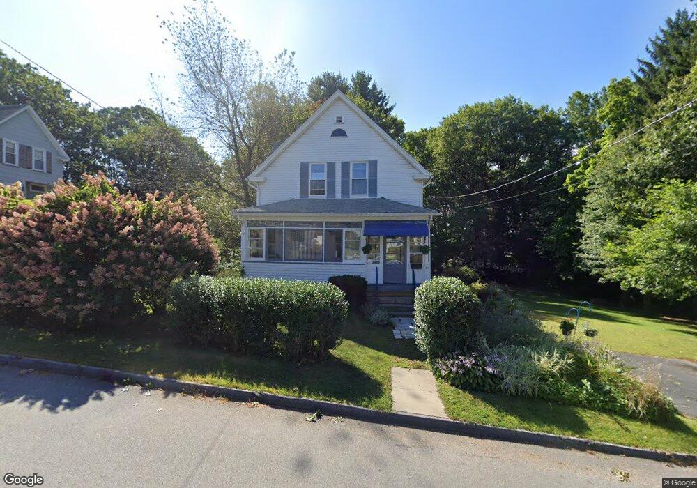
20 Tennyson St Worcester, MA 01610
College Hill NeighborhoodEstimated Value: $370,000 - $400,000
3
Beds
1
Bath
1,437
Sq Ft
$269/Sq Ft
Est. Value
About This Home
This home is located at 20 Tennyson St, Worcester, MA 01610 and is currently estimated at $387,179, approximately $269 per square foot. 20 Tennyson St is a home located in Worcester County with nearby schools including Jacob Hiatt Magnet School, Chandler Magnet, and Heard Street Discovery Academy.
Ownership History
Date
Name
Owned For
Owner Type
Purchase Details
Closed on
Jan 10, 2025
Sold by
Batcheldor Janice A Est and Batcheldor
Bought by
Clivio Diane M
Current Estimated Value
Create a Home Valuation Report for This Property
The Home Valuation Report is an in-depth analysis detailing your home's value as well as a comparison with similar homes in the area
Home Values in the Area
Average Home Value in this Area
Purchase History
| Date | Buyer | Sale Price | Title Company |
|---|---|---|---|
| Clivio Diane M | -- | None Available | |
| Clivio Diane M | -- | None Available | |
| Clivio Diane M | -- | None Available | |
| Clivio Diane M | -- | None Available |
Source: Public Records
Tax History Compared to Growth
Tax History
| Year | Tax Paid | Tax Assessment Tax Assessment Total Assessment is a certain percentage of the fair market value that is determined by local assessors to be the total taxable value of land and additions on the property. | Land | Improvement |
|---|---|---|---|---|
| 2025 | $4,502 | $341,300 | $119,900 | $221,400 |
| 2024 | $4,335 | $315,300 | $119,900 | $195,400 |
| 2023 | $4,146 | $289,100 | $104,300 | $184,800 |
| 2022 | $3,795 | $249,500 | $83,500 | $166,000 |
| 2021 | $3,656 | $224,600 | $66,900 | $157,700 |
| 2020 | $3,497 | $205,700 | $66,800 | $138,900 |
| 2019 | $3,362 | $186,800 | $60,500 | $126,300 |
| 2018 | $3,362 | $177,800 | $60,500 | $117,300 |
| 2017 | $3,231 | $168,100 | $60,500 | $107,600 |
| 2016 | $3,186 | $154,600 | $46,000 | $108,600 |
| 2015 | $3,103 | $154,600 | $46,000 | $108,600 |
| 2014 | $3,021 | $154,600 | $46,000 | $108,600 |
Source: Public Records
Map
Nearby Homes
- 72 Sophia Dr
- 55 Tennyson St
- 30 Davenport St
- 28 Bittersweet Blvd
- 10 Steele St
- 29 Steele St
- 17 Thenius St
- 22 Lesley Ave
- 6 Newton St
- 78 Greenwood St
- 2 Mystic St
- 26 Maxwell St
- 37 Elmwood St
- 148 Hampton St
- 61 Elmwood St
- 204-212 Hampton St
- 11 Gibbs St Unit 12
- 74 Esther St
- 607 Cambridge St Unit 4
- 47 Gibbs St